
MICHIGAN, USA — Those who live along the Grand River in both Kent and Ottawa counties are being warned tonight to watch out for flooding and ice jams over the next several days.
Both emergency management leaders in Kent and Ottawa counties say that the flooding is mainly affecting those who normally experience it.
"Some of the streets right now, in Plainfield Township in particular, (the water levels) are so high that vehicles probably won't be able to access all of the homes in the area much longer," says Kent County Emergency Management Coordinator Matt Groesser.
The Grand River sits just above flood stage right now.
"And unfortunately today, we got a little bit of bad news from the Weather Service, they're expecting some more rain over the next couple of days," he says.
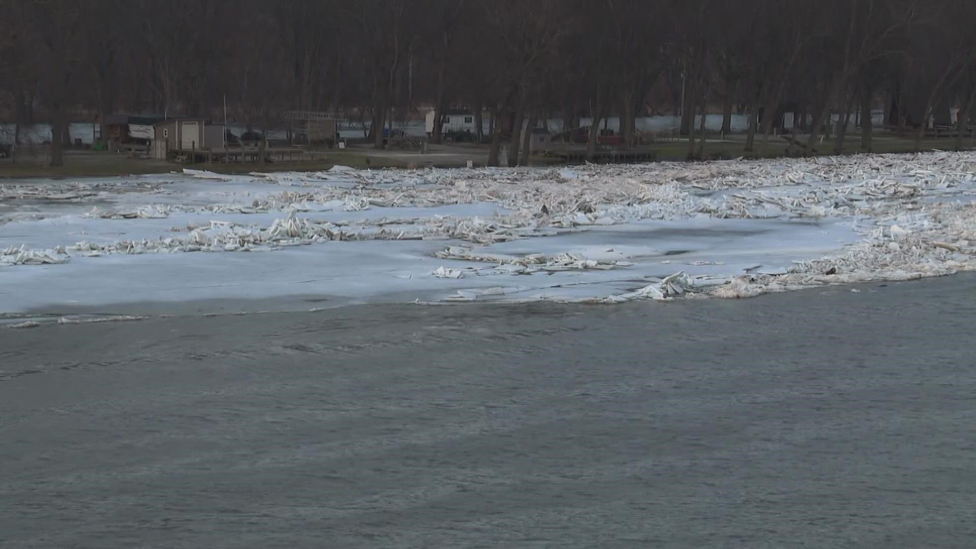
Ice jams on the Grand River


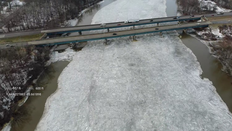

With about a half an inch of rain on the way, county leaders have a bird's eye view on the Grand River. They're looking for weak spots in the ice, where sheets or chunks of ice can break off and get stuck blocking the flow of the river.
"There's just a tremendous amount of water pushing against that ice jam. And, you know, there's one thing that we know about water is it's going to go wherever it can go," Groesser says. "It's going to go where it wants to go."
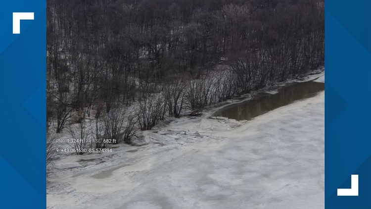
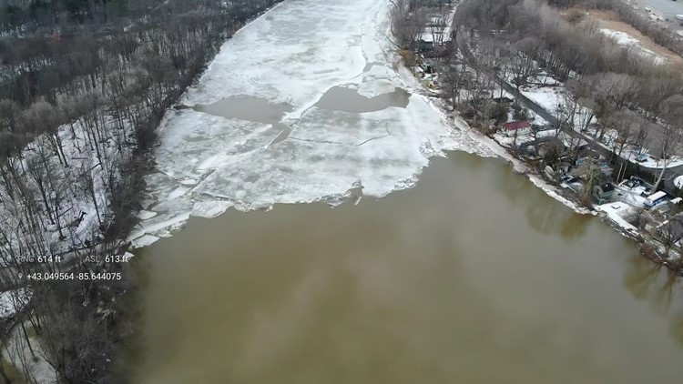
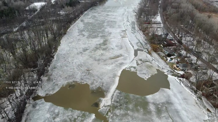
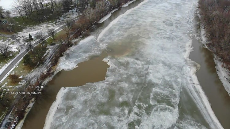
While Kent County hasn't seen ice jams yet, it's a different story in Ottawa County.
"Adding more fluid into the whole system right now isn't really what we need," says Ottawa County Emergency Management Director Louis Hunt. "We developed an ice jam near Robinson Township on Saturday."
It's since moved west a bit to Connor Bayou.
"What we're seeing of the broken up ice is that it's significant in thickness. So the ice that's breaking up, there's a tremendous amount of force behind it. And that ice is four and five inches thick," he says.
As for its trajectory, it's hard to tell for both the National Weather Service and Ottawa County Emergency Management.
"And they aren't even able to say with prediction how it might function, because every ice jam is kind of individual and unpredictable," Hunt says.
River levels on the Grand River are expected to go down starting Saturday, and county leaders say it will be a slow process. That means it's important to have an emergency plan and supplies if you're driving or living near the river, if you come across flooding, remember to seek higher ground.
Officials encourage drivers to turn around, don't drown.
►Make it easy to keep up to date with more stories like this. Download the 13 ON YOUR SIDE app now.
Have a news tip? Email news@13onyourside.com, visit our Facebook page or Twitter. Subscribe to our YouTube channel.