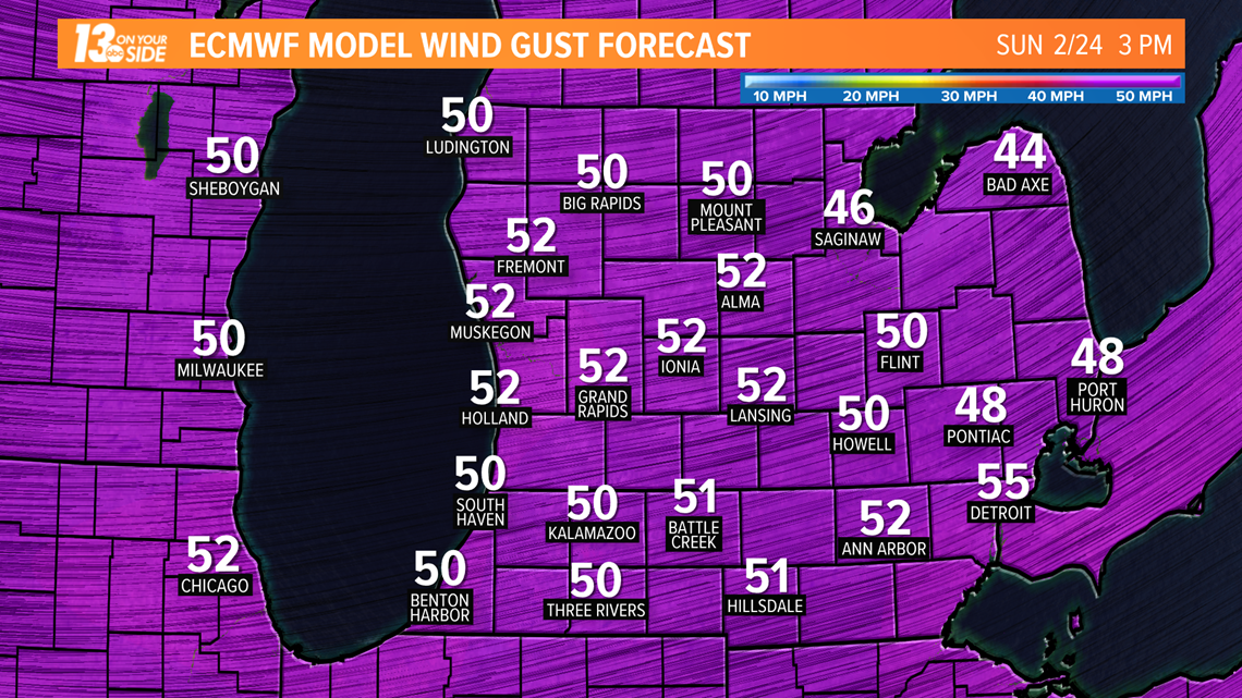
An area of low pressure will produce an assortment of weather conditions across West Michigan starting Saturday. It has the potential to bring down power lines and tree limbs on Sunday.
Rain will be the main precipitation type on Saturday as the system begins to arrive. However, there is enough cold air at the onset that a few hours of freezing rain are possible. Temperatures will quickly moderate changing the freezing rain over to rain for most of the area by Saturday afternoon.
There is enough instability that a thunderstorm or two can't be ruled out Saturday afternoon or evening. However, severe storms are unlikely.


The biggest threat this weekend arrives Sunday morning. Strong, damaging wind gusts are likely as the cold front sweeps across the area. An area of low pressure will quickly strengthen as it moves over the area. The wind has the potential to bring down tree limbs and power lines. Winds will slowly diminish Sunday night. However, the duration of the wind event will only exacerbate the threat for power outages.
Temperatures will plummet on Sunday. Rain will mix with and eventually transition to all snow. Strong winds will send bands of lake-enhanced snow well inland of Lake Michigan. Light accumulations of snow are possible with most of the snow ending early Monday.
You can keep up to date on outages and restoration times in your area by looking at the Consumers Energy Outage Map here.
Stay in the know about current weather conditions here, or download the 13 ON YOUR SIDE app.
► Make it easy to keep up to date with more stories like this.
Download the 13 ON YOUR SIDE app now. Email news@13onyourside.com, visit our Facebook pageorTwitter.


