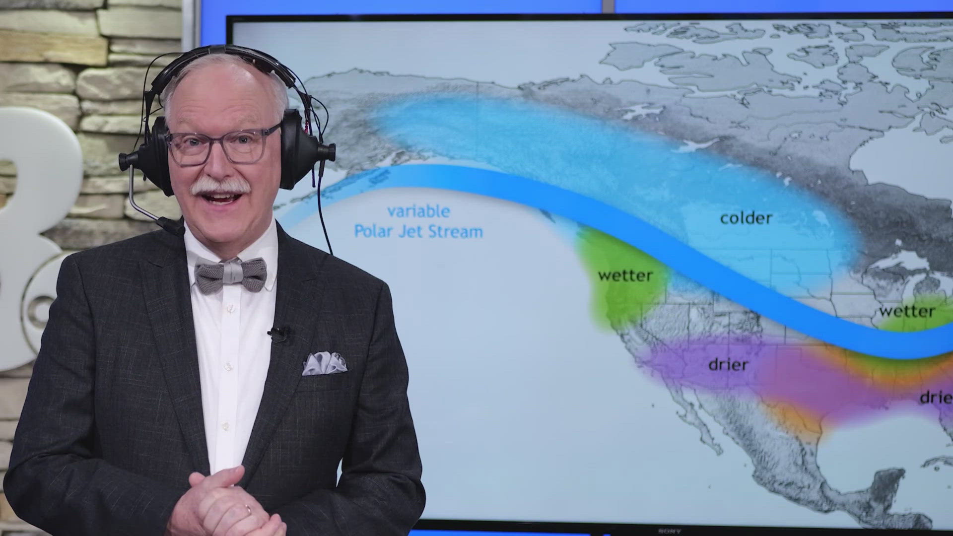
GRAND RAPIDS, Mich. — We are racing into the winter season, and the 13 Weather Impact Team has analyzed this season's data to determine the 2024-2025 Winter Weather Outlook.
Several factors, from large-scale patterns to climate change and even Lake Michigan, play significant roles in shaping the winter forecast.
Let’s start with the big picture.
GLOBAL PATTERNS
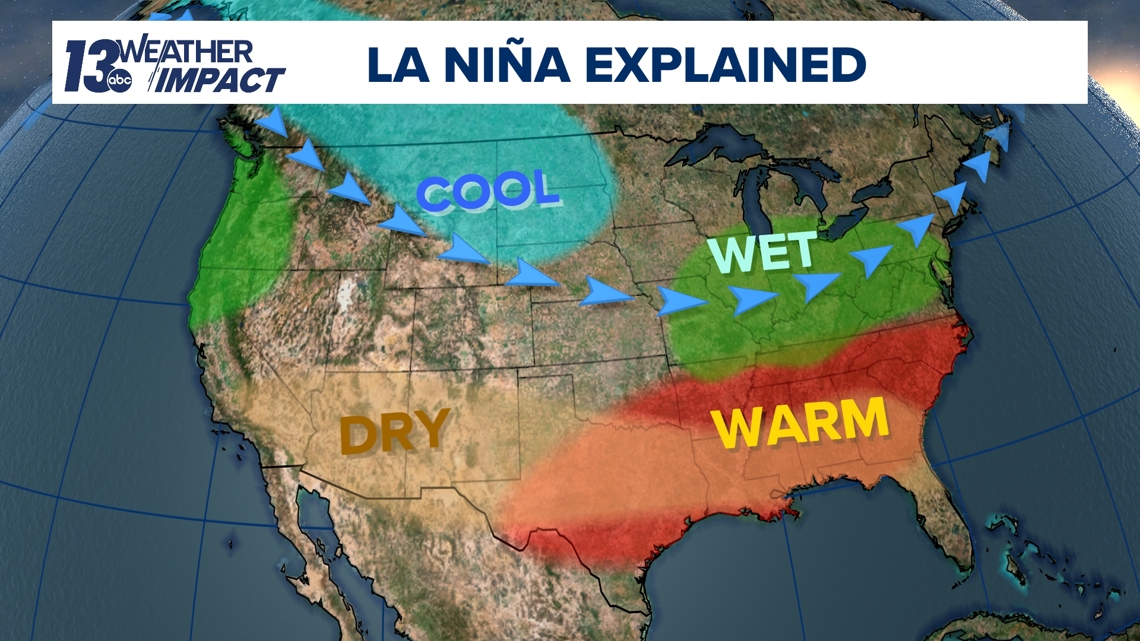
On a global scale, we expect to experience a weak La Niña this winter. This phenomenon has broader, more long-term impacts on winter patterns. La Niña winters in West Michigan typically feature a warmer October and November, as we have experienced; equal chances of snowfall and colder weather in December; and colder, snowier conditions in February and March. However, models indicate a weaker La Niña this year, slightly diminishing its influence on this season's winter forecast.

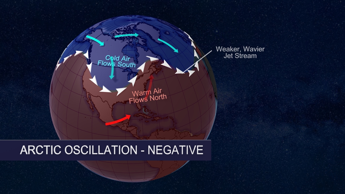
We can also look at the Arctic Oscillation, which is a circulation pattern that moves over the mid-to-high latitudes of the Northern Hemisphere and has impacts lasting on the order of a few days to a few weeks. When the Arctic Oscillation is in a negative phase, cold air can quickly plunge into the Midwest, bringing snaps of cold and snowy weather. This quick dip in very cold air is often referred to as the polar vortex.

CLIMATE INFLUENCES
We can't ignore the major impact our changing climate has on winter forecasting. Climate change is causing winter to be the fastest warming season for 74% of the United States, including West Michigan.

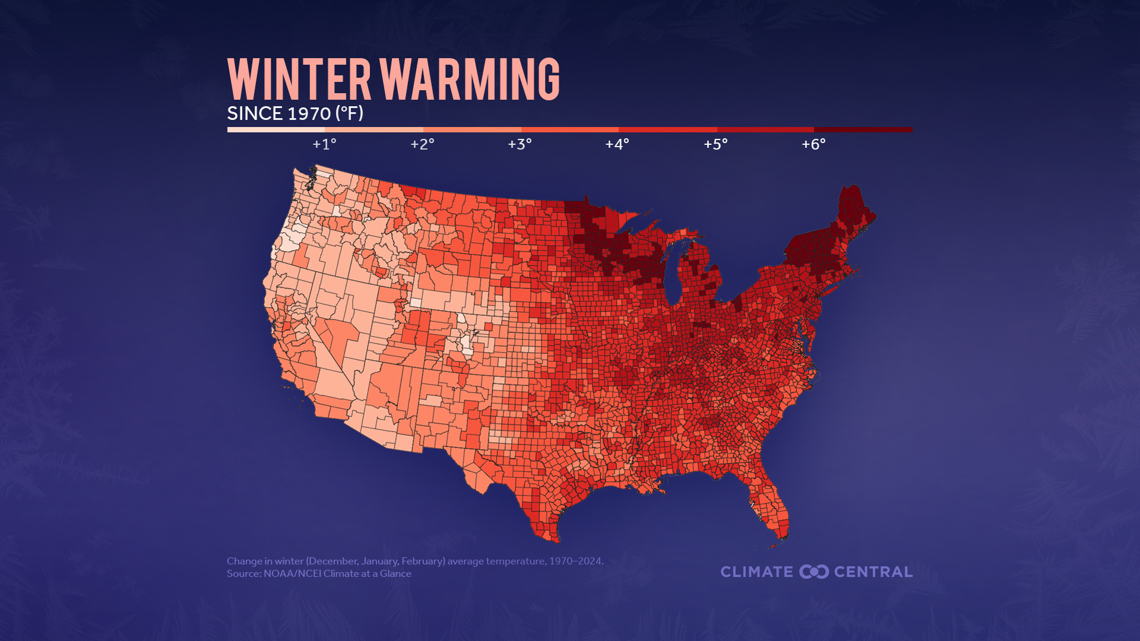
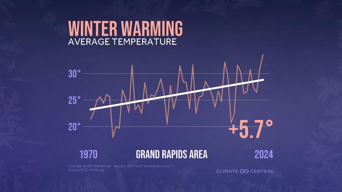
If you localize the impacts of climate change on Grand Rapids, you'll see that since 1970, our winter months have warmed by nearly 6 degrees.

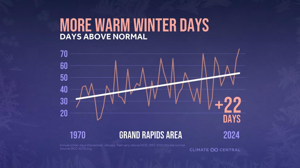
This leaves Grand Rapids with +22 days of above-normal temperatures. This warming trend has led to a decrease in Great Lakes ice coverage.

LOCAL INFLUENCES
Bringing us to the local influences of the Great Lakes.
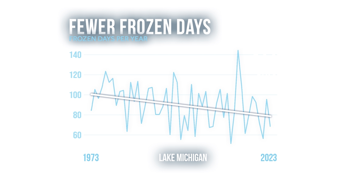
With warmer winter weather, the Great Lakes have less opportunity to form ice, leaving more open water to fuel lake-effect precipitation throughout the season. From 1973-2023, the annual peak ice coverage fell by 14.93%. Last winter, the maximum ice coverage was only 18.3% on Jan. 21, still under the historical average for that time in the season. With less ice and warmer waters, there is a higher likelihood for lake-effect snow or rain to be generated when a cold air mass moves over the relatively warmer lake.
Warmer temperatures may turn snow chances into rain chances instead. Consider last winter—seasonal precipitation totals landed slightly above average, but seasonal snow totals fell nearly 2 feet below average. This makes seasonal outlook forecasting pretty tricky if you are trying to look at it from the standpoint of just snowfall totals for the season.

2024 - 2025 WINTER WEATHER OUTLOOK
This year's results: A colder and snowier winter than the 2023–2024 winter season, but still warmer and less snowy than an average winter season.
Rain, snow, or sunshine the 13 Weather Impact Team is ready to track whatever conditions head our way this season.

Have a 30-second video or photo to share? We'd love to share it with everyone! Share your images by texting your name and location to 616.559.1310 or email to Weather@13OnYourSide.com or post it to our 13OnYourSide Facebook Page

