GRAND RAPIDS, Mich. — On April 9, 2021 NOAA announced that researchers at their Climate Prediction Center (CPC) had released the newest dataset for what to expect during hurricane season, at least on average. The results were not surprising to those who have kept an eye on climate change.
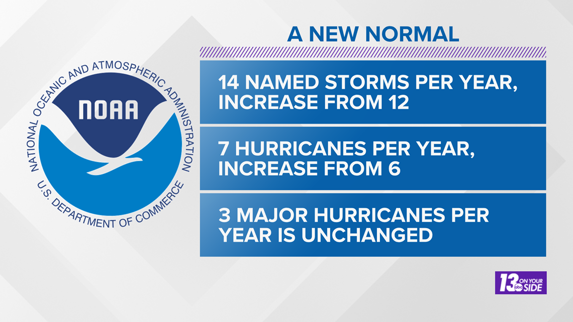
The new average says to expect 14 named storms per hurricane season, an increase from the previous 12. Also expect 7 hurricanes to form, an increase from the previous 6, and of those hurricanes 3 are still expected to become major hurricanes.
This data, spanning 30 years from 1990-2020, is replacing the previous period of record, which was 1980-2010.


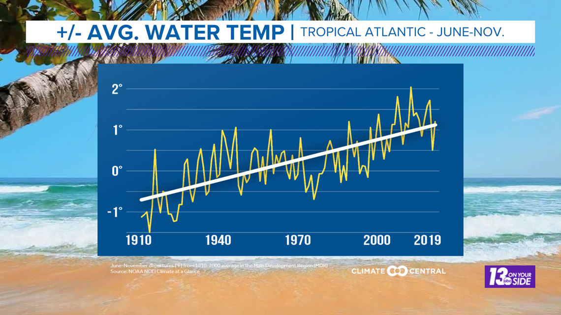
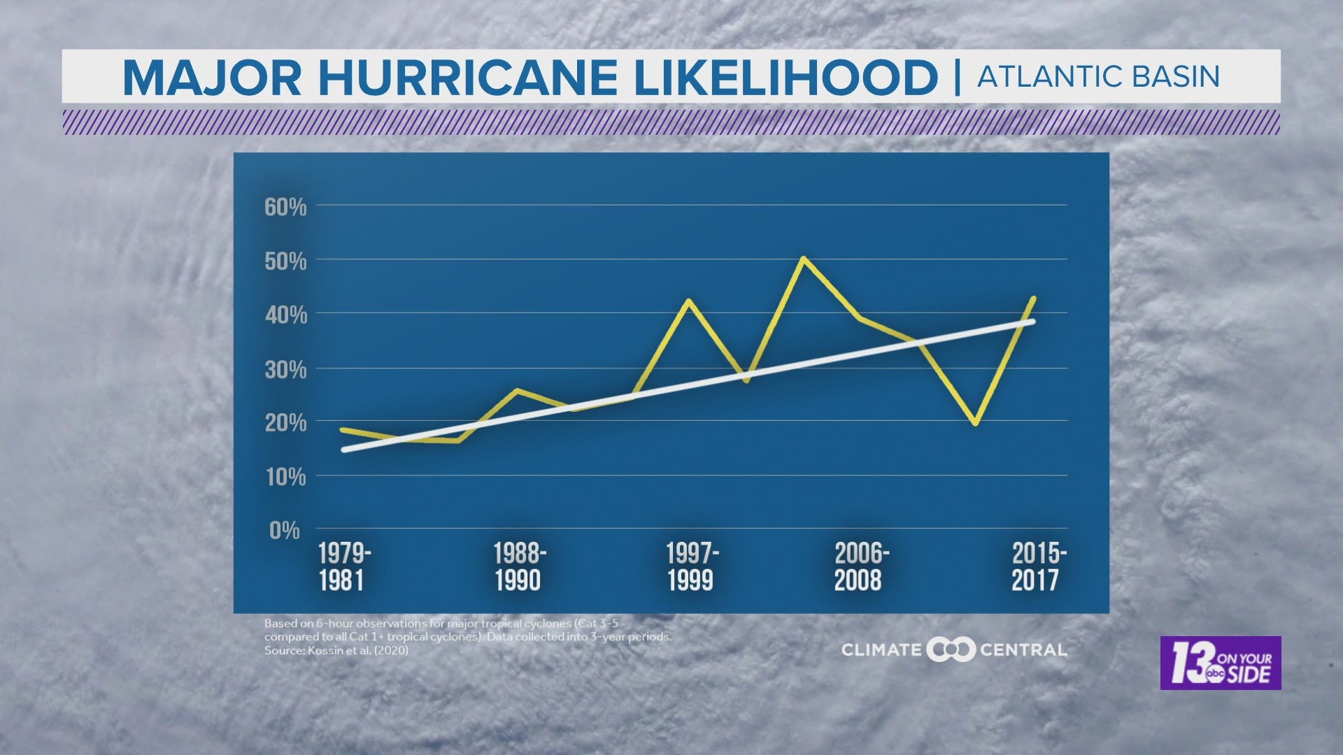
While the overall number of major hurricanes did not change in this new climate average dataset, the likelihood of a hurricane reaching major status has crept up some in recent decades. This, and the increase in overall storms, are both connected to the increasing ocean temperatures in the Tropical Atlantic where storms form.
Temperatures in these waters have been increasingly above normal in recent decades, and this increase in water temperature allows more moisture and heat energy to fuel tropical systems. The more fuel available, the more likely it is for a system to reach a level to be named and eventually become a hurricane.


This increase in activity also increases the likelihood that tropical systems will impact our weather here in West Michigan. There are three main ways our weather can be impacted by these systems.
- A tropical system may directly travel up toward West Michigan, bringing increased, possibly heavy, rainfall during a period that would otherwise be dry. It may also serve as a catalyst for some severe storms given the right conditions.
- A tropical system may combine with an approaching low pressure system and greatly increase its rainfall potential due to tropical moisture. This could lead to things such as flooding due to excessive rainfall or even severe weather from the increased spin and instability in the atmosphere.
- A tropical system can move to the east of West Michigan, and while it may not directly impact us, it will hold up any other weather systems from progressing through. This can result in an extended period of dry, possibly hot, weather if a high pressure system was in place, or an extended period of rainy/stormy conditions if a low pressure system was in place.
These are just the most likely impacts to our weather here in West Michigan from any potential tropical activity. However, regardless of what may come from the tropics, you can expect the 13 On Your Side Weather Team will be here to forecast it for you in advance!
-- Meteorologist Michael Behrens
Follow me on social media! Facebook Meteorologist Michael Behrens, Twitter @MikeBehrensWX, and Instagram @MikeBehrensWX.
Email me at: MBehrens@13OnYourSide.com
Have a 30-second video or still photo to share? We'd love to share it with everyone! Email your image to Weather@13OnYourSide.com or post it to our 13OnYourSide Facebook Page.
►Make it easy to keep up to date with more stories like this. Download the 13 ON YOUR SIDE app now.
Have a news tip? Email news@13onyourside.com, visit our Facebook page or Twitter. Subscribe to our YouTube channel.

