GRAND RAPIDS, Mich. — After a holiday blizzard that shook the Midwest, skies have been oddly quiet. While we expect more precipitation in the forecast, it doesn't look to arrive in its standard form for the month of January.
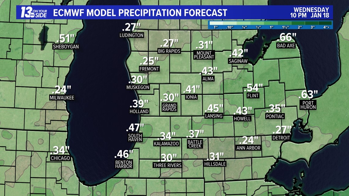
Sunday night into Monday takes us into a damp pattern and the primary precipitation type will be rain. Rain will continue on both Monday and Tuesday. We are expecting anywhere from 0.3" to 1.0" of rainfall, and very little mixing to occur.

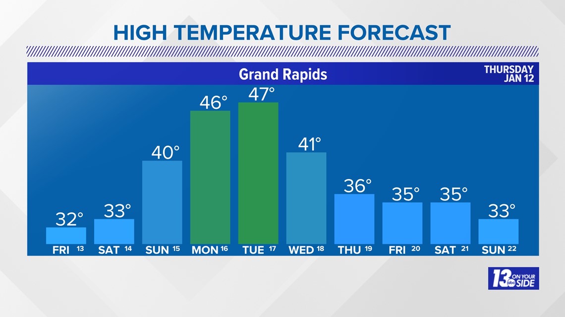
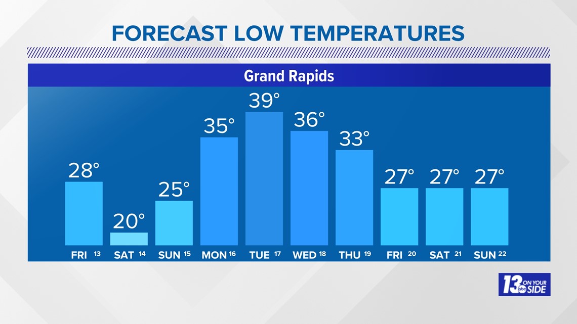
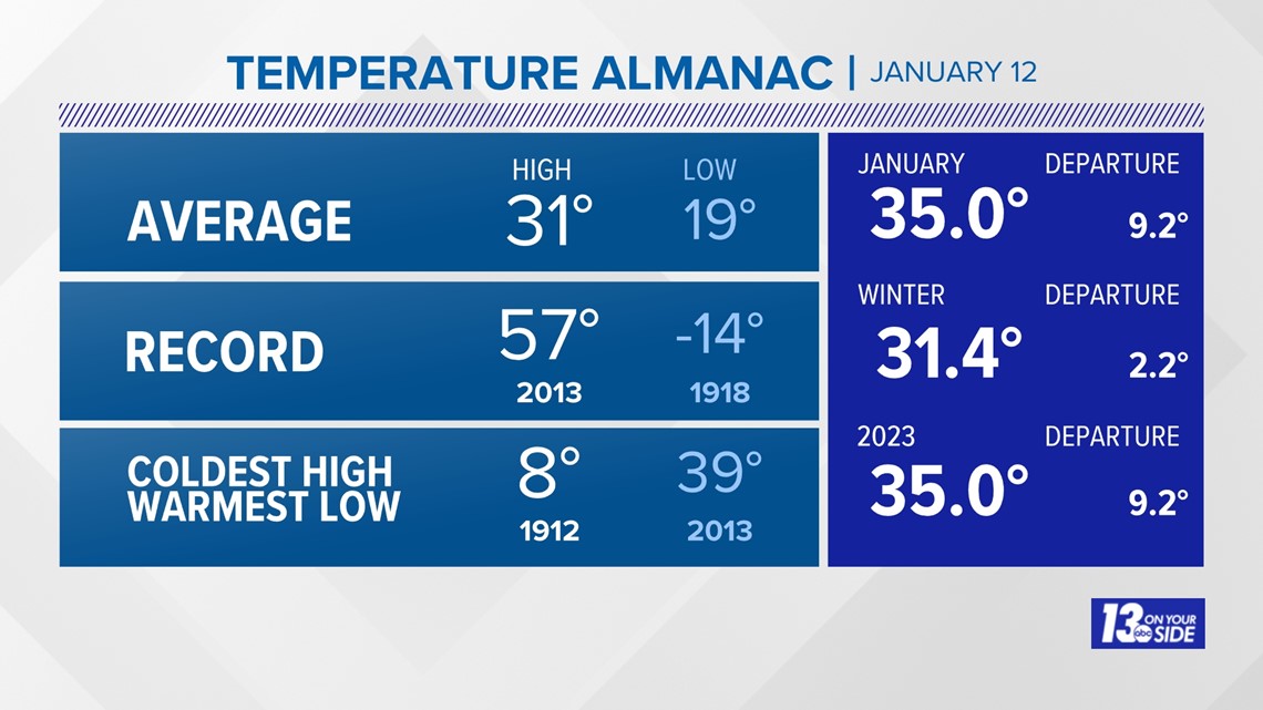
The reason behind this unusual forecast is pretty simple: Temperatures are just too warm. Our 10-day forecast keeps highs in the 40s Sunday through Wednesday. Grand Rapids average afternoon high temperatures for this time of year should sit around 31° with overnight lows in the teens. Although, even our overnight lows, several nights out of the 10-day are above where our average afternoon high temperature should be!


While this is what we are seeing in the short-term, long-term outlooks don't look to provide much winter-like hope. Our 8 to 14 precipitation outlook from Thursday, Jan. 19 through Wednesday, Jan. 25 calls for above average temperatures and above average precipitation. That means that the likelihood of us seeing any sustainable snow, without melting or intermixing rain, looks low through almost the entire month of January. It's not to say we won't see snow, but the chances of it sticking around are low.
While we are only 12 days into the month, we are already at 9.2° above average and the winter season in total is about 2.2° above normal.

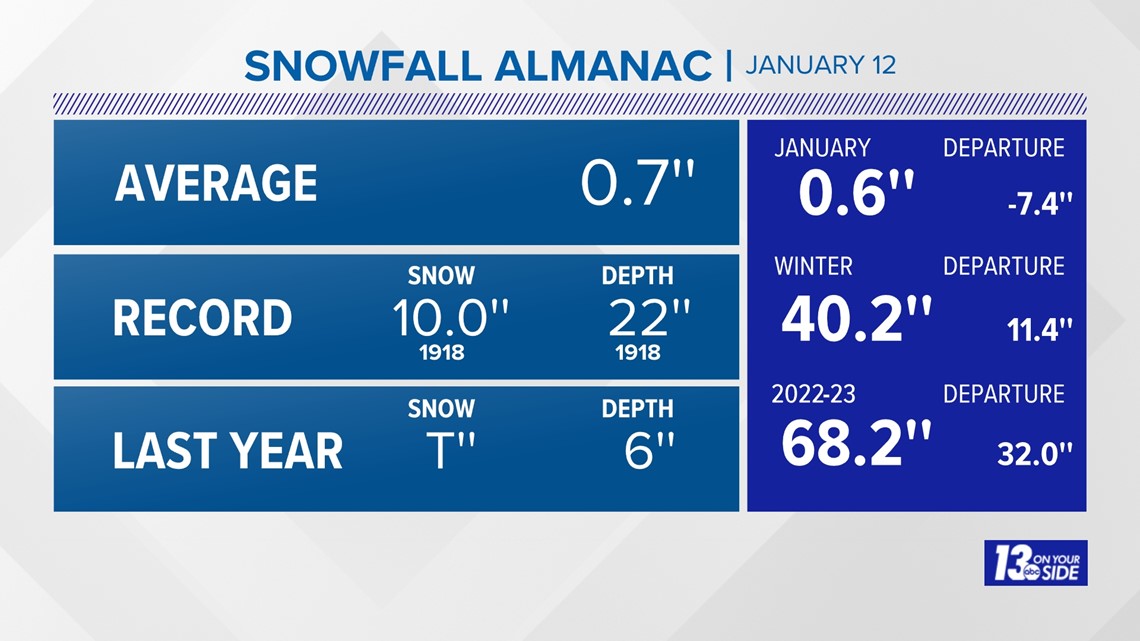
We also are down in terms of snowfall by 7.4". Although, between the blizzard and other lake-effect snow events, our winter season is still rounding out above average by 11.4" with a seasonal total at 40.2" so far.

This warm spell is not only a bummer for those who enjoy and rely on winter recreation, but it is also slowing the development of our Great Lakes ice coverage. Right now we are only seeing 3% ice coverage on Lake Michigan. That is 13.3% below where we should be for this time of year.
This pattern is noticeably becoming more common and linked by scientists to climate change.
Overall, while we started the winter season rather bullish, it seems to be backing off and trending milder.
Have a 30-second video or photo to share? We'd love to share it with everyone! Share your images by texting your name and location to 616.559.1310 or email to Weather@13OnYourSide.com or post it to our 13OnYourSide Facebook Page
►Make it easy to keep up to date with more stories like this. Download the 13 ON YOUR SIDE app now.
Have a news tip? Email news@13onyourside.com, visit our Facebook page or Twitter. Subscribe to our YouTube channel.

