

MICHIGAN, USA — It’s been a lackluster November from the standpoint of winter weather. Sunday’s forecast will try to change that, with a round of accumulating snow expected across West Michigan.
SNOWFALL TIMELINE
Snow is set to arrive late Saturday night to daybreak Sunday, primarily from a Muskegon to Big Rapids line, back to the lakeshore. Snow showers will overspread the entirety of West Michigan throughout the morning, continuing the rest of the day as the low pressure system passes across the Great Lakes region.
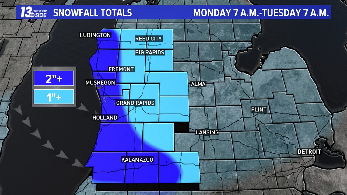
Colder air will filter behind the system, kicking up the lake effect snow machine late Sunday into Monday. Southwesterly winds Sunday will turn northwesterly Sunday night, shifting snow bands. This’ll mostly impact locations between I-96 and I-94, with travel impacts possible for the Monday morning commute.
SNOW ACCUMULATION & IMPACTS
Precipitation is expected to be all snow (with a small exception for mix along the immediate lakeshore) as temperatures start in the upper 20s, climbing into the middle 30s by afternoon. Even with temperatures climbing slightly above the freezing mark, especially along the immediate lakeshore, precipitation will fall as snow.
Intensity of the snow Sunday will be on the lighter side, but consistent throughout the daylight hours. There will be heavier bursts of snow, via lake enhancement, off a southwesterly wind, generally westward of US-131. Areas most likely to see the lake enhancement have been placed under a Winter Weather Advisory from early Sunday through Monday morning.

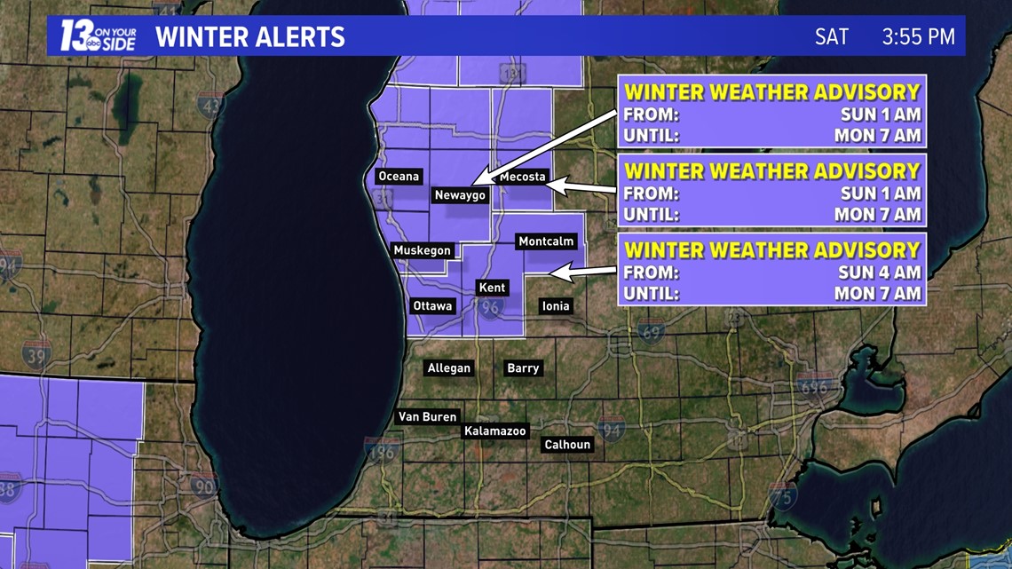
On a broad-brush note, 1-2+” of snow is expected across West Michigan. Lake enhancement will provide higher amounts, 3-4”+, primarily from Muskegon Co. to the north between US-31 and US-131 (places include Twin Lake, Fremont, Hesperia, Pentwater, Ludington).
Localized locations that see the steadiest/heaviest lake enhancement may approach 4-6" by the end of Sunday.

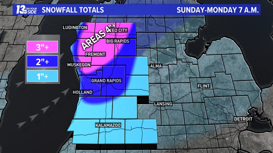
Once the lake effect takes over late Sunday into early Monday, additional accumulation – on the order of 1-2” – is likely in the typical northwest lake effect snow belts between I-96 and I-94, as well as along the lakeshore counties.

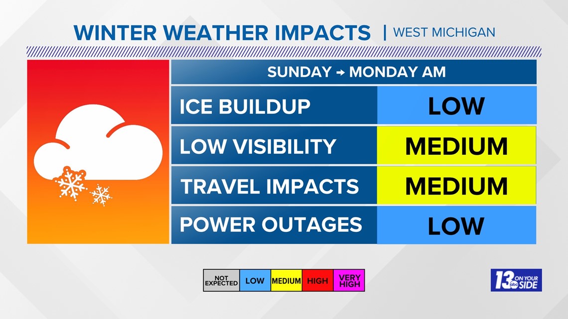
Snowfall amounts will be spread out throughout the entirety of Sunday, but steady enough to accumulate on the roads, especially in areas that contend with the heavier bursts. Side streets, overpasses, and bridges serve the greatest chance to become snow-covered and slick. Visibility will be reduced area wide as the snow becomes widespread by late morning.

NEXT WEEK
It’ll remain a winter feel the rest of next week as the calendar turns to December. Temperatures will only top out in the lower 30s on Monday, with additional lake effect snow chances Tuesday. Putting things into perspective, average high temperatures are still in the lower 40s the last week of November.
Stay with the 13 ON YOUR SIDE Weather Team for updates!.
Have a 30-second video or photo to share? We'd love to share it with everyone! Share your images by texting your name and location to 616.559.1310 or email to Weather@13OnYourSide.com or post it to our 13OnYourSide Facebook Page
►Make it easy to keep up to date with more stories like this. Download the 13 ON YOUR SIDE app now.
Have a news tip? Email news@13onyourside.com, visit our Facebook page or X/Twitter. Subscribe to our YouTube channel.