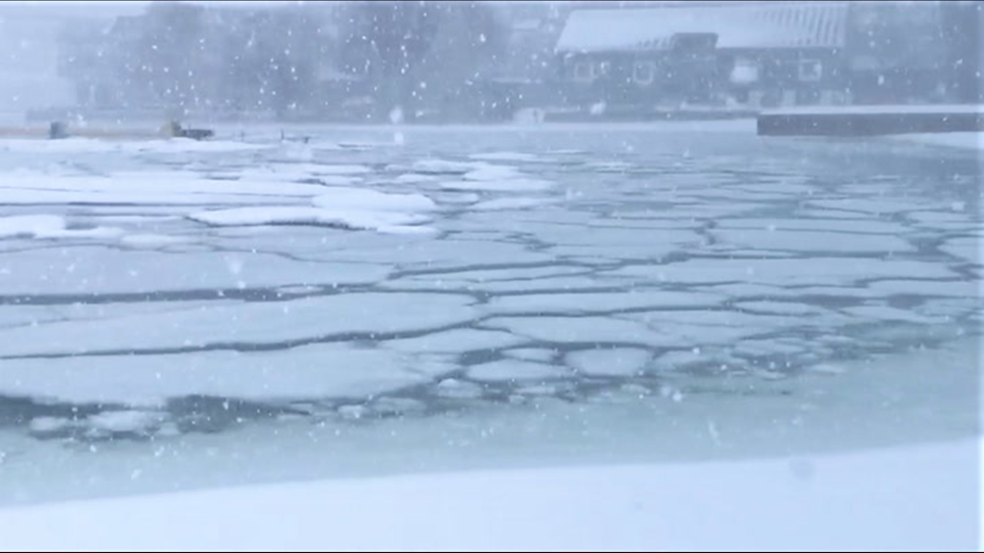
Ice coverage on the Great Lakes is way behind normal for late January due to a lack of sustained cold this winter -- and only glancing blows from Arctic air until now. AccuWeather meteorologists say those factors likely played a role in a recent weather event, and it could continue an unusual weather trend through the rest of the season.
"This winter has been warmer than average, and with the lack of cold air over the Great Lakes, ice on all of the Great Lakes has been lacking this season," AccuWeather Meteorologist Matt Benz said.
Since daytime highs are normally near to below freezing -- 32 degrees Fahrenheit -- and nighttime lows usually fall well below freezing around the Great Lakes this time of year, ice tends to build up quickly this time of year. However, many locations have had multiple days above freezing and even some nights above 32 F, hindering the formation of ice.
Ice coverage as of Jan. 20 has been low the last three years, but this year stands out among the bunch. In 2019, 18.5% of the Great Lakes was covered with ice. Last year, that number was 11.3%. In 2021, only 3.9% of the Great Lakes is ice-covered.
Lake Erie has the highest potential to develop ice first as well as freeze over completely because it is the shallowest of the lakes. Even though this is the coldest part of the winter when ice should be rapidly increasing in coverage, only 3% of the lake has ice on it. While ice was low two years ago, nearly a third of Lake Erie was frozen. Amazingly, the ice coverage was even lower on this date last year, at just 1.8%.
On average, the surface of Lake Erie is frozen 40-50% by this time of year.
While there have been occasional intrusions of colder air, most have not lasted very long. This lack of persistent cold air has allowed for an abundance of another winter weather feature.
"When Arctic air arrives by late January, the ice acts as a lid, keeping moisture from escaping the lake surface, and this can lead to a downturn in lake-effect snow events downwind," Benz said. "The reduction in open water also reduces the fetch -- or the distance that winds blow over open water -- and that also reduces the amount of moisture that escapes into the atmosphere," he added.
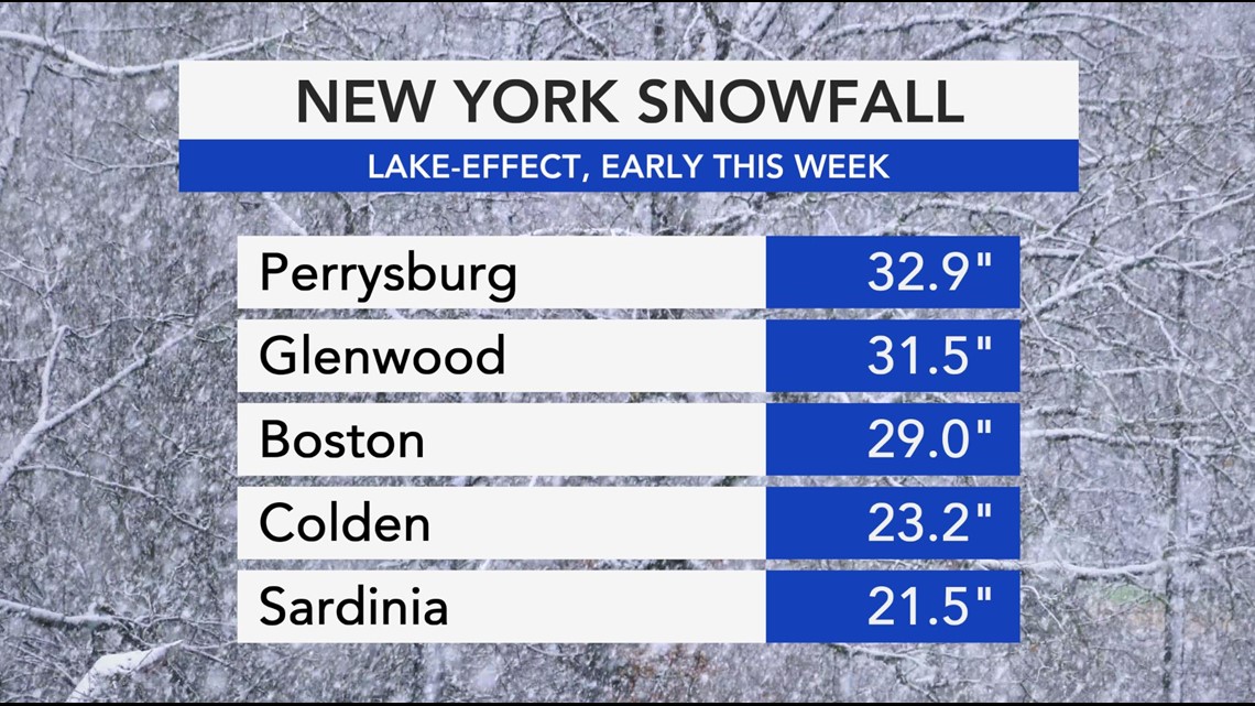
This shutdown of the lake-effect snow machine is typical by the middle of January, but this hasn't been the case this year as evidenced by heavy snow that fell earlier this week. With so much open water and so little in the way of ice, parts of New York state reported snowfall totals more typical for late in the fall.
AccuWeather Broadcast Meteorologist Geoffrey Cornish explained that one could easily argue that some of these early-week totals east of Lake Erie wouldn't have been as impressive had Lake Erie had more ice coverage or had lake surface temperatures been 2-3 degrees colder.


"This year with the lack of ice, there is nothing to hold back lake moisture from escaping into the atmosphere when Arctic air plunges southward," Benz added. "This means that heavy snow events that you would normally find early in the season are still occurring this time of year."
Snowfall climatology to the west of the Appalachian Mountains show late fall and early winter as the most likely periods for high snowfall totals. This is quite different than areas located just a couple hundred miles farther east, including cities closer to the East coast, where the three snowiest months on average are January, February and March.
Erie, Pennsylvania, typically picks up 27.5 inches of snow in December and 29.6 inches in January, while snowfall totals in February and March are much lower at 18.2 inches and 13.7 inches, respectively.
Cornish added that observations showing "low concentration" of ice on portions of Lake Erie is the tell-tale sign that the ice is beginning to form.
"Given the pattern, it is just a matter of time," Cornish said. "I suspect we will soon start to see a decent rise to the teens and 20% range at least, in the next several days."
The first burst of Arctic air in 2021 is expected to drop temperatures and bring lake-enhanced snowfall to the Northeast into this weekend.
With the rest of January and all of February to go, ice coverage will increase. On the other hand, with more than a third of the winter already over, it is very unlikely that the Great Lakes will freeze over entirely, which has happened in some years. And because of that, lake-effect snow will continue to be a possibility for the rest of the winter and possibly even into early spring.

