A storm threatening heavy rain and flooding concerns in the Northwest into the middle of this week will strengthen and take aim at the Midwest and bring a dramatic change to the weather. The system will unload heavy snow, generate gusty winds and send a piercing blast of cold air into the region late this week.
The winter weather will follow a taste of unusual warmth, causing a case of weather whiplash for millions of Americans. Temperatures will climb as much as 25 degrees above average during midweek ahead of an abrupt change to harsh, midwinter conditions from portions of the Plains to the Great Lakes region.

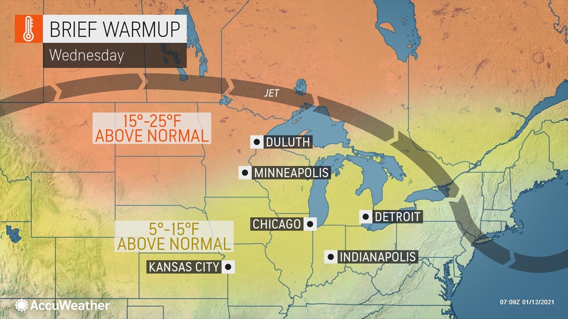
At Pierre, South Dakota, temperatures are forecast to plunge from a high just shy of the record of 60 F set in 1983 on Wednesday to the middle 20s Thursday night with AccuWeather RealFeel® Temperatures in the single digits. The normal high and low temperatures at Pierre are 30 and 10 degrees, respectively. Even though the temperature change will be less extreme farther to the east, the storm will bring temperatures back to near average in its wake.
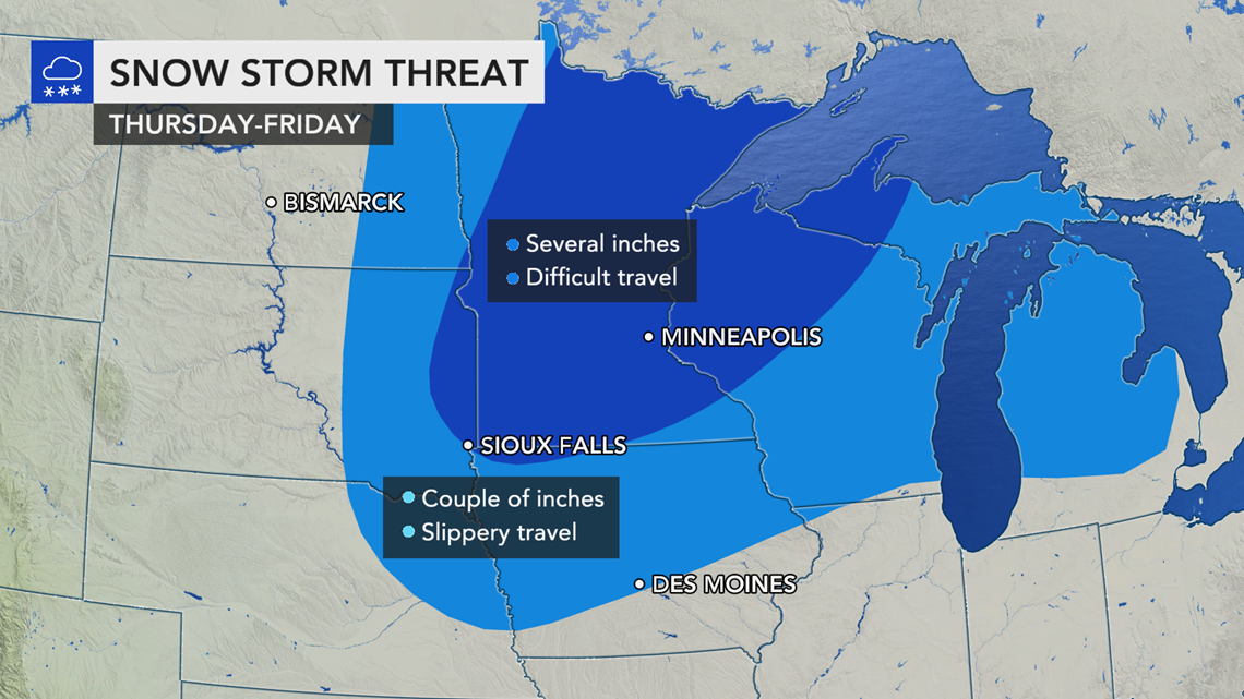
The storm will race across the southern Canada Prairies during Wednesday night and then take root around the Great Lakes on Thursday, where it is forecast to stall and unload snow into Friday from the eastern parts of the Dakotas and northeastern Nebraska to northwestern Ontario.

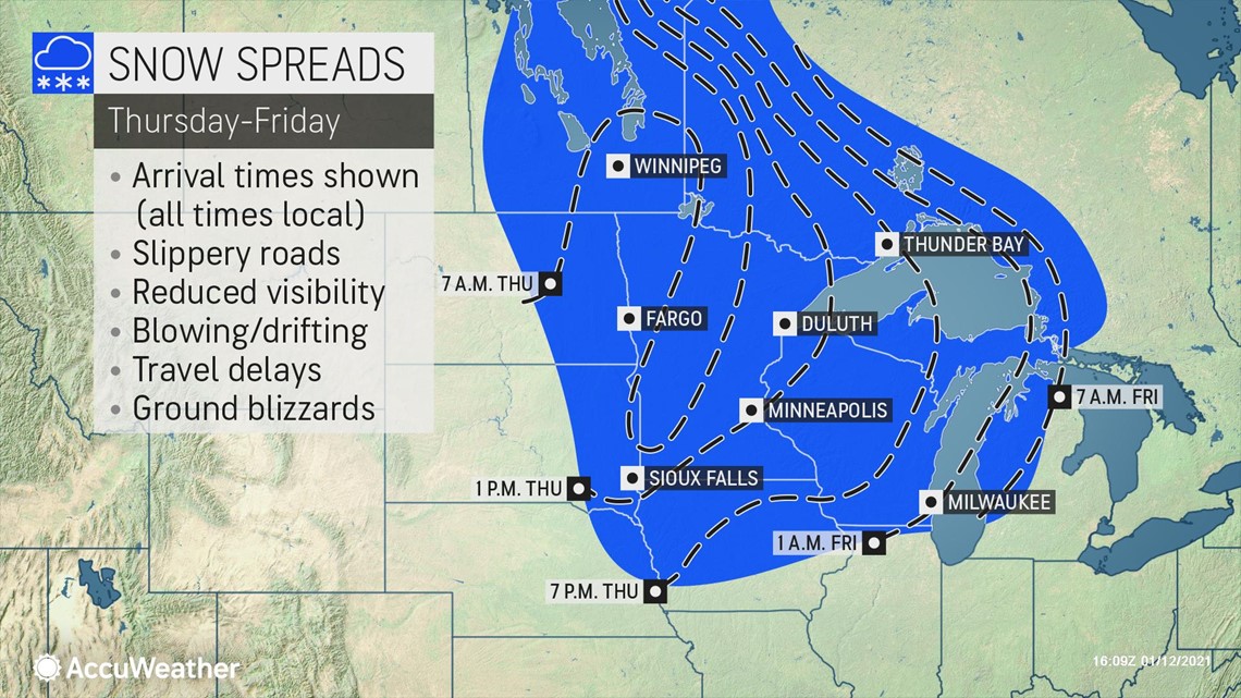
"The heaviest snow, on the order of 6-12 inches (15-30 centimeters) with an AccuWeather Local StormMax™ of 16 inches (40 centimeters), is forecast from northeastern Minnesota and northwestern Wisconsin to part of the Upper Peninsula of Michigan and the northern shores of Lake Superior in Ontario," according to AccuWeather Senior Meteorologist Brett Anderson.
Enough snow to shovel and plow can extend from along the Red River of the North along the Dakota/Minnesota border to northwestern Iowa and central Wisconsin.
As a cold front advances from the storm, a brief band of snow, snow showers or a wintry mix is forecast to progress from eastern Iowa, northern and central Illinois and southeastern Wisconsin during Thursday afternoon and evening to portions of Indiana, Michigan and western Ohio during Thursday night. Southern Ontario, eastern Ohio, northern West Virginia and western Pennsylvania will face wintry precipitation Friday.

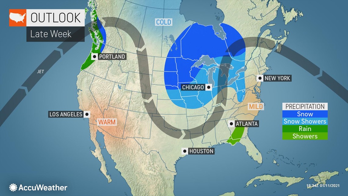
While this band of snow and mixed precipitation is not expected to bring much in the way of an accumulation, just enough can occur to briefly coat roads and sidewalks and make for slippery walking conditions and sudden changes to driving conditions on area highways.
Around Chicago, conditions may quickly trend from a high well in the 30s during the day Friday to the 20s with a brief period of snow and slippery conditions during the evening hours.
As the storm system intensifies, winds will ramp up as well, adding to travel dangers. Gusts from 70-90 mph are anticipated over parts of Montana and Wyoming on Wednesday.
"Wind gusts between 70 and 80 mph are likely outside of the snowfall area from the eastern slopes of the Rockies in Montana, Wyoming and Colorado to the western and central parts of the Dakotas, Nebraska and Kansas during Wednesday night and Thursday," AccuWeather Senior Storm Warning Meteorologist Eddie Walker said.

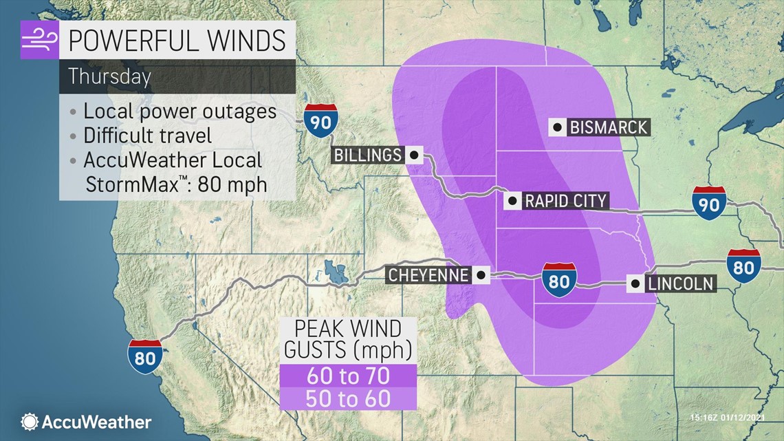
Winds this strong can create dangerous handling of high-profile vehicles and can raise the potential of vehicle rollovers.
"Gusts between 30 and 50 mph will ramp up from Thursday to Friday within the snow area on the Plains and Upper Midwest, west of the Great Lakes. This can create blizzard conditions due to blowing and drifting of snow on the ground," Walker said.
The combination of gusty winds and colder air moving in with the storm can take a lot of heat away from roads and sidewalks at a fast pace. This flash freeze-up can make driving and walking especially dangerous due to the rapidly changing weather conditions from Thursday to Friday.

Very windy conditions are forecast to persist farther west over the Plains and eastern slopes of the Rockies into Friday.
As the colder air begins to pass over the relatively open waters of the Great Lakes, lake-effect snow bands are likely to develop. The exact alignment and persistence of these bands will determine the amount of snow that falls from location to location. Since the air coming in is not tremendously cold, lake-effect is not likely to be intense, but only a small amount of snow can make for slippery and dangerous travel.
The greatest impact from lake-effect into Friday night is likely west of lakes Erie and Ontario. During Saturday and Saturday night, some lake-effect snow is likely to extend to areas east of lakes Erie and Ontario as well.
The eastward progression of the cold air associated with the storm is likely to be delayed a bit along the Atlantic Seaboard. However, a storm moving northward along the leading edge of the cold air may be able to bring rain that changes over to snow across part of the interior mid-Atlantic and New England. The chance will exist for some snowflakes to fly in the major cities along Interstate 95 from northern Virginia to Maine.

