ARLINGTON, Texas — Snow can come from a variety of sources, but it's not very often those sources end up over Texas, at least not around the Dallas/Ft. Worth Metroplex. This past week has given the region a major impact of winter weather that they have not seen in years.
In addition to the system snowfall around the region, smaller scale snow features were also able to develop. This included things such as lake effect snow, not from a major body of water, but from the shear difference in temperature between the air and the small to medium sized lakes around the region.
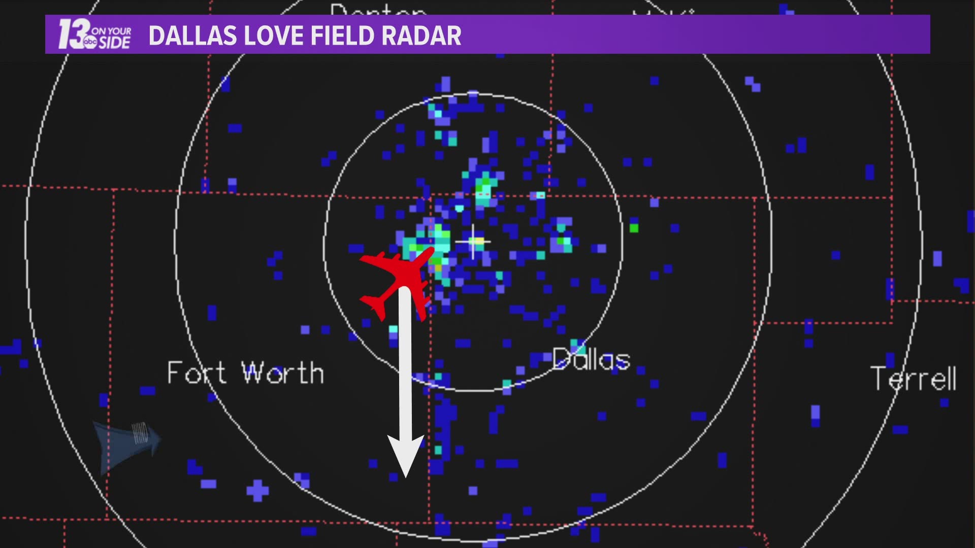
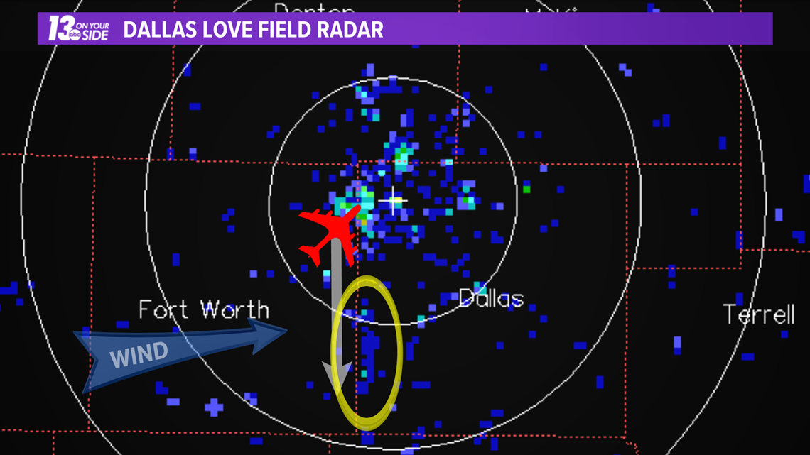
However, there was one area of light snowfall late in the morning hours of February 12th that didn't fit the mold of the rest. A small band extending north to south right along the border between Dallas and Tarrant county. A band that lined up almost perfectly with DFW airport.
It was, airplane effect snowfall!

So what created this kind of snowfall? Let's take a look!
How It Happens:
For the purposes of this article there several different kinds of snowfall that we can collectively call "effect based" snowfall.
The most common type of this snowfall is lake effect snowfall. This happens when cold air flows over warm lake water causing the moisture rich warm air rising off the lake to condense into snow producing clouds.
RELATED: What is lake effect snow?
The same process, though in a much much smaller area, can happen with cold air flowing into the warm moisture rich air being exhausted by a power plant. This would be called, rather uncreatively, power plant effect snow.

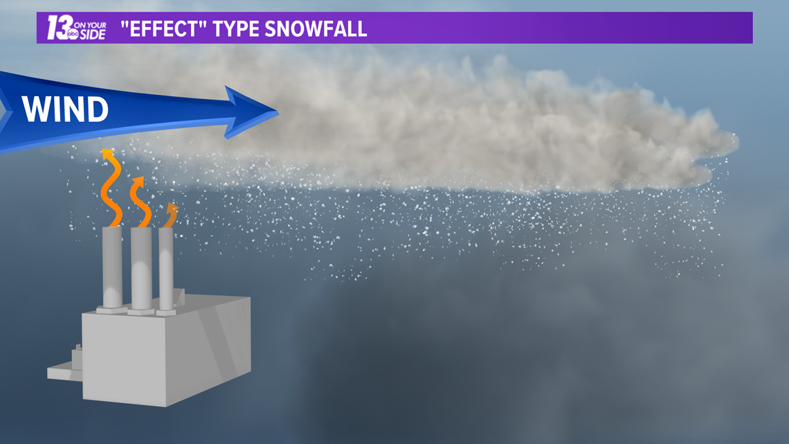
While this may have been occurring around the region, this would look on radar like a much smaller version of lake effect. Thus it would follow along with the winds aloft, which on the 12th were flowing west to east.
The band on radar was forming north to south, perpendicular to the winds aloft.
Digging further into the picture, these bands were noticed to be forming south of the DFW airport, whose runways are also oriented north to south. In fact, these bands were forming just slightly to the east, as pushed by the winds, from the flight path of planes taking off and landing from the airport.
It would appear that the planes were helping to generate this snow band, and that assumption would be correct.
On the 12th there was a weather phenomenon known as an inversion over the Dallas/Ft. Worth Metroplex. This means air above the surface is actually warmer than air further down, in effect keeping air trapped near the surface instead of rising.

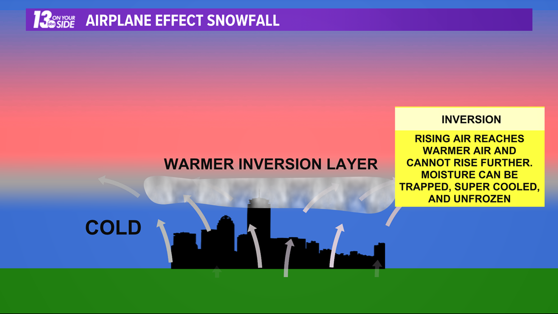
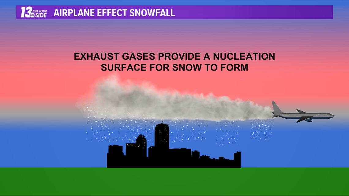
Moisture in the air trapped near this boundary can become super cooled, staying a liquid below the freezing point, because it does not have anything to freeze onto in order to start forming an ice crystal. That is until an airplane comes through.
The moisture and exhaust particles expelled by the airplane create the perfect source for these super cooled droplets to cling onto and start to form ice crystals. If enough planes travel through the area of super cooled droplets a small band of snow can form, with some of it eventually reaching ground level.

While in the grand scheme of the weather impacts to Texas this past week airplane effect snowfall had zero impact, it is still interesting to look at the science behind why it occurred.
With regard to the bigger picture, be sure to keep those impacted hardest by this winter storm in your thoughts, and if you would like to help in the recovery, the link below has resources on how to do so.
Stay safe and stay warm!
-- Meteorologist Michael Behrens
Follow me on social media! Facebook Meteorologist Michael Behrens, Twitter @MikeBehrensWX, and Instagram @MikeBehrensWX.
Email me at: MBehrens@13OnYourSide.com
Have a 30-second video or still photo to share? We'd love to share it with everyone! Email your image to Weather@13OnYourSide.com or post it to our 13OnYourSide Facebook Page.
►Make it easy to keep up to date with more stories like this. Download the 13 ON YOUR SIDE app now.
Have a news tip? Email news@13onyourside.com, visit our Facebook page or Twitter. Subscribe to our YouTube channel.

