GRAND RAPIDS, Mich. — As we head into the second week of May we are going to be making a hard shift from our cool and cloudy April/early May into a warmer and drier weather pattern here in West Michigan.
These warmer temperatures, pushing into the 70s Monday and 80s by Tuesday, will result in drying surface materials. This will be accelerated by low relative humidity levels and gusty winds.
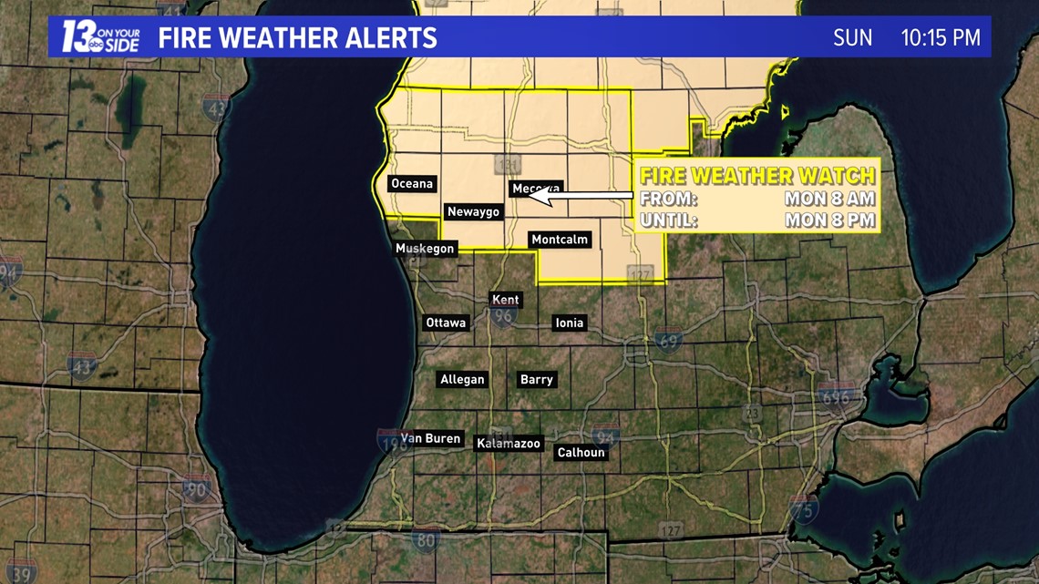
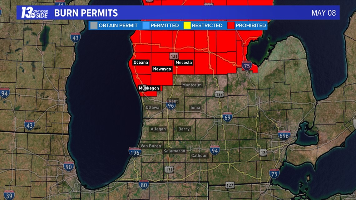
As a result burn bans are in place for all counties in Michigan that usually allow open burning, and a fire weather watch is in place for our northern counties as well.
The National Weather Service advises that red flag conditions may develop on Monday as well.


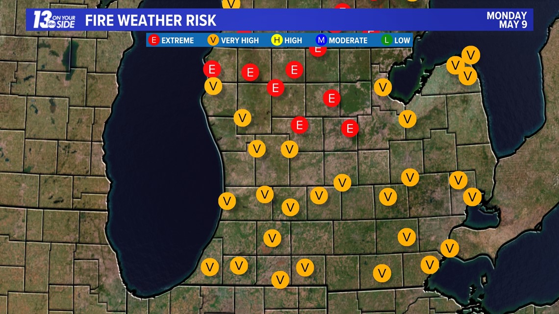
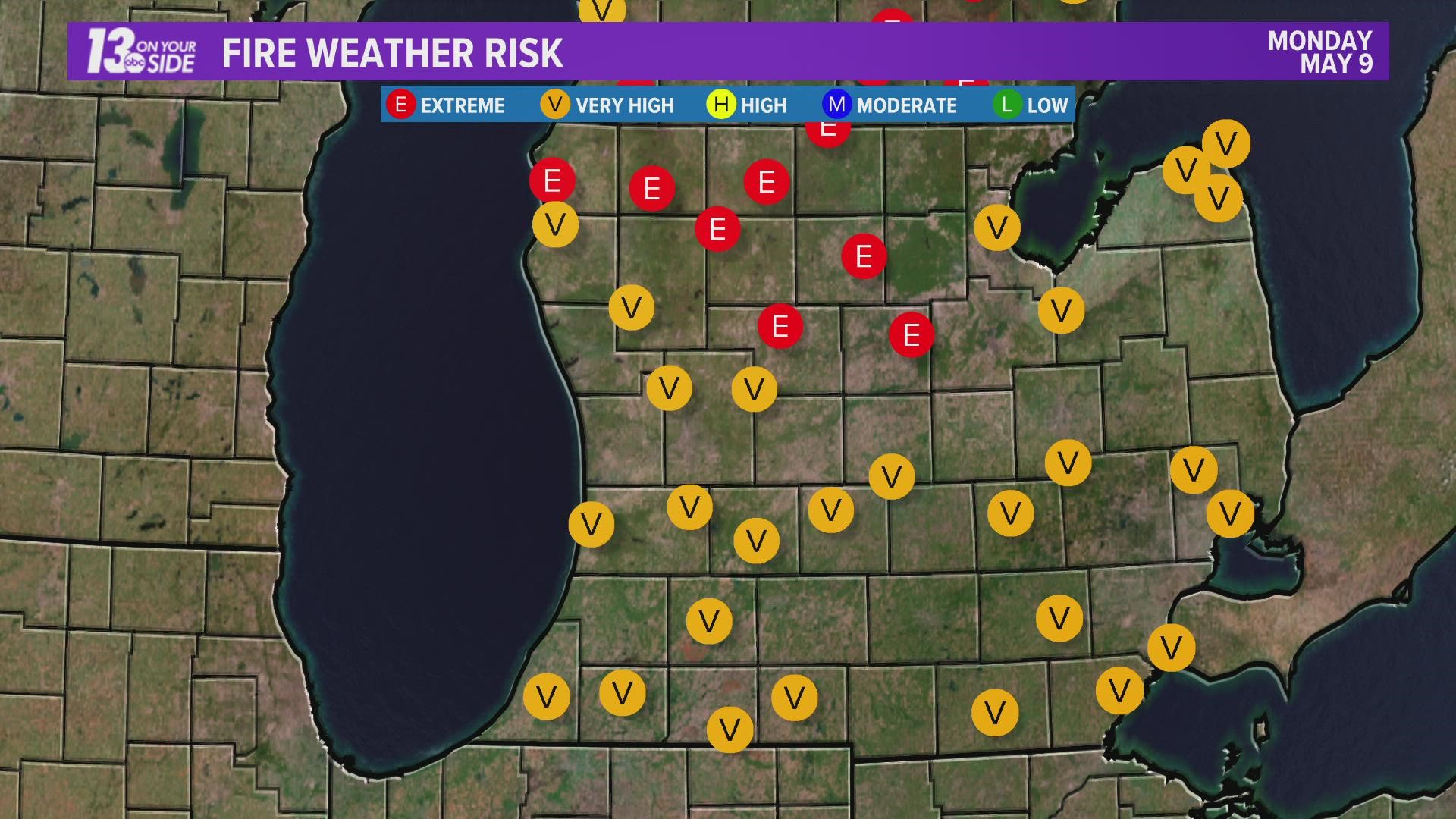
Fire weather dangers across the entire state will be in the very high to extreme category on Monday. These will remain high to very high into Tuesday as well.


Winds at times on Monday will be gusting up above 30 mph, which when combined with dry surface materials and low relative humidities can result in conditions where a fire can get out of control quickly.
As a precaution you should avoid tossing cigarette butts outdoors, grilling near grassy areas, parking vehicles in tall grass, towing a trailer with dragging trailer chains, or any other activity that make result in sparks, flames, or heat sources near dry surface fuels.


More moist air should move in by the midweek and the fire danger is expected to decrease some then. Stick with 13 On Your Side for the latest forecast and updates all week long.
-- Meteorologist Michael Behrens
Follow me on social media! Facebook Meteorologist Michael Behrens, Twitter @MikeBehrensWX, and Instagram @MikeBehrensWX.
Email me at: MBehrens@13OnYourSide.com
Have a 30-second video or still photo to share? We'd love to share it with everyone! Email your image to Weather@13OnYourSide.com or post it to our 13OnYourSide Facebook Page.
►Make it easy to keep up to date with more stories like this. Download the 13 ON YOUR SIDE app now.
Have a news tip? Email news@13onyourside.com, visit our Facebook page or Twitter. Subscribe to our YouTube channel.

