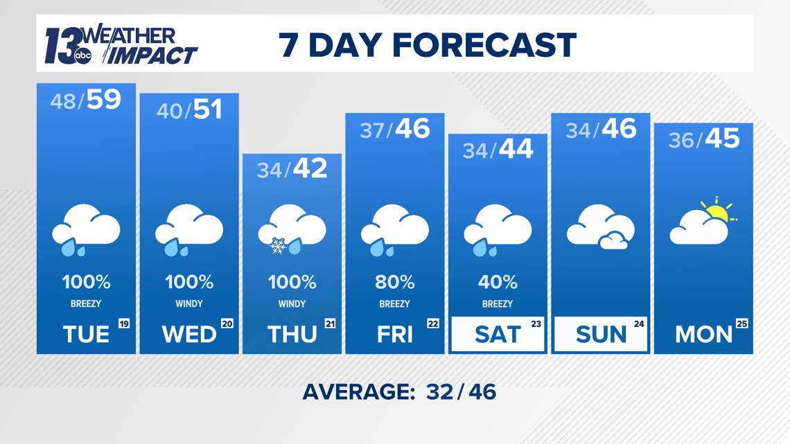
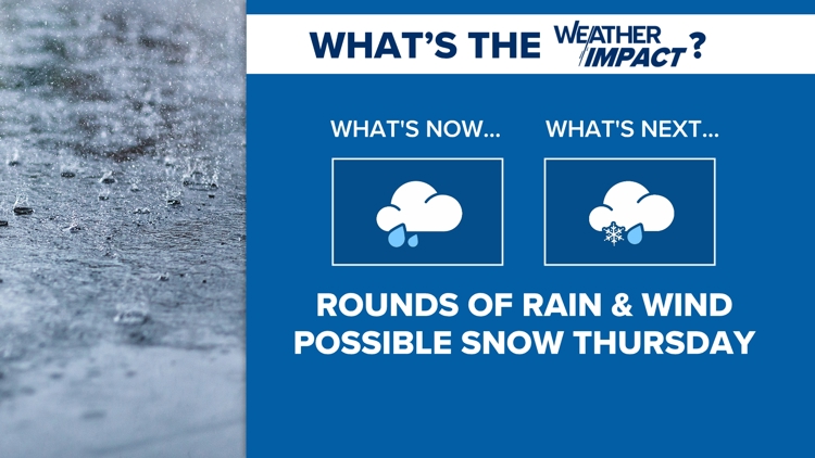
GRAND RAPIDS, Mich. — It’s been a tranquil fall overall, but a dynamic weather pattern is set to take hold of West Michigan in the coming days. Expect several days of windy, rainy conditions and possibly the season’s first snow accumulation for some areas by the end of the week.
RAIN TUESDAY; WARM
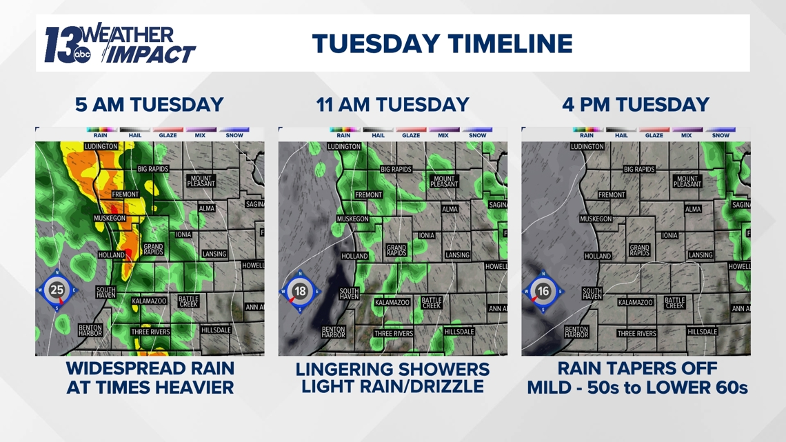
A widespread round of rain will kick off Tuesday as a warm/occluded front lifts through West Michigan, associated with a strong low-pressure system to our northwest. Nothing impactful is expected with the morning rain, which will diminish as the day goes on.
In the wake of the warm/occluded front, temperatures Tuesday will soar into the upper 50s to lower 60s, nearly 15 degrees above average at this point of November.

RAIN WEDNESDAY, POSSIBLE SNOW THURSDAY
The trickiest part of the forecast comes Wednesday into Thursday as a secondary low-pressure system develops in the lower Great Lakes region, intensifying rapidly as it interacts with the original system's dynamics. Widespread precipitation and windy conditions will accompany the secondary low-pressure system Wednesday and Thursday, primarily near and west of its center.
In West Michigan, the chance of rain will increase throughout the day, with the expectation of widespread rain by the evening. Depending on the amount of cold air, this system may introduce a switchover to snow in certain areas Wednesday night into Thursday morning.

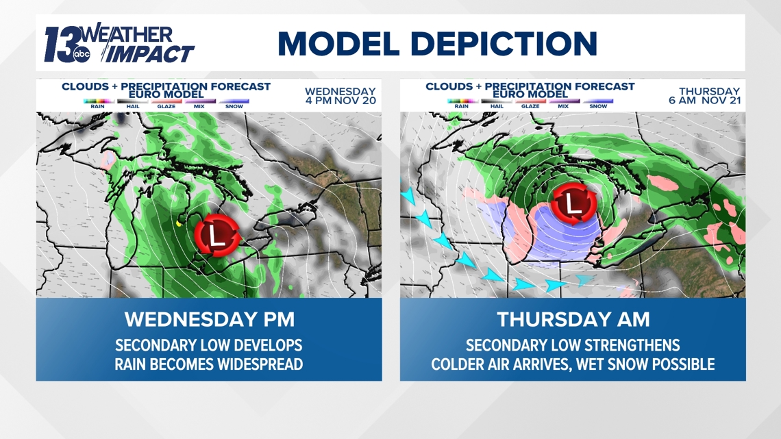
The greatest likelihood of a brief switchover to snow will be near and eastward of US-131, away from the influence of the relative warmer waters of the Great Lakes. Precipitation near the lakeshore is expected to remain all rain as the relative warmer waters of the Great Lakes modify the air mass. The rain and snow mix will be most persistent overnight Wednesday into Thursday morning, gradually tapering off during the latter half of Thursday.

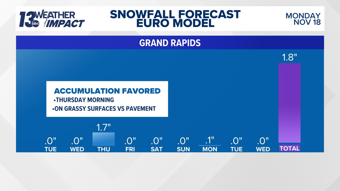
Impacts appear minimal as of now, with air temperatures remaining above freezing and ground/soil temperatures in the upper 40s to lower 50s. At this point of the forecast, any snow will be limited to grassy surfaces, and accumulation would be meager. Impacts could become greater if snowfall rates become heavier than expected. Heavier rates of snow could briefly overcome the above-freezing air and ground temperatures and accumulate on some roadways in the dawn hours of Thursday.
It’ll become increasingly windy Wednesday into Thursday, with northwest gusts of 30+ mph across the region. Gusts of 40+ mph will be possible on Thursday, especially along the lakeshore.
LINGERING SHOWERS FRIDAY
Unsettled weather will continue through the end of the week, but the influence of the secondary low-pressure system will wane. Precipitation will be mostly in the way of rain, outside of a few wet snowflakes. Calmer conditions finally return this upcoming weekend.

