
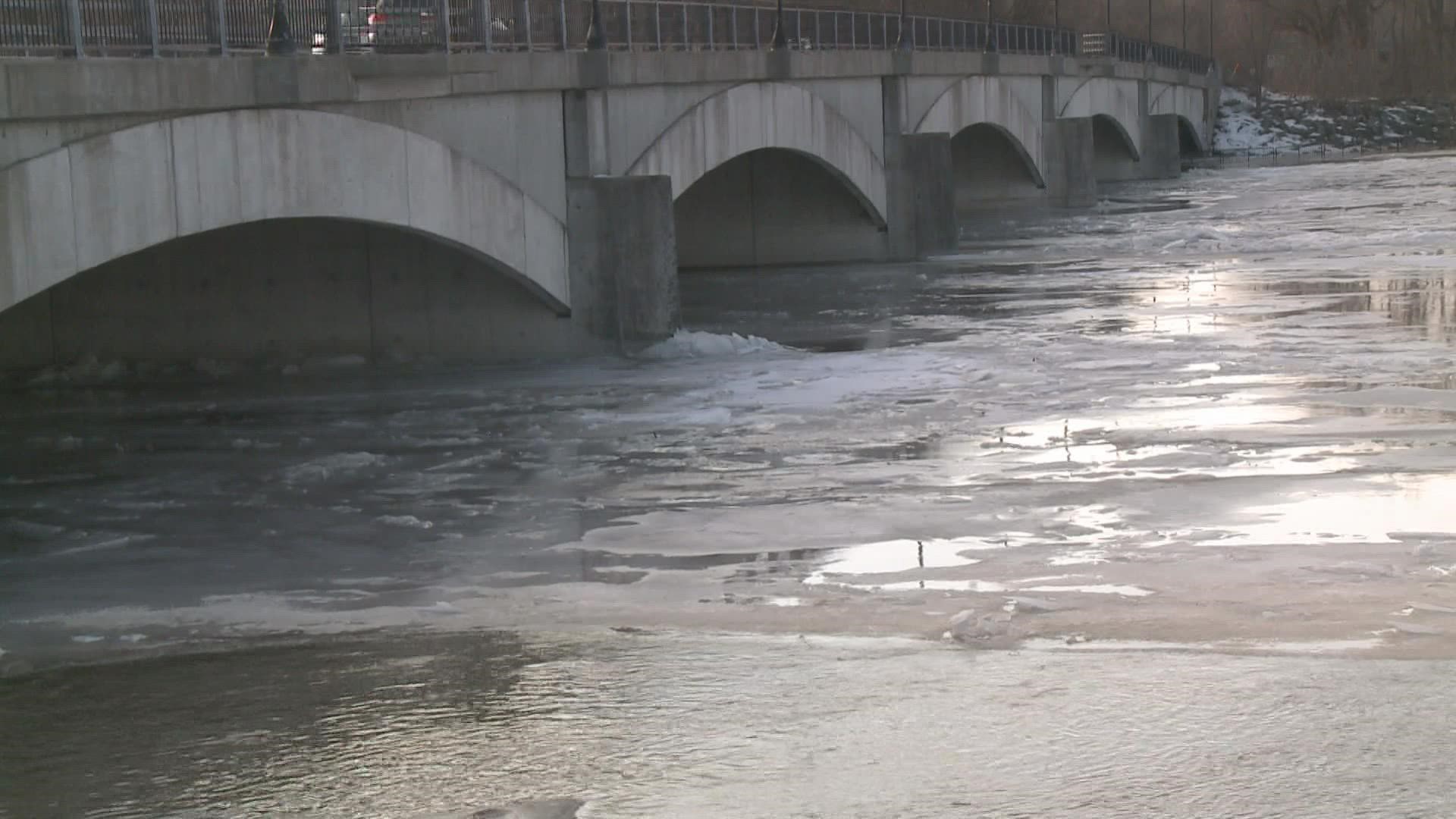
MICHIGAN, USA — We started to see ice jams form in parts of West Michigan on Saturday, and with the surge of warm weather that hit the region on Sunday, more ice jams and flooding have formed around the region.
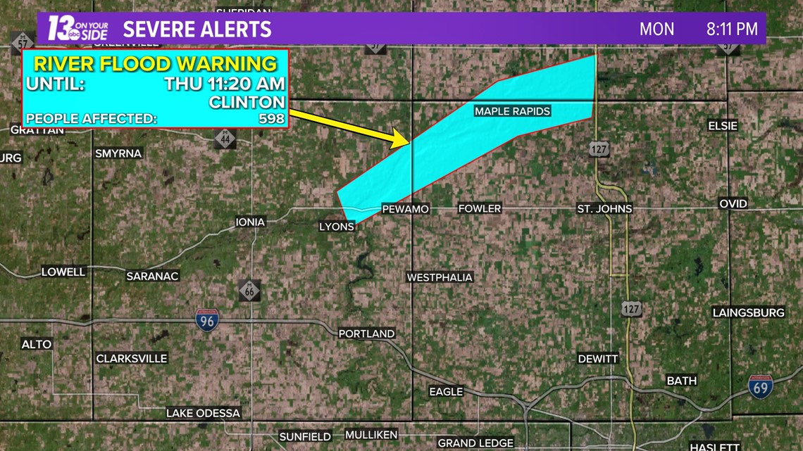
As of 8:30 p.m. on Monday night, there were three area rivers that were under flood warnings around West Michigan.
First, the Grand River near Robinson Township in Ottawa County. This river saw a "significant ice jam" on the river near the M-231 bridge. This jam is causing flooding in parts of Robinson Township including along Limberlost Lane and Van Lopik Avenue. The ice jam has also destroyed the local river gauge at this location.
The ice jam has since moved from the bridge down toward Connor Bayou. As the ice jam continues to move downstream in the days ahead additional flooding may occur, including in some areas that typically do not have flooding issues.


Next, the Grand River in Comstock Park was seeing minor flooding, especially along Abrigador Trail and Willow Drive in Kent County. The river was forecast to reach 13.1 feet as of the forecast Monday evening, which could cause minor flooding to homes along the river. Flood stage is at 12.0 feet.


An additional flood warning was impacting the Maple River in Ionia County as of Monday night.
Flooding along the Maple River at Maple Rapids was reported. Minor flooding is expected with the river forecast to hit 9.5 feet, with flooding expected along County Line Road. Flood stage is at 9.0 feet.

Remember, if you come across a flooded roadway, never attempt to drive through it. Also, keep in mind that flooding from ice jams can be unpredictable and develop and change rapidly. If you live along or commute next to a river in any of these areas experiencing ice jams pay extra attention to river conditions in the coming days and have a response plan ready!
Please report any ice jams or flooding to your local authorities.
-- Meteorologist Michael Behrens
Follow me on social media! Facebook Meteorologist Michael Behrens, Twitter @MikeBehrensWX, and Instagram @MikeBehrensWX.
Email me at: MBehrens@13OnYourSide.com
Have a 30-second video or still photo to share? We'd love to share it with everyone! Email your image to Weather@13OnYourSide.com or post it to our 13OnYourSide Facebook Page.
►Make it easy to keep up to date with more stories like this. Download the 13 ON YOUR SIDE app now.
Have a news tip? Email news@13onyourside.com, visit our Facebook page or Twitter. Subscribe to our YouTube channel.