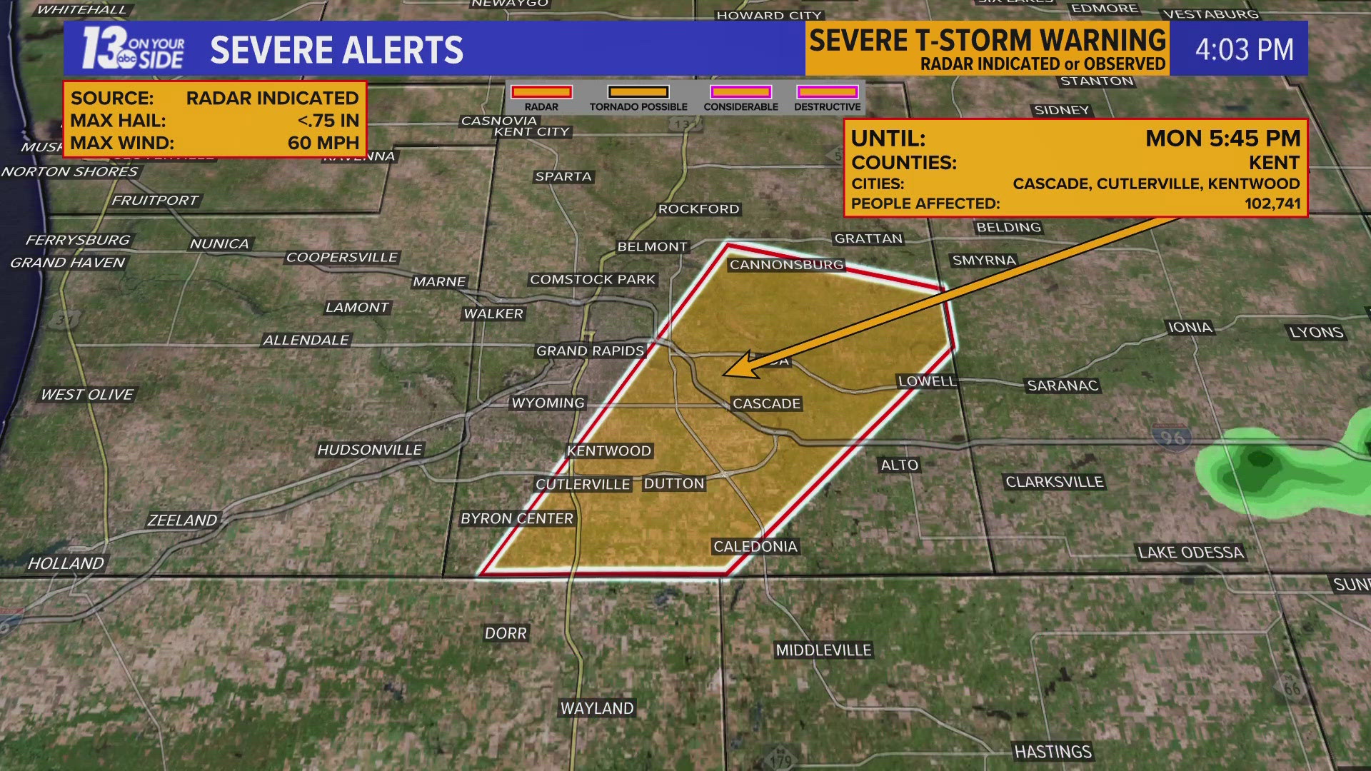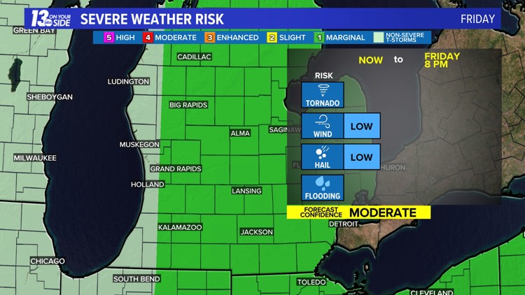
GRAND RAPIDS, Mich. — Most are enjoying a nice Friday so far – and many will stay that way - but a risk of storms does exist the rest of the day.
Thunderstorms will somewhat pick up in coverage this afternoon into the early evening via a warm/cold front combo sweeping through Lower Michigan.
Coverage of thunderstorms will remain hit or miss, but the opportunity will be better in two spots: Near US-10 via the warm front, and east of US-131 via the cold front. It’s doable one or two thunderstorms can become severe with strong wind/large hail.
There’s no need to cancel outdoor plans, but an extra eye on the sky is for the best so you're not caught off guard.
►Make it easy to keep up to date with more stories like this. Download the 13 ON YOUR SIDE app now.
Have a news tip? Email news@13onyourside.com, visit our Facebook page or Twitter. Subscribe to our YouTube channel.
Watch 13 ON YOUR SIDE for free on Roku, Amazon Fire TV Stick, Apple TV and on your phone.