GRAND RAPIDS, Mich. — A mixture of tricks and treats – there’s plenty to discuss in this year's Halloween forecast around West Michigan.
Thursday will mark the transition from recent record warmth to a cooler, more seasonable air mass on Friday as a cold front arrives. This’ll keep the stout wind around all of Halloween, along with the opportunity of rain, even a few thunderstorms.
RAIN/T-STORMTIMING:
Scattered showers and thunderstorms will increase in coverage around daybreak Thursday and continue through the morning. Most of West Michigan will avoid a complete washout, though any thunderstorms may bring brief, heavy downpours.

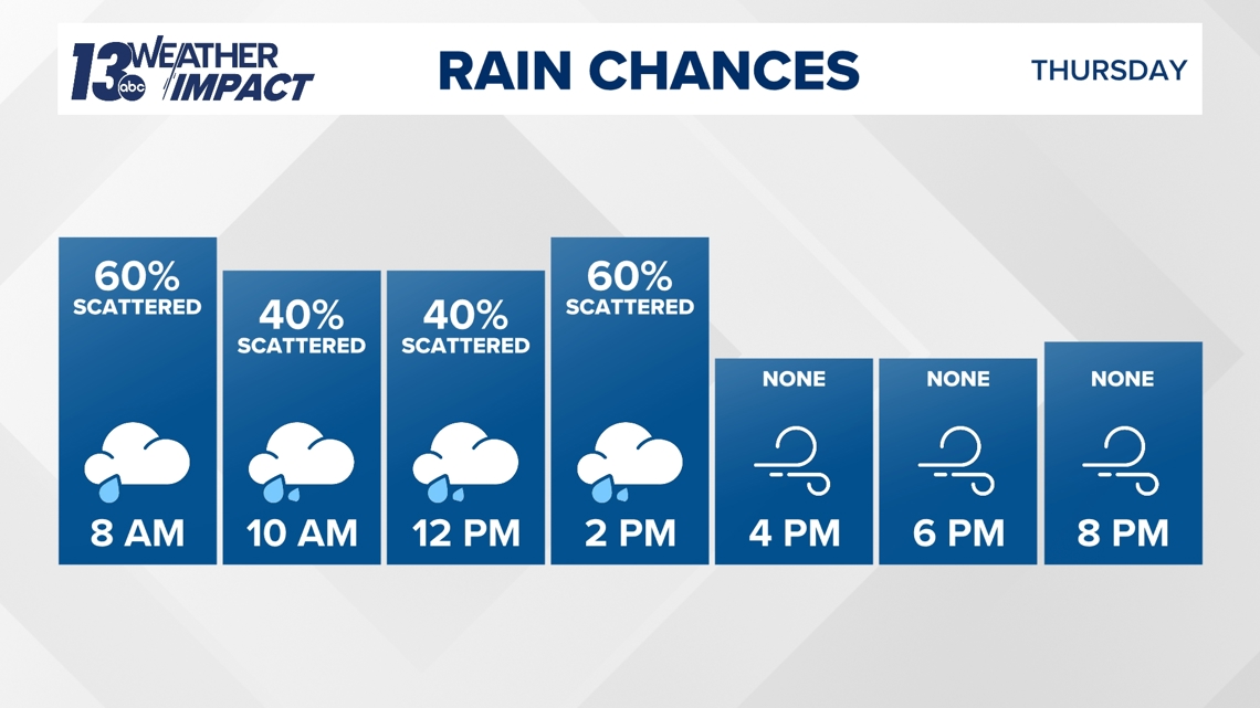
A cold front will move through midday into early afternoon, producing a secondary line of showers and thunderstorms. While the Storm Prediction Center has not indicated a severe weather risk, locally strong wind gusts are possible in any thunderstorms that develop. The cold front and accompanying line of thundershowers will quickly move through West Michigan, clearing out by mid to late afternoon.
Dry conditions are expected to persist through the entire trick-or-treating period in the late afternoon and evening. A few light lake-effect rain showers may develop late Thursday night, but these are likely to hold off until after festivities have wrapped up.
WIND
It’s been windy for a few days around West Michigan, and it’s expected those winds will continue all of Halloween. The stout wind will likely be the biggest trick of the Halloween forecast.

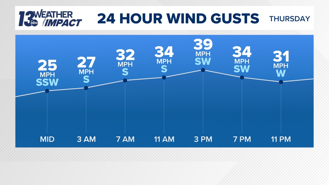
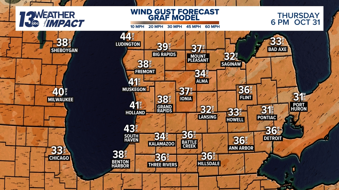
Sustained winds of 15 to 25 miles per hour, with gusts of 30 to 40 miles per hour will be commonplace throughout the day, including trick-or-treating time. The wind will be out of the southwest through the afternoon before gradually turning to the west by the evening, once the cold front passes. The strongest wind gusts – in excess of 40 mph – will be likeliest along the lakeshore.

The wind will gradually relax Thursday night into Friday as high pressure settles over the Great Lakes.
TEMPERATURES
It won’t be record warmth, but much of Halloween will remain mild and above average for this time of year
Highs on Halloween will be in the 60s to near 70F, which’ll be achieved in the early afternoon hours just prior to the arrival of the cold front. However, things will start to cool down quickly into the evening, with temperatures falling through the 50s, even into the 40s in the coldest locations, during trick-or-treating time.
Temperatures by daybreak Friday will bottom out in the upper 30s to lower 40s, with daytime highs only rebounding into the 50s.
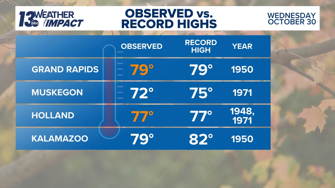
NEAR RECORD WARMTH WEDNESDAY
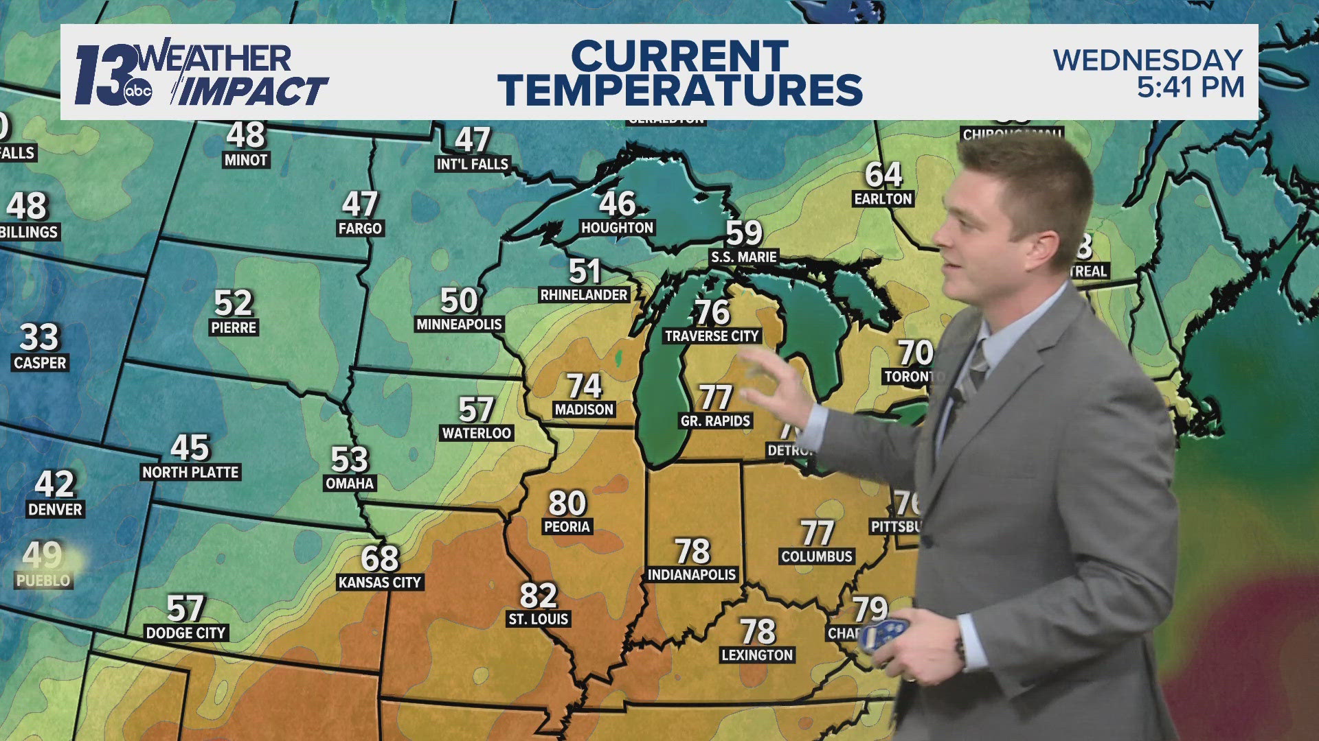
Wednesday was unseasonably warm, with temperatures soaring into the 70s. Grand Rapids and Holland tied their record high temperature for October 30, while Muskegon and Kalamazoo came just a few degrees short.

You can check the latest forecast from the 13 Impact Weather Team HERE.
Have a 30-second video or photo to share? We'd love to share it with everyone! Share your images by texting your name and location to 616.559.1310 or email to Weather@13OnYourSide.com or post it to our 13OnYourSide Facebook Page

