GRAND RAPIDS, Mich. — As we get deeper into the season of fall, Michigan often becomes a battleground between warm and cold air masses. Low pressure giants roar across the state bringing gusty winds and huge temperature swings.
While we are still days away, forecast models are suggesting that another intense storm may develop in the Great Plains and slam into West Michigan just in time for a nasty trick on Halloween.
Consistency
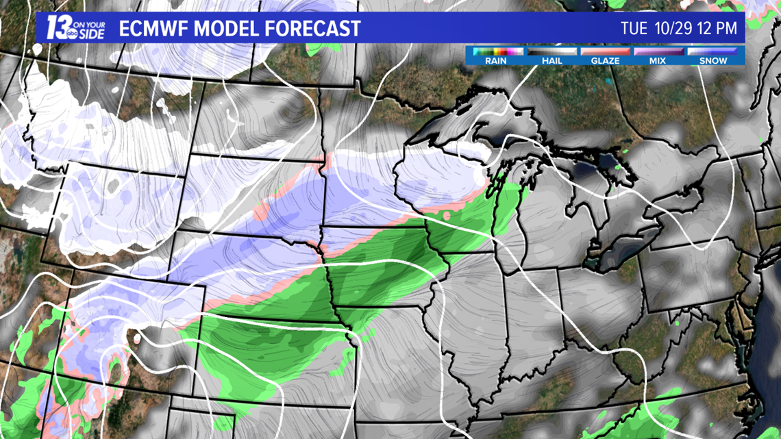
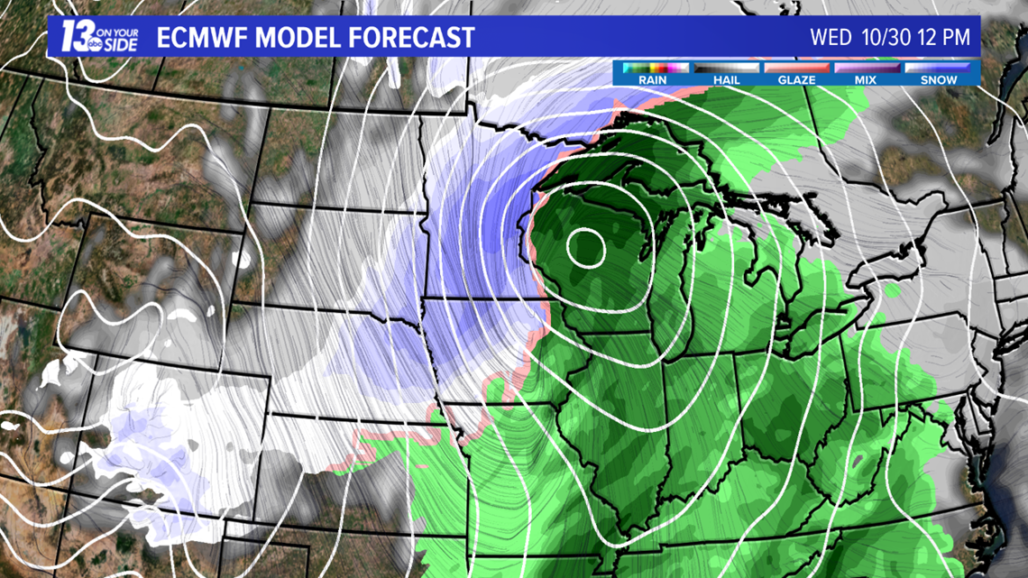
When considering a mid-range forecast (looking more than three days ahead) a lot can change on a day-to-day basis. Meteorologists consult multiple forecast models before offering a prediction. The often reliable European Centre for Medium-Range Weather Forecasts, more commonly known as the Euro, has predicted a strong low pressure system will develop in the Great Plains next week. Another model called the Global Forecast Model (GFS) shows a similar storm system developing with variations on timing and position.
High confidence in a forecast comes from multiple forecast models agreeing on the development of a storm for several consecutive days leading up to the actual event.


Ingredients
Several ingredients need to come together in order for this scenario to play out. High pressure will need to settle in early in the week over New England while a trough develops over the Rockies. As cold air pours south from Canada, interaction with a developing Low near Colorado and New Mexico could further deepen the trough producing a stronger circulation. Finally, upper level winds will need to tap in to this system and draw it north toward the Great Lakes region.
Impacts
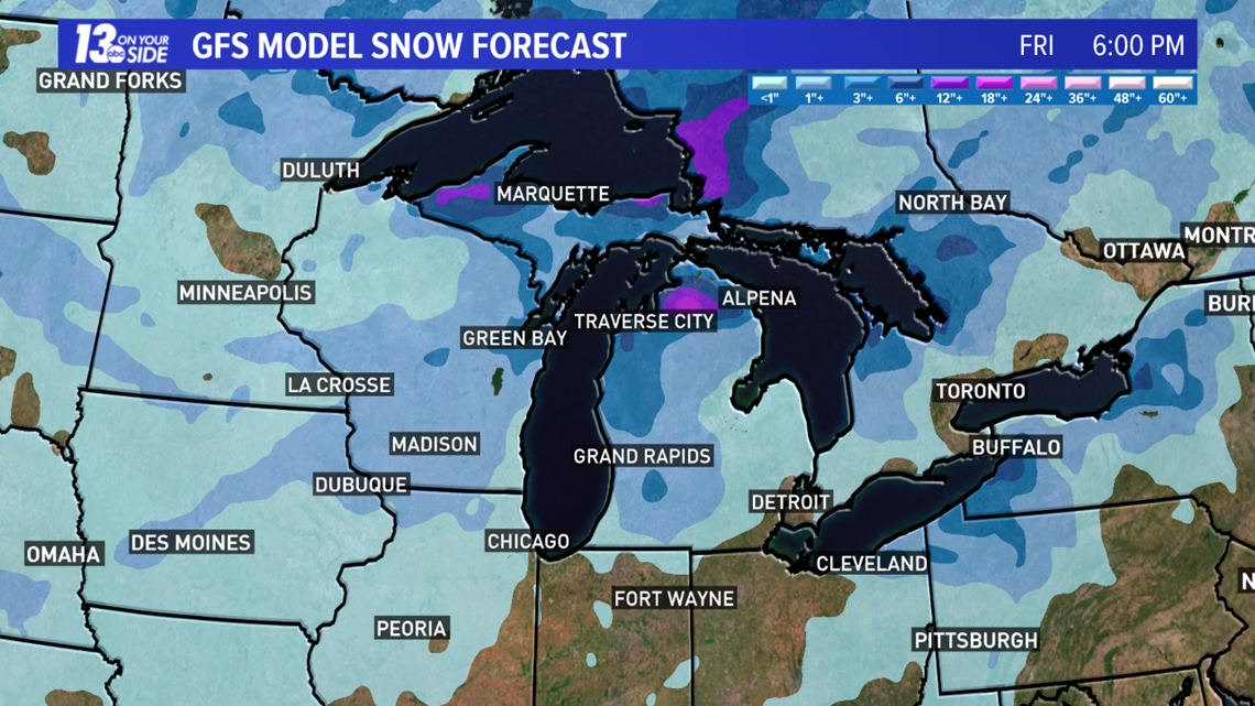
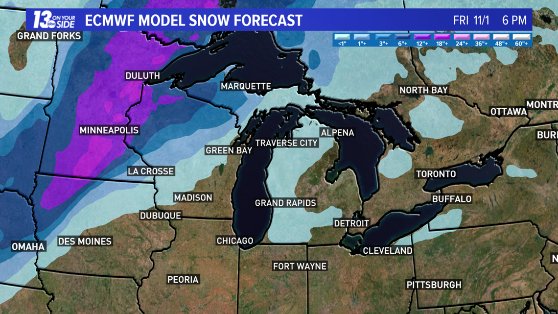
If everything happens the way the models are forecasting right now (which almost never happens) Wednesday, Oct. 30 with be rainy and windy with warmer than average temperatures and a few thunderstorms possible as well. As the center of the storm passes into Canada, it will drag drastically colder air down south and any left over precipitation will transition from rain to snow.


Historical Perspective
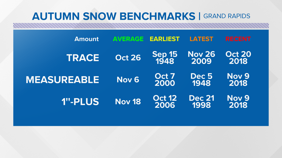
Obviously a lot can change between now and then. Statistically speaking, West Michigan is getting close to its average date of the first trace of snow occurring on Oct. 26.
Halloween snow is unusual in West Michigan but not unheard of. Grand Rapids recorded 0.4" of snow on Halloween in 2017.

►Make it easy to keep up to date with more stories like this. Download the 13 ON YOUR SIDE app now.
Have a news tip? Email news@13onyourside.com, visit our Facebook page or Twitter. Subscribe to our YouTube channel.

