GRAND RAPIDS, Mich. — Summer days may be waning, but the focus of the forecast remains the heat and humidity this week across West Michigan. A 13 Weather Impact Alert remains in place for Monday and Tuesday.
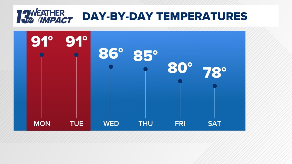
90° MONDAY & TUESDAY
Monday and Tuesday will be the height of the heat, with high temperatures expected to reach the upper 80s to lower 90s. Putting this in perspective, average high temperatures are around 80° for late August - Monday and Tuesday will be 10°+ above average. Nighttime lows will only fall into the lower 70s, meaning there will be minimal relief from the daytime excessive heat.

There’ll be no escaping the humidity too as a muggy to tropical airmass settles over the region. Dew points will range from the upper 60s to lower 70s. Heat indices – also referred to as the ‘feels like’ temperature – will be near triple digits both days in the afternoon to early evening hours. If Tuesday remains rain/storm-free, the heat index may approach 105° in the hottest and muggiest locations.
Much of this summer has avoided 90°+ days – Grand Rapids has only had four days to hit the mark, three such days in Muskegon as well. On average, Grand Rapids typically sees 10 days of 90°+ days each year.
It’ll take until the end of the upcoming week into the weekend to completely relieve the heat and humidity.
If you have outdoor work and/or plans, staying hydrated and slowing down is key in battling the heat. It’s also important to check on those more susceptible to the heat—kids, the elderly, and pets.
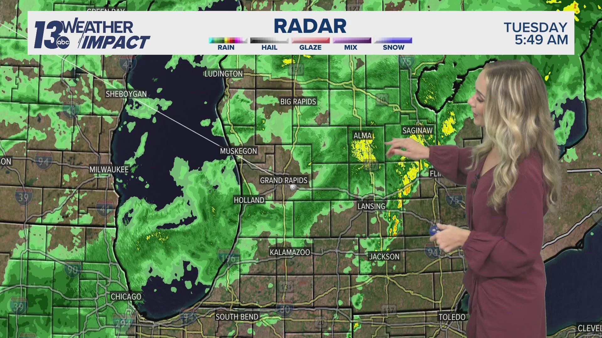
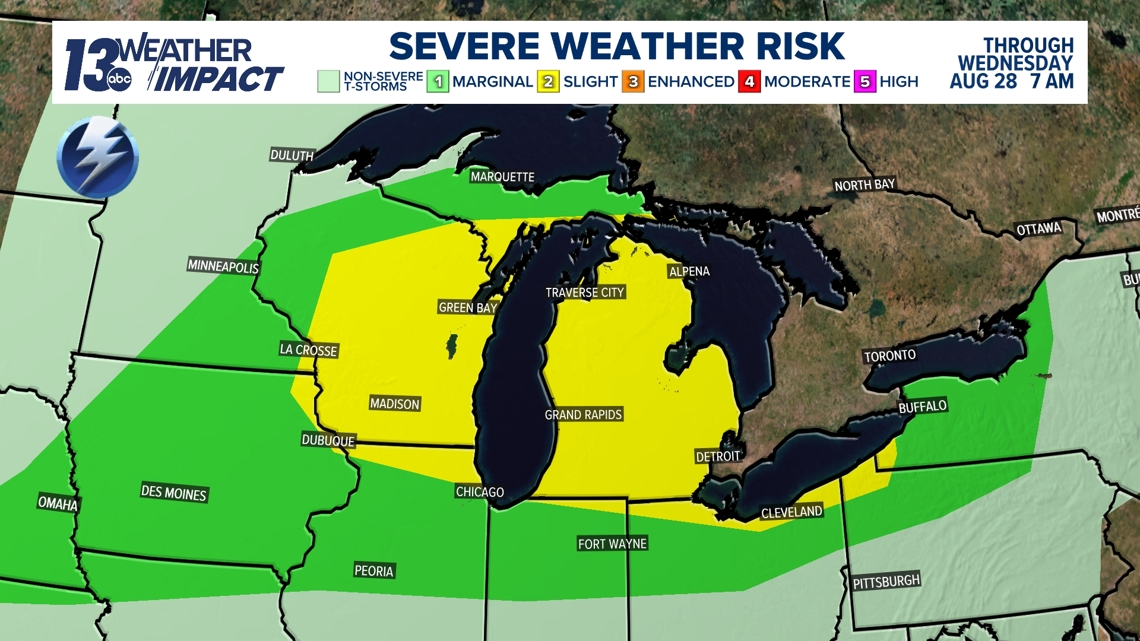
MONDAY NIGHT SEVERE RISK
The Storm Prediction Center has upgraded portions of West Michigan to a Marginal Risk (level 1 of 5) and Slight Risk (2 of 5) for potential severe thunderstorms overnight Monday into early Tuesday. Thunderstorms will hinge on upstream development but would provide a damaging wind threat if their momentum travels into West Michigan.

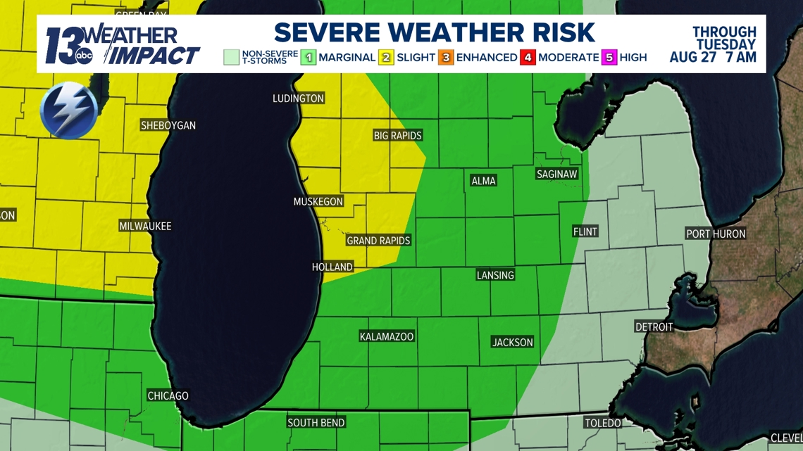
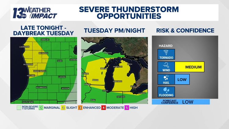
TUESDAY SEVERE RISK
There’s an increased possibility of stronger thunderstorms on Tuesday as the Storm Prediction Center has placed all of West Michigan at a Slight Risk (level 2 of 5) for severe weather.
The risk is not a slam dunk as models have struggled with the timing and placement of thunderstorms, including the possibility Tuesday will remain dry. The right ingredients - ample moisture and lift from an approaching low-pressure system - are there, but the strongest mid and upper-level forcing will be further north.
If storms do come to fruition, they will have plenty of fuel to work with under the heat and humidity. Damaging wind and large hail are the main severe risks.

TEXT US
TEXT your weather photos to us at 616-559-1310.
Please include the following with your photo(s):
- Your storm photos
- Your first and last name
- Date and time of your photos
- Locations of your photos
- What’s in your photos?
13 Weather Impact Alerts highlight key times to be weather aware. Weather that has an impact on day-to-day plans will trigger an alert. The 13 Weather Impact Team will explain when to expect the weather, what impact it will have, and how to keep yourself safe and comfortable with clear, easy-to-understand graphics. See how to get these alerts here.