HOLLAND, Mich. — Winter weather has arrived in full force with accumulating lake-effect snow falling across West Michigan since Thanksgiving night.
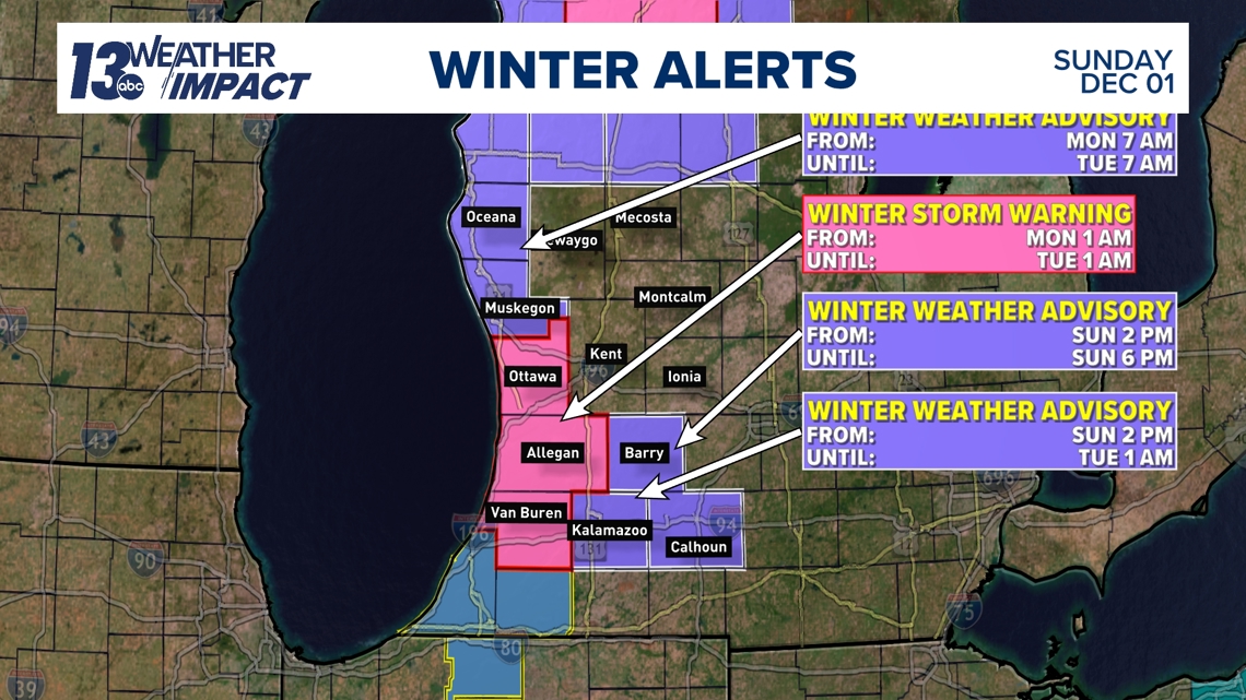
Lake-effect continues into the work week with a Winter Storm Warning in effect from 1 a.m. Monday morning to 1 a.m. Tuesday morning for Ottawa, Allegan and Van Buren Counties.
Oceana, Muskegon, Barry, Kalamazoo, Calhoun, and Mason Counties are also in Winter Weather Advisories for various timeframes.

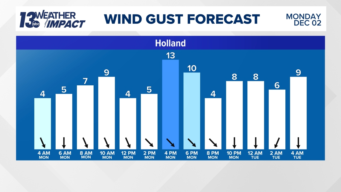
Winds take on a more northerly direction throughout Monday, keeping most of the lake-effect snow closer to the shoreline rather than moving further inland.
This could mean that snow bands will stay over the same areas throughout the day, resulting in higher totals underneath the heavy, persistent bands.

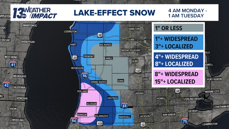
This setup will likely bring 8"+ of snowfall to portions of southwest Michigan with the highest totals likely in Allegan and Van Buren Counties closer to 15"+. Localized totals could reach upwards of 18" if bands of lake-effect snow stay in one spot for a long period.
North of I-96 could see more than 3" of snow with localized 6"+ totals possible in Mason, Oceana, and northern Muskegon Co. Most of West Michigan further inland, including Grand Rapids, can expect smaller totals, likely 1" or less.

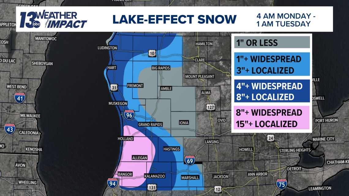
Impacts will be most significant underneath the heaviest and most persistent snow bands - most likely found in a line from the Holland area through Van Buren Co.
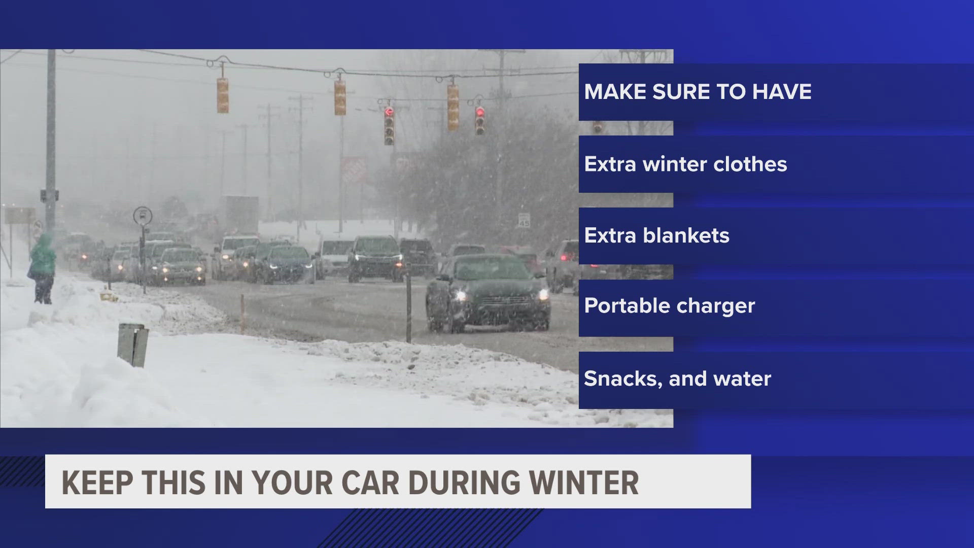
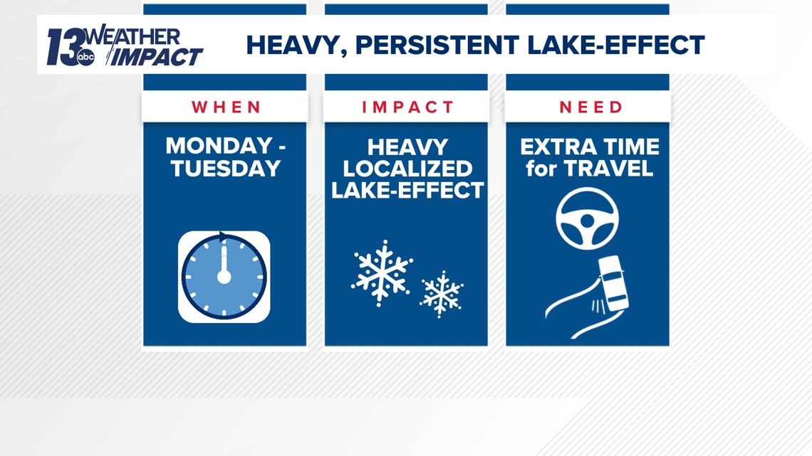
Expect travel in affected areas to be very difficult throughout Monday with both the morning and evening commutes likely to be impacted by slippery roads and reduced visibility. Extra time will be needed on roadways with slide-offs and crashes possible.

Have a 30-second video or photo to share? We'd love to share it with everyone! Share your images by texting your name and location to 616.559.1310 or email to Weather@13OnYourSide.com or post it to our 13OnYourSide Facebook Page


