GRAND RAPIDS, Mich. — Making your weekend plans? Well, indoor activities might be the best option, because widespread soaking rain will put a damper on any outdoor activities.
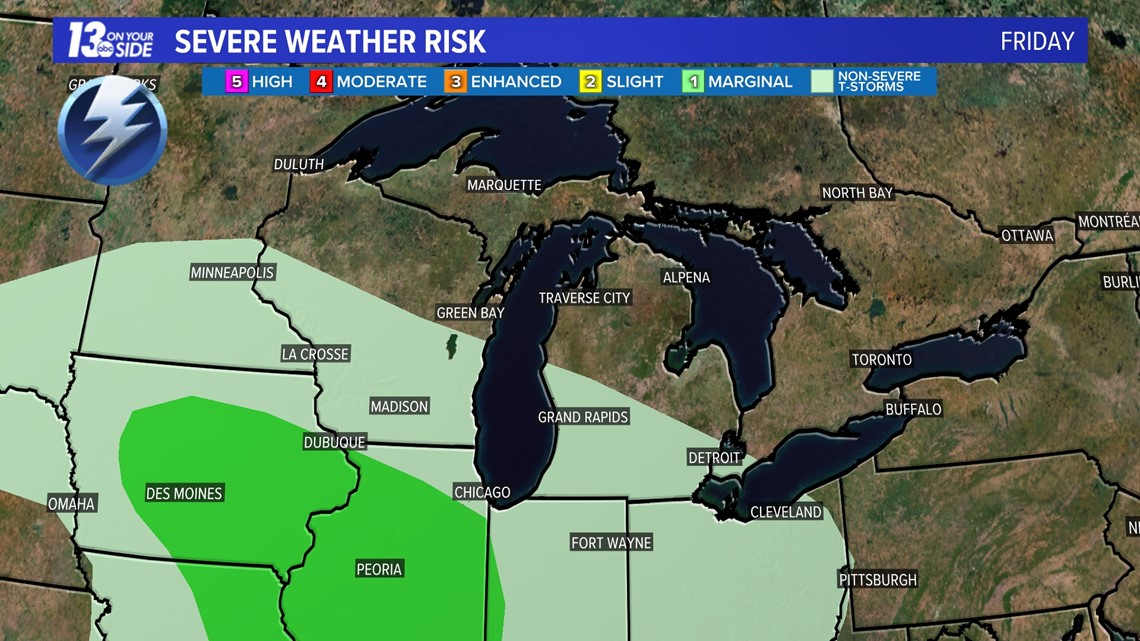
WHAT: A low-pressure system works toward Michigan from the west Friday morning into the afternoon. Bringing gusty winds and heavy rain to the area. Severe weather will remain to the SW of us, but an isolated thunderstorm is possible.

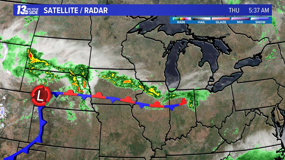

TIMING: Most rainfall today and into early tomorrow morning will be nuisance showers. Although, it can't hurt to have the umbrella on hand starting tonight. The heavy rain makes its way to the lakeshore by 3 p.m. Friday and becomes widespread throughout the late afternoon hours. Heavy rain will continue through early Saturday afternoon, becoming more scattered and wrapping up Saturday evening.

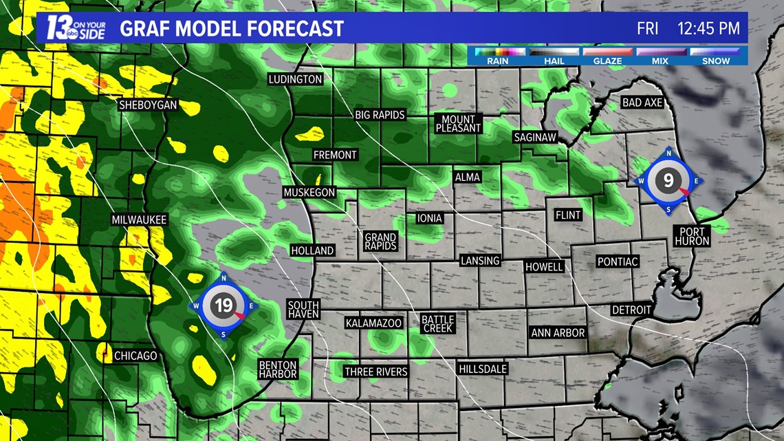

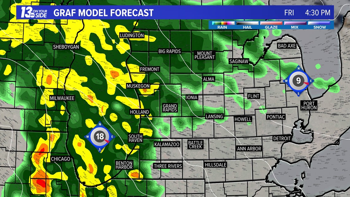

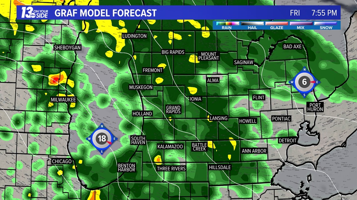

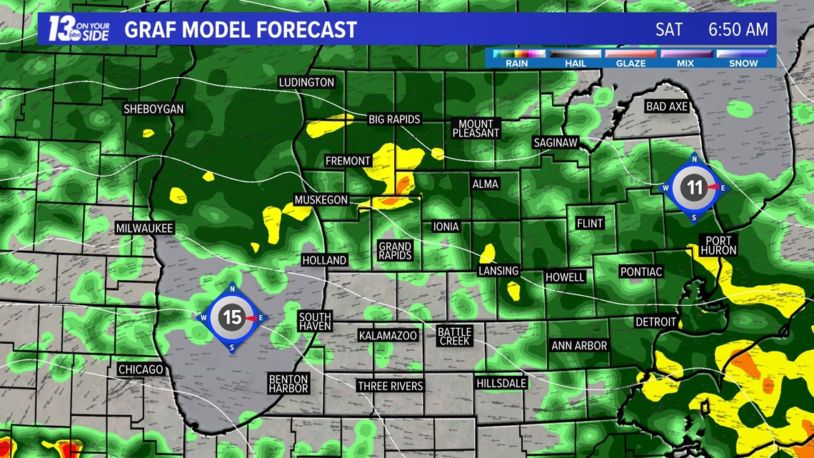

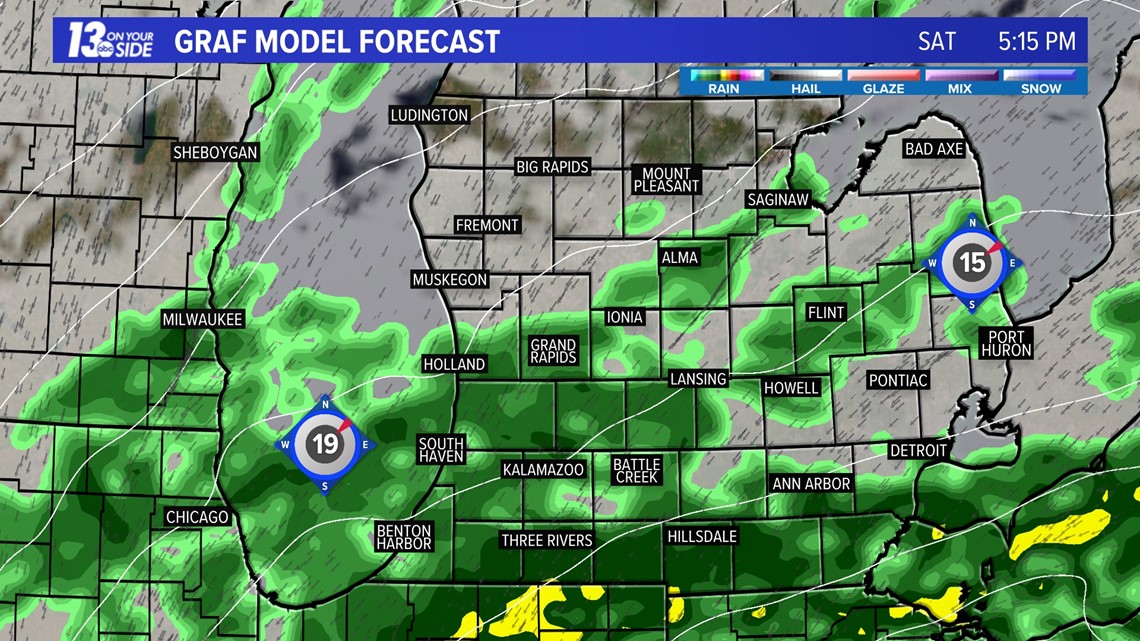
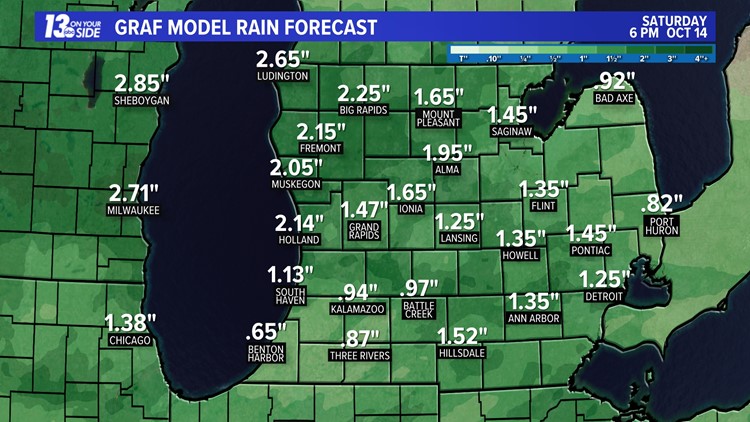
AMOUNTS: This rain is going to bring everyone at least an inch of water. Those west of US-131 will likely be closer to the 2" mark and anywhere we see isolated thunderstorm activity totals could get closer to 3"+.


THREATS: Thunderstorms should remain non-severe. Isolated flooding is possible, but not of high concern. Winds will be gusty at 35+ mph. This, with the heavy rainfall, could create some reduced visibility while driving.
If you have apple-picking plans, Sunday is your best bet. Beyond an isolated lake effect shower, skies will be mainly dry. Winds are still going to be a bit breezy and clouds will likely linger.
6-10 Day Outlook
Tue. Oct. 17 through Sat. Oct. 21 calls for near average temperatures and near average precipitation. Average highs are around 58-60° with an average precipitation of 0.65".
8-14 Day Outlook
Thu. Oct. 19 through Wed. Oct. 25 calls for near average temperatures and near average precipitation. Average highs are around 57-59° with an average precipitation of 0.91" and average snow of 0.1''.
Have a 30-second video or photo to share? We'd love to share it with everyone! Share your images by texting your name and location to 616.559.1310 or email to Weather@13OnYourSide.com or post it to our 13OnYourSide Facebook Page.