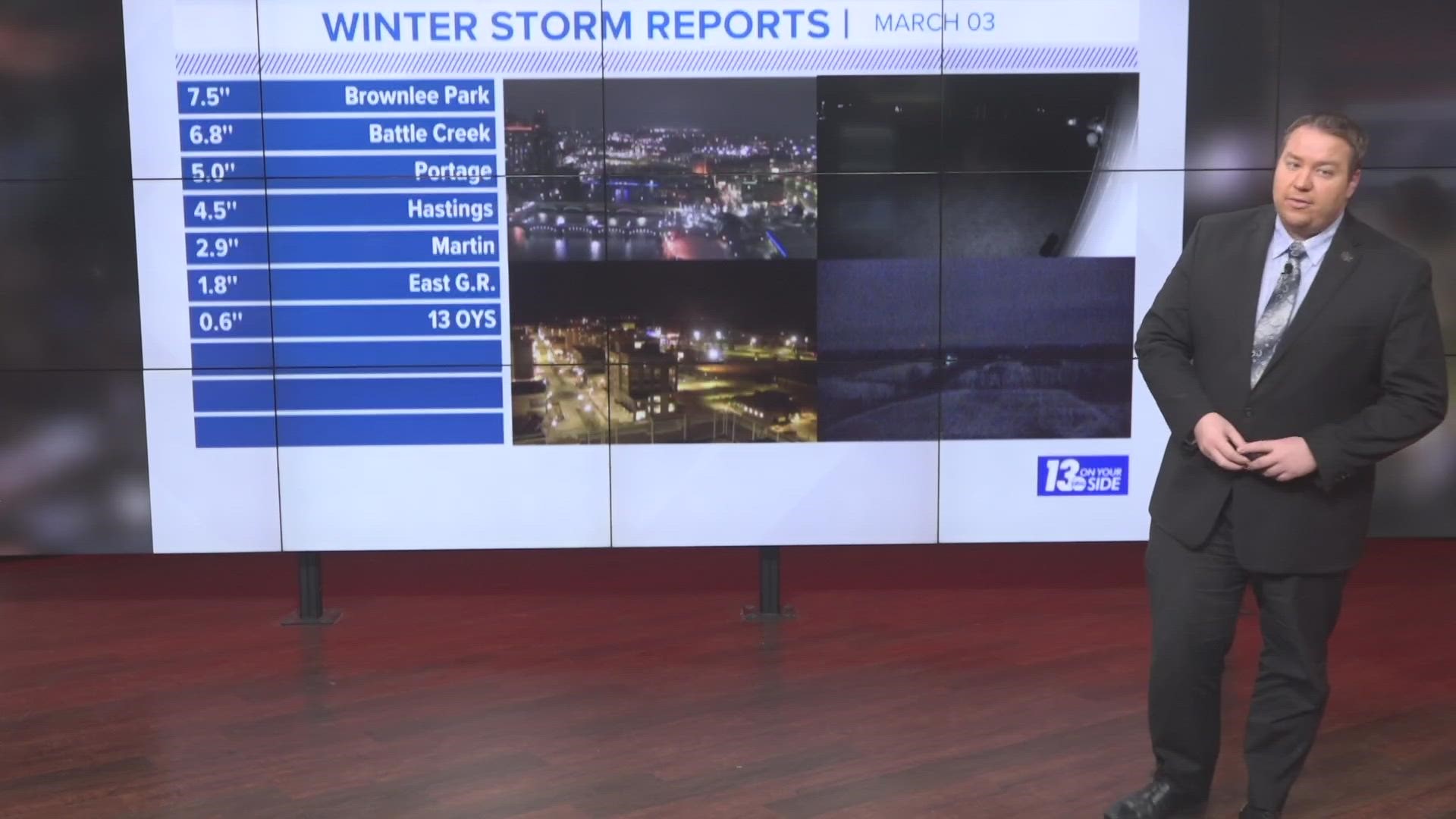
GRAND RAPIDS, Mich. — UPDATE 12 AM: Snowfall has now largely wrapped up around West Michigan. Below is an early look at totals reported throughout the region. The article below contains information previously published about our weather forecast.
Depending on where you were in West Michigan on Friday evening, you were either taking in a nice sunset, or dealing with heavy and wet snowflakes.
As expected, a sharp gradient has been setting up in terms of the haves and have nots for snowfall across the region. Everything from just a trace in areas northwest of I-96, to snowfall rates up to and over an inch per hour near I-94.
Snowfall is beginning to tapper in the northwestern regions of West Michigan, and along the lakeshore. Snowfall will remain heavy for the next few hours from Ionia County through Kalamazoo, and over toward the east. Snow will come to an end around midnight.

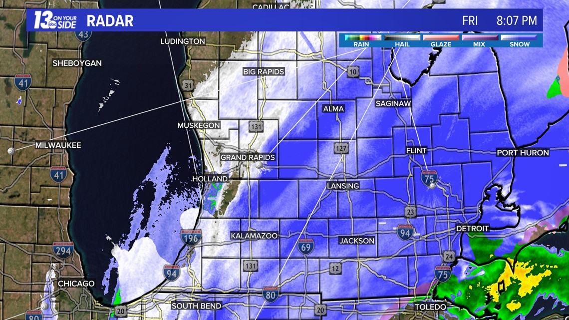
In the regions still experiencing the snowfall, potential heavy accumulation will continue. In some areas, another 4+ inches of snow may fall before all is said and done.

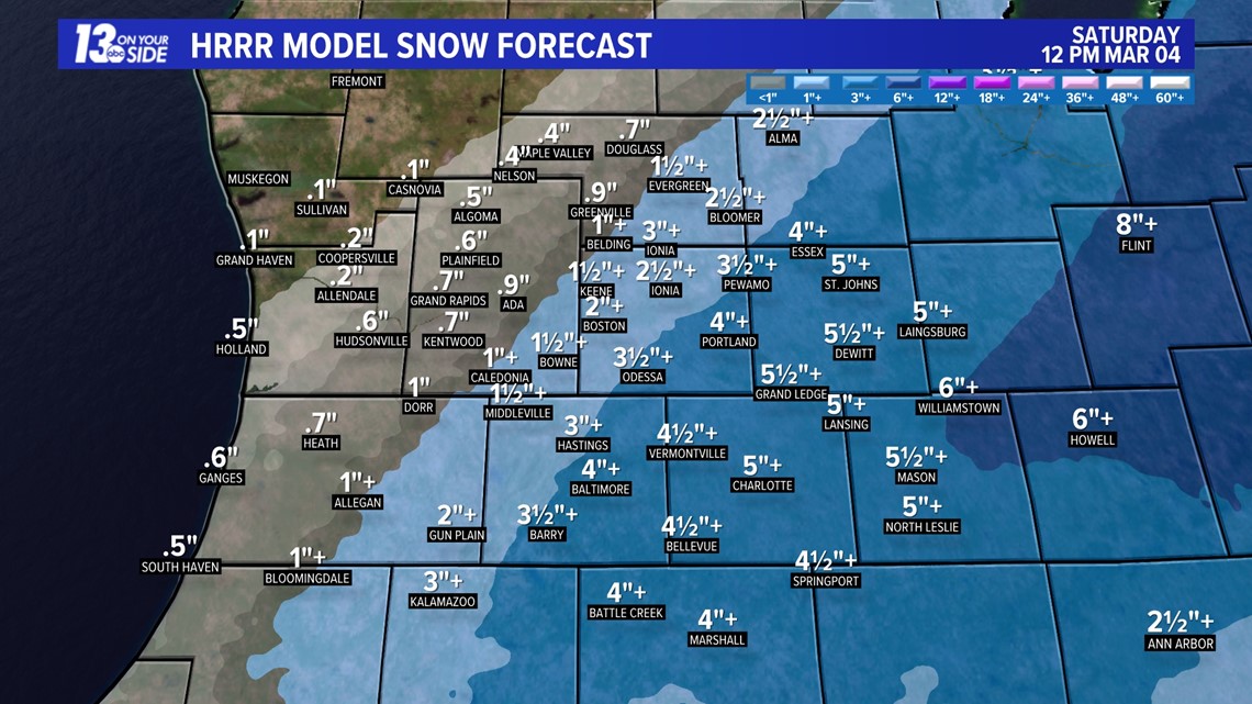
This leaves us still within our forecasted ranges for West Michigan. It will not be a shock if some areas along I-94 go over 9 inches when the snow stops falling.

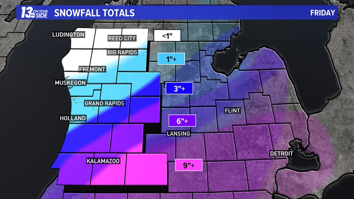
In the hardest hit regions, mostly along I-94, US-131 South of Kent County, and I-69, travel will remain difficult. Watch for slow downs and whiteout conditions that have developed throughout the evening.

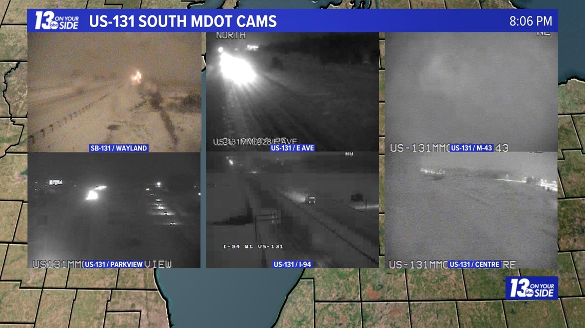
Stay safe out there West Michigan and stick with 13 ON YOUR SIDE for the latest on this winter storm!
-- Meteorologist Michael Behrens
Follow me on social media! Facebook Meteorologist Michael Behrens, Twitter @MikeBehrensWX, and Instagram @MikeBehrensWX.
Email me at: MBehrens@13OnYourSide.com
Have a 30-second video or still photo to share? We'd love to share it with everyone! Email your image to Weather@13OnYourSide.com or post it to our 13OnYourSide Facebook Page.
►Make it easy to keep up to date with more stories like this. Download the 13 ON YOUR SIDE app now.
Have a news tip? Email news@13onyourside.com, visit our Facebook page or Twitter. Subscribe to our YouTube channel.

