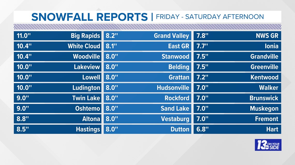
GRAND RAPIDS, Mich. — After heavy wet snow made the commute home Friday evening very tricky, yet another round of heavy and impactful snow is moving into West Michigan Saturday night through early Sunday. This snow will be added to the nearly half a foot to a foot that fell on Friday, with some areas of West Michigan already up to 17 inches on the ground in the last week!
While the first two rounds of snow were heavy and wet, with temps that stayed near freezing, this round will come with much colder air. As of such blowing and drifting will be fighting plow crews even beyond the initial snowfall.

The Timeline:
Bands of lake-effect snow had already started to fall on Saturday evening, and they are expected to continue and intensify through the overnight. Warm lake waters and cold air moving in will be the perfect environment for heavy bands of snow through Sunday morning.
Most of the region should expect to see slow travel, low visibility, and snow covered roads through Saturday night.

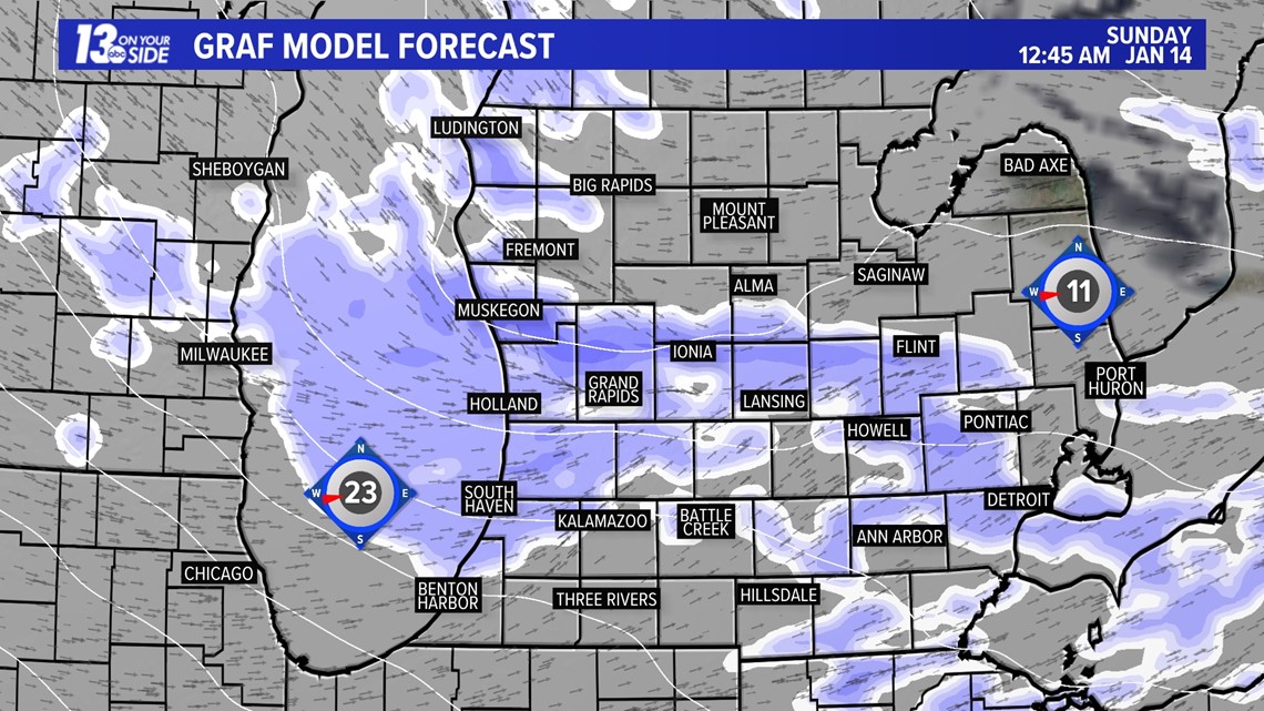
Snow will continue to stay intense overnight, with the heaviest bands setting up between I-96 and I-94. This will be most widespread west of US-131, with a more narrow axis of heavy snow stretching inland as far as Ionia county toward Lansing.
This is expected to continue up through sunrise on Sunday.

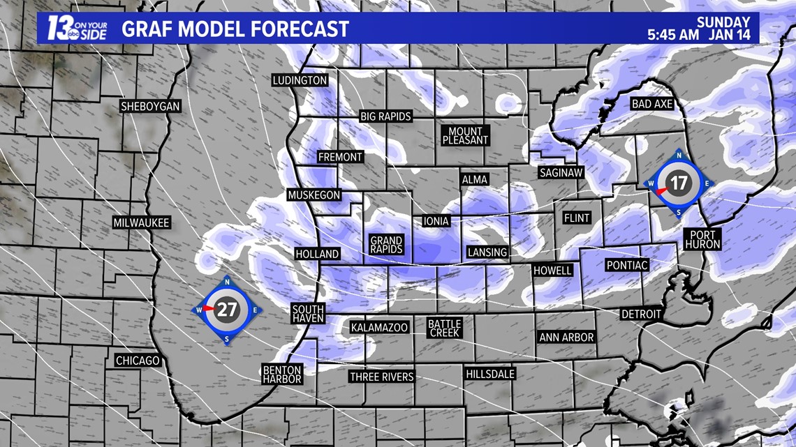
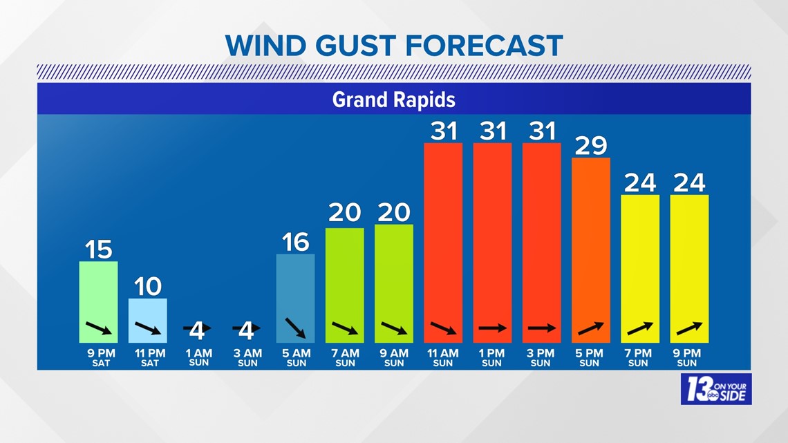
As we move toward the midday on Sunday snow bands should start to taper off, but winds will stay gusty, meaning blowing and drifting are expected to continue. Expect winds of 15 to 30 mph with higher gusts throughout the day on Sunday.

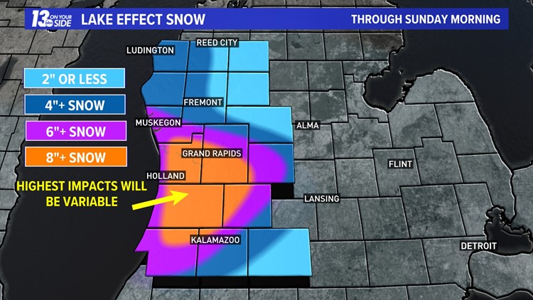
Snow Totals:
As is the nature with lake-effect snow, impacts are expected to be highly variable and can change from one mile to the next. That being said, many areas are expecting heavy accumulation through Sunday morning.
Areas from Muskegon county inland toward Ionia and down toward Kalamazoo could see 6 or more inches of snowfall. Inside this region we are expecting a more localized area that could see 8 inches to over a foot of snowfall. The exact placement of this band is uncertain, but by Sunday morning we are expecting that some areas would have been hit with very heavy snowfall.
The cold air means this snow will be much fluffier and finer than what fell earlier this week, allowing blowing and drifting to take hold. This will make calculation of final snow totals somewhat challenging, but the main focus should be impacts are expected to be felt through Sunday and travel, especially early, will be challenging.


What's Next?
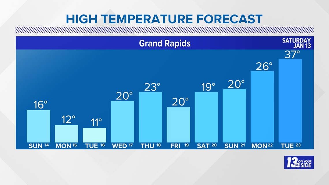
More lake-effect snow and very cold temperatures are ahead as we head into the next week, with highs that fall into the teens and lows to the single digits. Some areas along I-94 may see sub-zero low temperatures over the next week!

Make sure you stay safe and stay warm this week West Michigan! Stick with 13 On Your Side for the latest forecast updates and weather alerts!
-- Meteorologist Michael Behrens
Follow me on social media! Facebook Meteorologist Michael Behrens, X/Twitter @MikeBehrensWX, and Instagram/Threads @MikeBehrensWX.
Email me at: MBehrens@13OnYourSide.com
Have a 30-second video or still photo to share? We'd love to share it with everyone! Email your image to Weather@13OnYourSide.com or post it to our 13OnYourSide Facebook Page.
►Make it easy to keep up to date with more stories like this. Download the 13 ON YOUR SIDE app now.
Have a news tip? Email news@13onyourside.com, visit our Facebook page or X/Twitter. Subscribe to our YouTube channel.