GRAND RAPIDS, Mich. — Snow was already starting to fall across West Michigan during the evening commute on Wednesday, and this is just the beginning of a high impact, multi-day snow event. Once snowfall rates start to pick up on Thursday morning, impacts will remain around the region through Saturday before things start to quiet back down.
The reason this event will last so long is several weaker low pressure systems with a cold front moving through the great lakes region. This means we have the needed instability, influx of cold air and consistent winds flowing across Lake Michigan to sock us into a snowy pattern for the better part of three days.

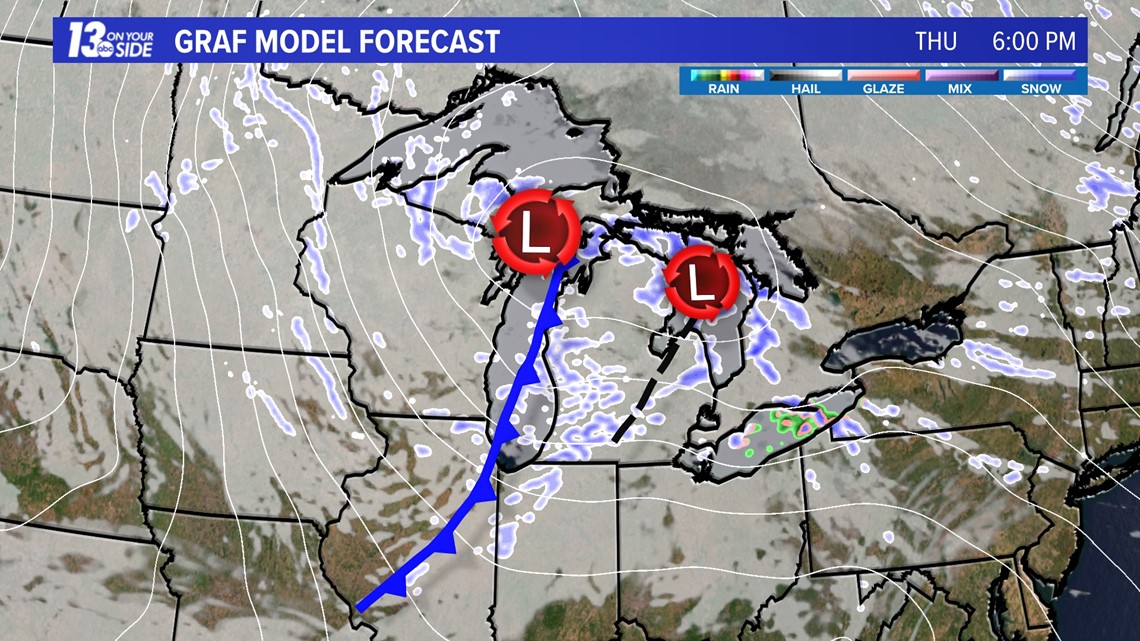
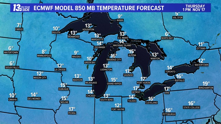
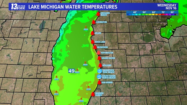
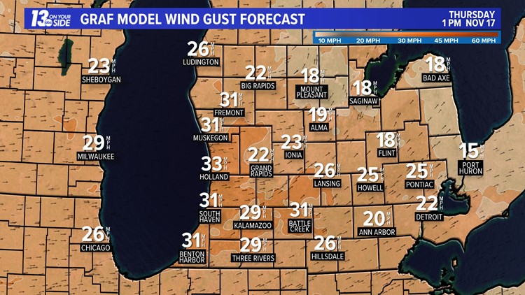
This round of systems will combine with a perfect environment to generate lake-effect snowfall in our state. We are looking at lake temperatures in the 40s and 50s, air temperatures in the 30s, and air above the surface in the teens. Combine this all with several days of blustery winds, gusting up to 20 to 30 mph, and it would honestly be a bigger shock if we didn't see any lake-driven snowfall.
Here's a look at the ingredients below:
Lake-Effect Ingredients 11/16/2022
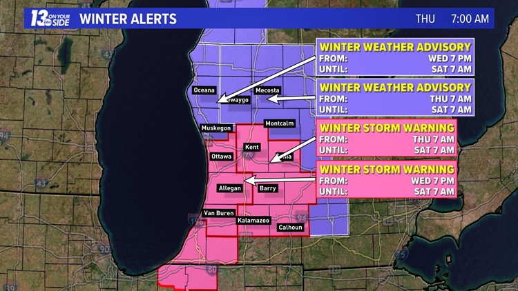
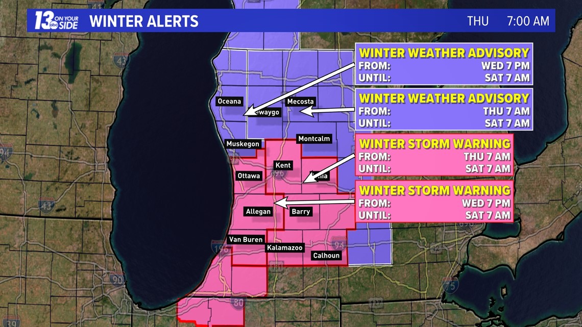
With these factors in place, all of the 13 On Your Side viewing area, and most lower Michigan, is under some form of winter weather alert from now through Saturday.
Ottawa, Allegan and Van Buren Counties are under a Winter Storm Warning from now through 7 a.m. Saturday.
Kent, Ionia, Barry, Kalamazoo and Calhoun Counties will join them at 7 a.m. Thursday morning.
Muskegon and Oceana Counties are under a lower-impact Winter Weather Advisory from now through 7 a.m. Saturday, with Newaygo, Mecosta and Montcalm Counties joining them at 7 a.m. on Thursday morning.

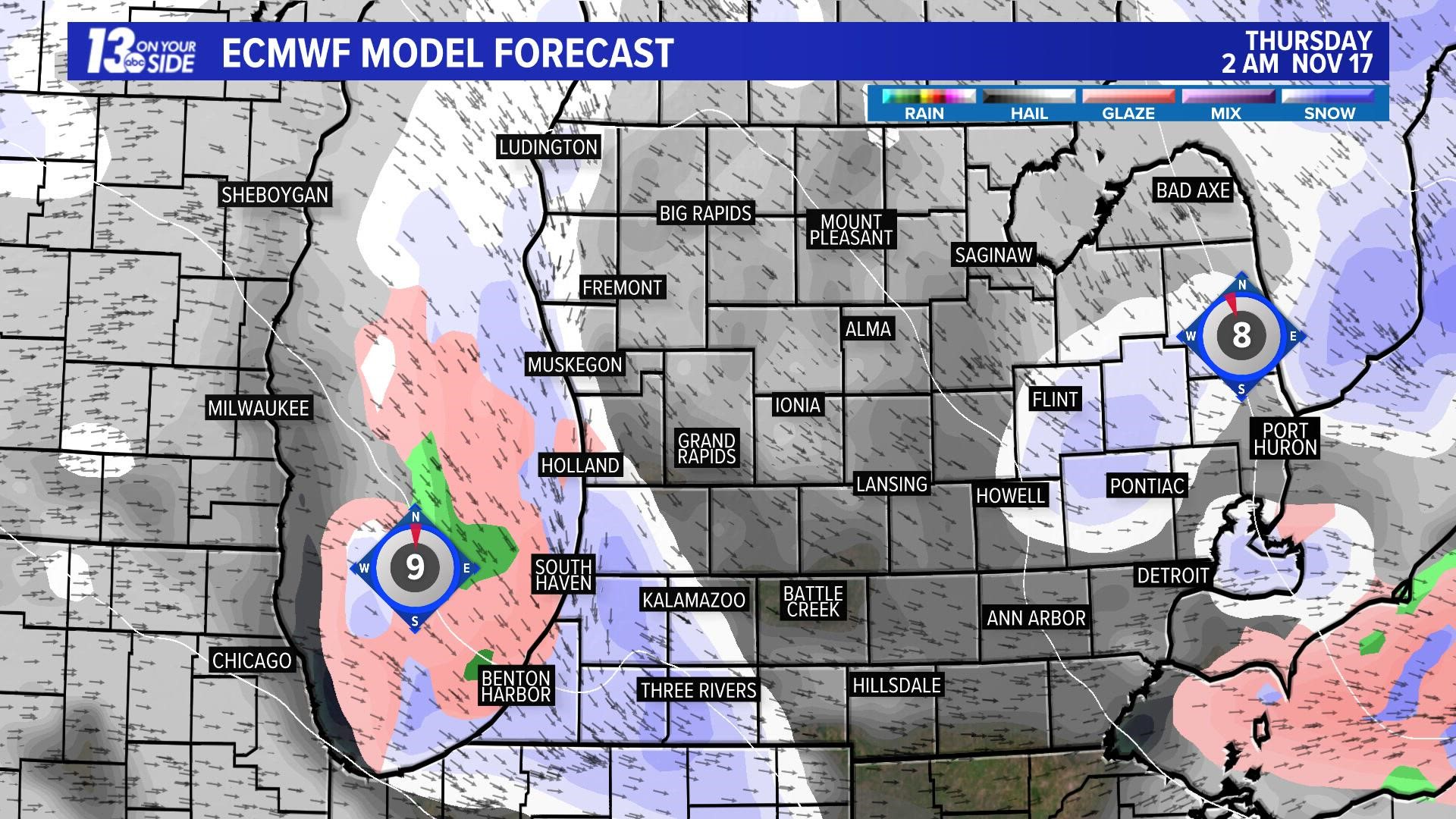
This snowfall will come with peaks and valleys of activity based on the formation of the heaviest bands throughout the alert duration, but snow should be expected at any time from Thursday through Saturday. The video below shows the European model run from Wednesday evening.
All of this activity will result in a broad area of impactful snow accumulation across West Michigan. By Thursday morning, many will have picked up at least an inch or two, with areas from Holland south that could be as high as 4+.

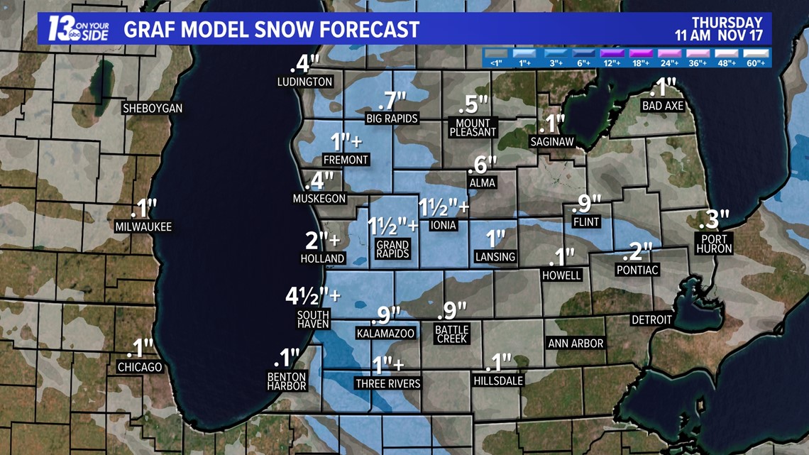
From here, snow continues to pile up as lake-effect bands continue Thursday afternoon and early Friday morning. Friday morning, many locations will likely have 5+ inches of snowfall.

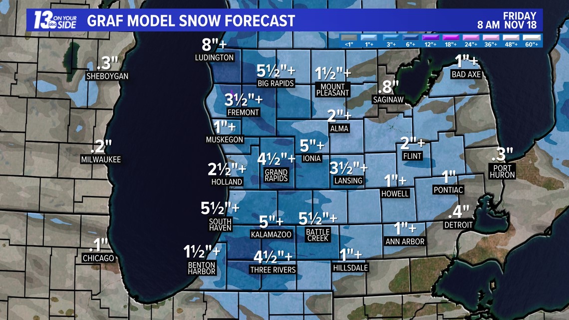
Like the day before, snow continues to fall Friday, with totals approaching the 8+ to 10+ range as we head into Saturday morning. The winds mentioned before, gusting at 20 to 30 mph, generally from the west, will make drifting snow on north/south roads likely through the weekend as well.

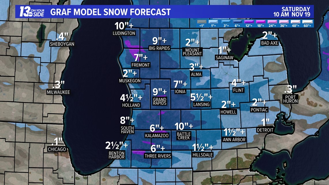
This will be a prolonged and high impact event, so make sure you are adjusting your travel plans with delays in mind. Keep with 13 On Your Side through the storm for the latest forecast updates and school/event closings and delays.
Track the snow with radar on the 13 On Your Side News & Weather Apps!
-- Meteorologist Michael Behrens
Follow me on social media! Facebook Meteorologist Michael Behrens, Twitter @MikeBehrensWX, and Instagram @MikeBehrensWX.
Email me at: MBehrens@13OnYourSide.com
Have a 30-second video or still photo to share? We'd love to share it with everyone! Email your image to Weather@13OnYourSide.com or post it to our 13OnYourSide Facebook Page.
►Make it easy to keep up to date with more stories like this. Download the 13 ON YOUR SIDE app now.
Have a news tip? Email news@13onyourside.com, visit our Facebook page or Twitter. Subscribe to our YouTube channel.


