GRAND RAPIDS, Mich — After a period of warm and dry weather, winter is making a comeback, and the upcoming snowfall next week is expected to pack a punch.
WHAT:
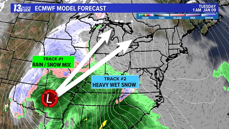
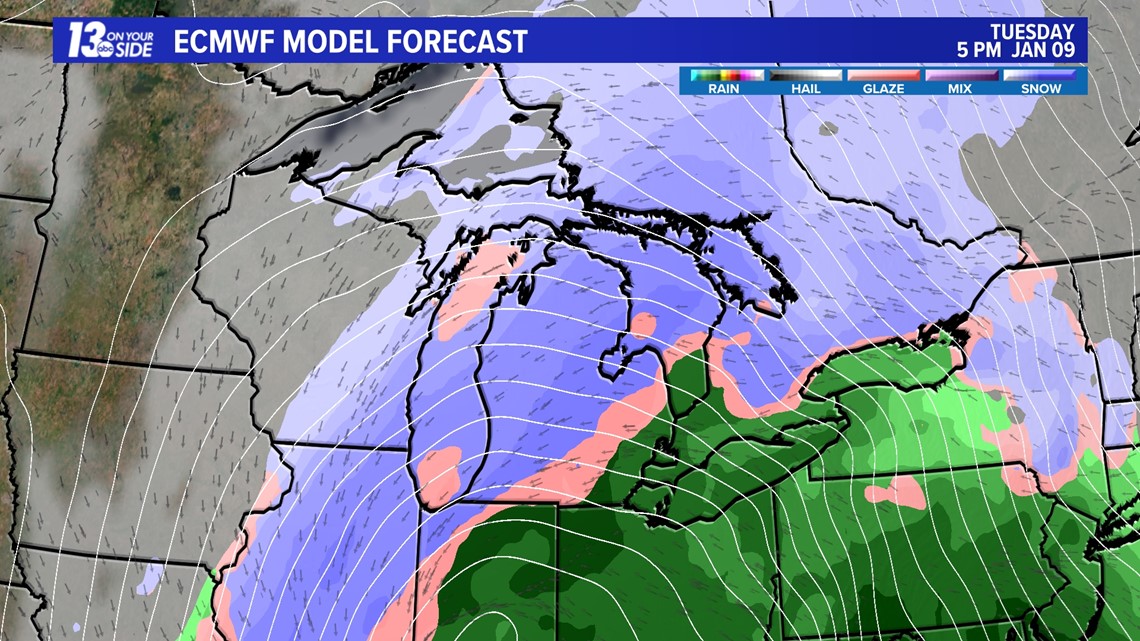
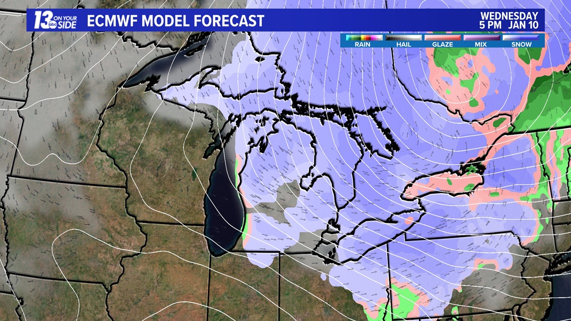
A strong low-pressure system is set to reach the Great Lakes region on Tuesday, Jan. 9 and wrap up by Jan. 10. This system has the potential to unleash heavy, wet snowfall accompanied by strong and gusty winds. While models currently agree that the low will result in significant snowfall for West Michigan, there remain variables that introduce uncertainty into the forecast.

TIMELINE:
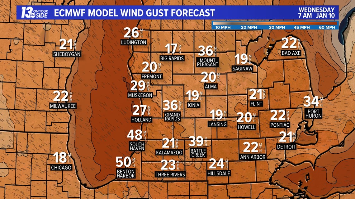
Snowfall looks to begin early Tuesday morning and continue through Wednesday afternoon. Snow will likely be heaviest throughout the afternoon hours Tuesday into Wednesday night. Winds will intensify on the back edge of the system, gusting near 35+ mph.




UNCERTAINTY
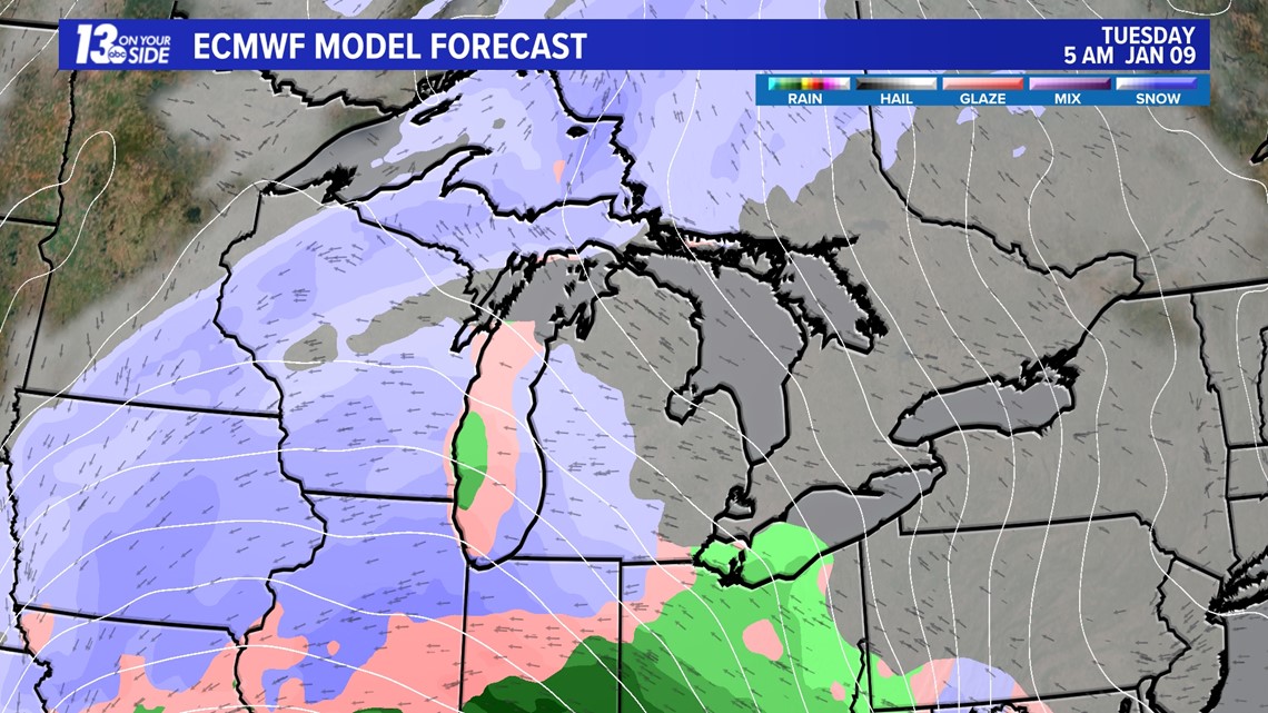
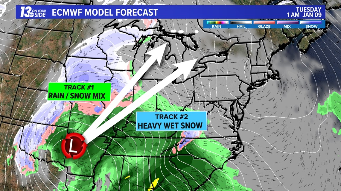
Weather operates from the upper levels downward. Meteorologists begin their forecasts by looking at the upper atmosphere, which gives insight into the path of the surface low-pressure system. While long-term models are okay at predicting this process, true accuracy is achieved when we observe the actual setup of the upper levels materialize. It is only then that we can confidently predict the track of the surface low.
For a more in-depth understanding of the science involved, a meteorologist from the National Weather Service in Grand Rapids has provided a comprehensive breakdown on X.
All that being said, two things could happen, and one seems more likely than the other. So, first off, there's Track One—that's where we get a mix of snow and rain. If this happens, the impacts won't be too bad, because the rain will just wash away the snow pretty fast.
Now, Track Two, on the other hand, brings in heavy snow and strong winds on Wednesday. That combo would make driving difficult and cause power outages. So, keep an eye out for what might be headed our way.

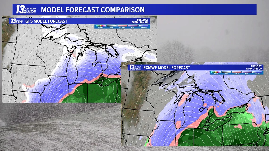
Having stated that, snowfall totals are very much up in the air. Even with the European model and the American model having very similar tracks, snowfall totals still differ in West Michigan. The European model brings everyone a widespread 5+ inches of snow, whereas the American model brings a heavier swath to the metro Detroit area and leaves West Michigan with lower totals.

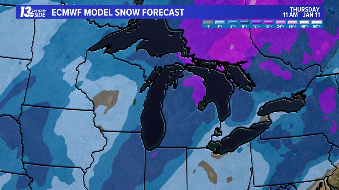


If either model unfolds, there is a possibility of West Michigan experiencing impactful snowfall in some capacity. To determine which one will be more accurate, we need to see how the upper levels move in the coming days.
Plus, winter weather doesn't stop there. Additional rounds of snowfall are expected Thursday night through Saturday of next week. Winter is BACK!
►Make it easy to keep up to date with more stories like this. Download the 13 ON YOUR SIDE app now.
Have a news tip? Email news@13onyourside.com, visit our Facebook page or Twitter. Subscribe to our YouTube channel.
Watch 13 ON YOUR SIDE for free on Roku, Amazon Fire TV Stick, and on your phone.


