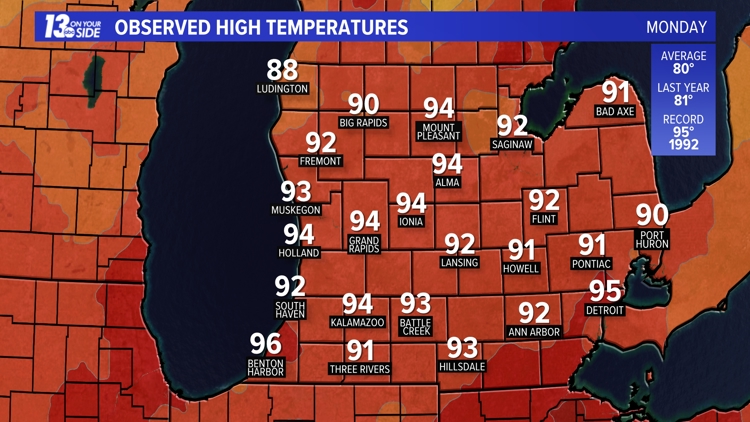
MUSKEGON, Mich. — Yesterday was hot—in fact, hot enough that we broke two record-high temperatures in Muskegon and Holland. Grand Rapids also saw its first 90-degree temperature of the season yesterday at 94° but did not break any records.
RECORD HEAT
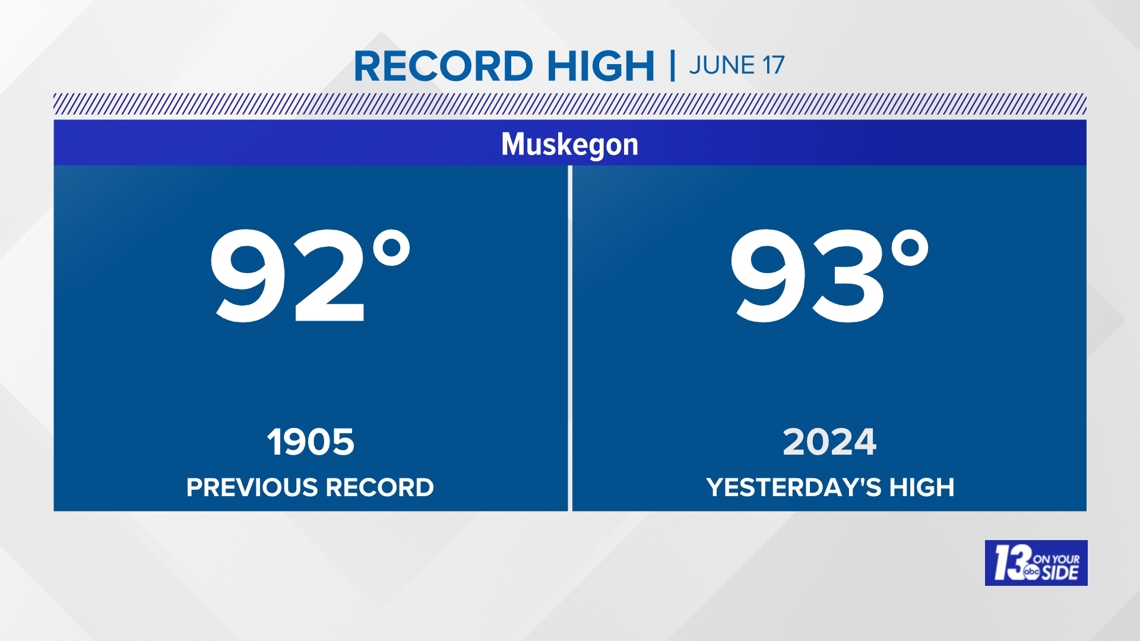
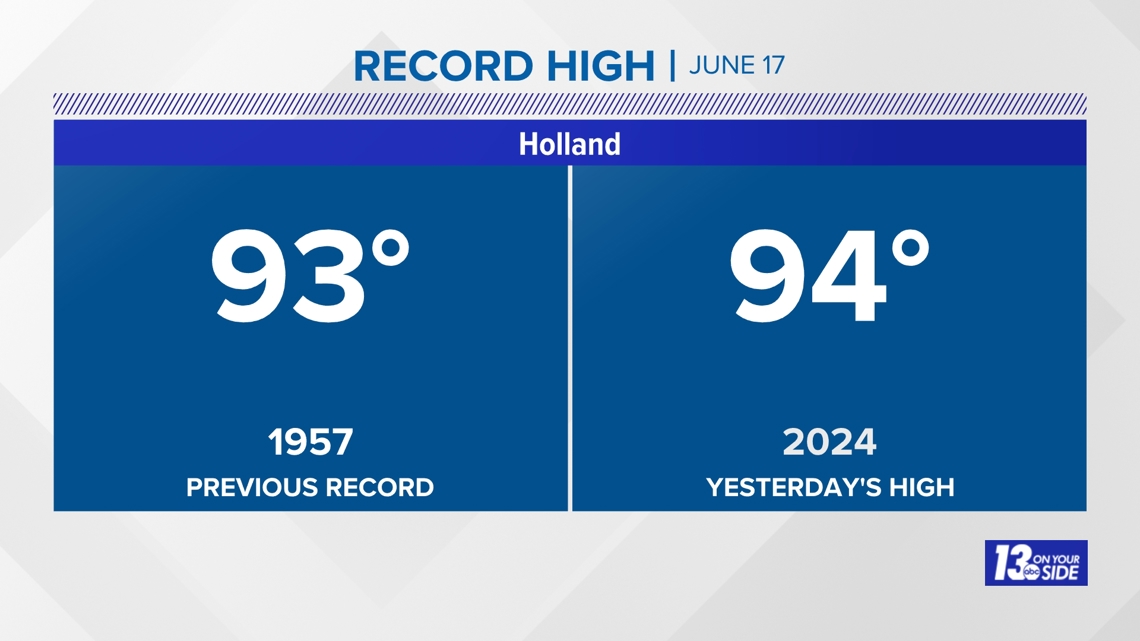
A record high of 93° was set in Muskegon, breaking the old record of 92° set back in 1905. A record high was also set in Holland at 94°. This broke the old record of 93° set in 1957.


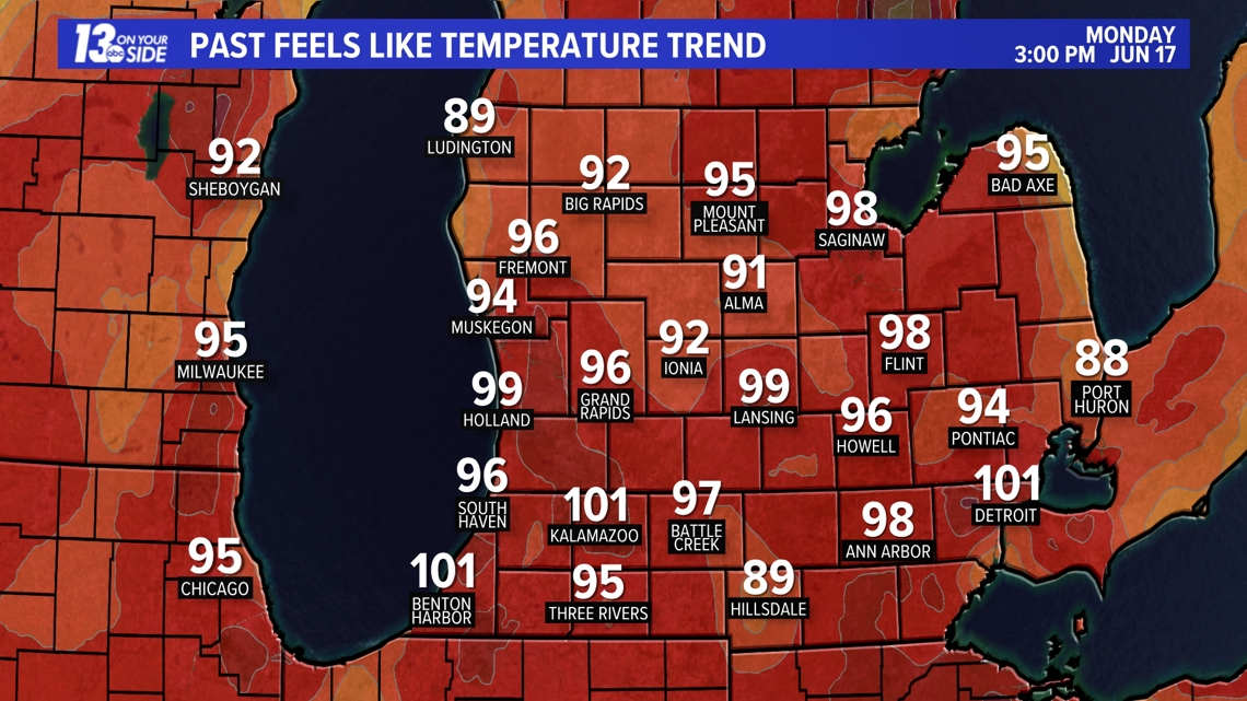
This combined with our high humidity levels kept heat index values near 100°.

AVERAGES
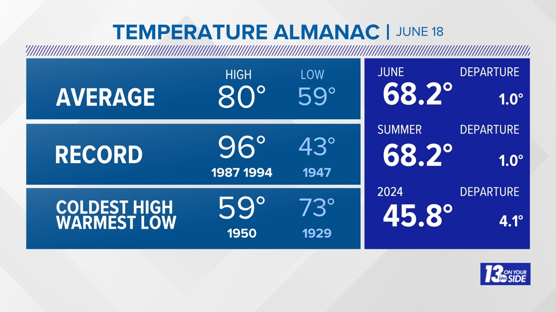
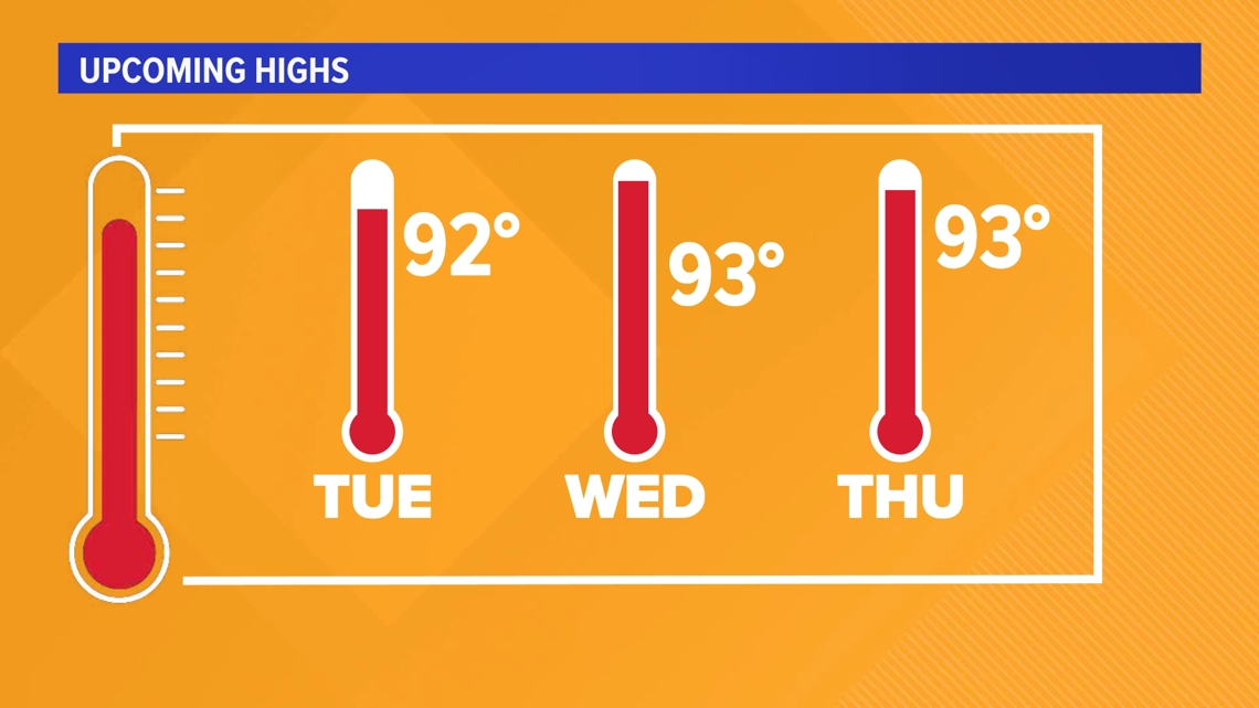
Our average temperature for June 18 in Grand Rapids is 80° for the high and 59° for the average low. At least 10 degrees above average temperatures are expected through Saturday. The record high for today in Grand Rapids is 96° and 91° in Muskegon. Muskegon will likely come close to breaking its high again today while Grand Rapids will be just shy.


HEAT ADVISORY
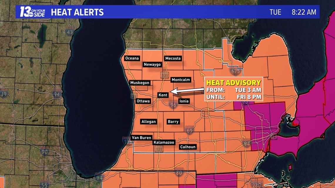
Hot temperatures will continue, hitting at least 90° through Saturday, with high humidity levels. Thus, the National Weather Service of Grand Rapids has issued a Heat Advisory through 8 p.m. on Friday. We would not be surprised if this heat advisory is extended into Saturday. By Sunday dewpoints drop significantly and highs will only make it into the 80s.

6-10 Day Outlook
Sun. Jun. 23 through Thu. Jun. 27 calls for above average temperatures and above average precipitation. Average highs are around 81-82° with an average rainfall of 0.66".
8-14 Day Outlook
Tue. Jun. 25 through Mon. Jul. 1 calls for above average temperatures and near average precipitation. Average highs are around 82-83° with an average rainfall of 0.90".
Have a 30-second video or photo to share? We'd love to share it with everyone! Share your photos by text 'STORM' to 616-559-1310.
►Make it easy to keep up to date with more stories like this. Download the 13 ON YOUR SIDE app now.
Have a news tip? Email news@13onyourside.com, visit our Facebook page or Twitter. Subscribe to our YouTube channel.
Watch 13 ON YOUR SIDE for free on Roku, Amazon Fire TV Stick, and on your phone.