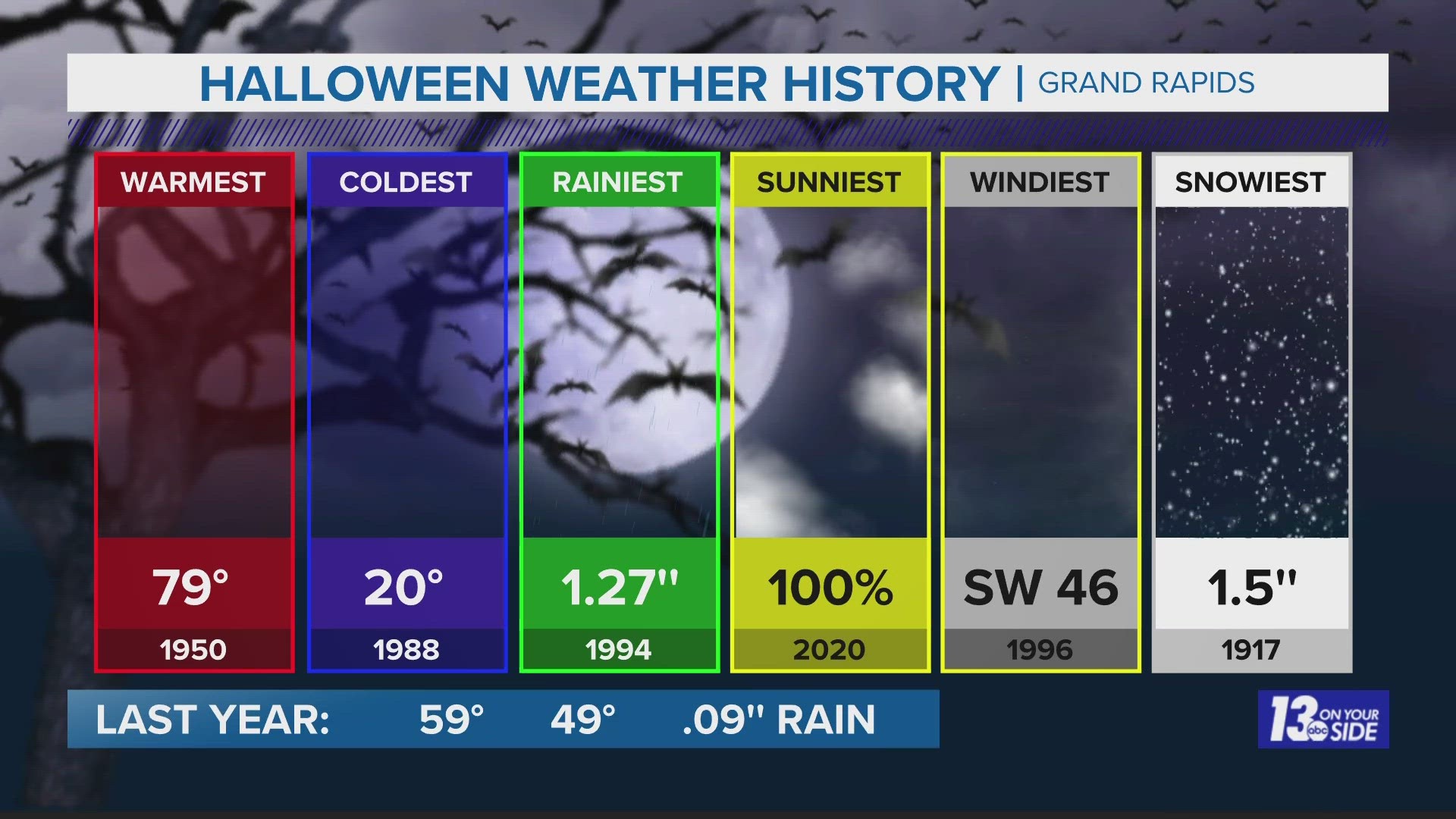
GRAND RAPIDS, Mich. — Snow on Halloween isn’t unheard of, but there have only been a handful of years where it’s accumulated across West Michigan.
Grand Rapids has recorded accumulating snowfall on only four Halloween’s (1917, 1932, 2017, 2019) – weather data goes back to the 1890s. Eight other Halloweens have seen a trace amount of snow at Grand Rapids. For Muskegon, 10 Halloween have seen a trace amount of snow, but no accumulation.
In terms of the coldest Halloweens, this year will be towards the top. Only five Halloween’s have failed to reach 40° for a high temperature (1906, 1913, 1917, 1932, 1996) at Grand Rapids. At Muskegon, only seven Halloweens have failed to reach 40° for a high temperature.
Halloween is off to a chilly start and will stay that way throughout the day. We have a forecast high of 38°, but it will feel like the upper 20s to low 30s all day long. This comes as our next low-pressure system works into the region, bringing gusty winds, lake-enhanced snow, and system snow. Lake effect has already begun, but the system snow will begin around noon and end around 8 p.m.
Snowfall totals will vary depending on your location. 1 to 3 inches is likely across the areas in dark blue and pink. There will likely be an isolated spot of 3"+ of snowfall. The '+' indicates that there could be totals higher than 3 inches.
IMPACTS
Dynamics look strong enough to bump up snowfall totals for Muskegon, Newaygo, & Oceana Co. Because of this, our first Winter Weather Advisory of the season has been issued by the NWS. Snow will struggle to stick at first, but the rate of snow for locations under the advisory will continue to overcome the warm ground temperatures, bringing some impacts. Bridges and overpasses will become slick and visibility will likely be reduced at times.


►Make it easy to keep up to date with more stories like this. Download the 13 ON YOUR SIDE app now.
Have a news tip? Email news@13onyourside.com, visit our Facebook page or Twitter. Subscribe to our YouTube channel.

