GRAND RAPIDS, Mich. — Hurricane season has only just begun and we are already on to our third named storm of the year, Tropical Depression Cristobal, having weakened from a Tropical Storm.
This storm will be taking a track to the north heading toward Wisconsin, but that track is close enough to West Michigan that we can expect impacts to our weather by Tuesday night.

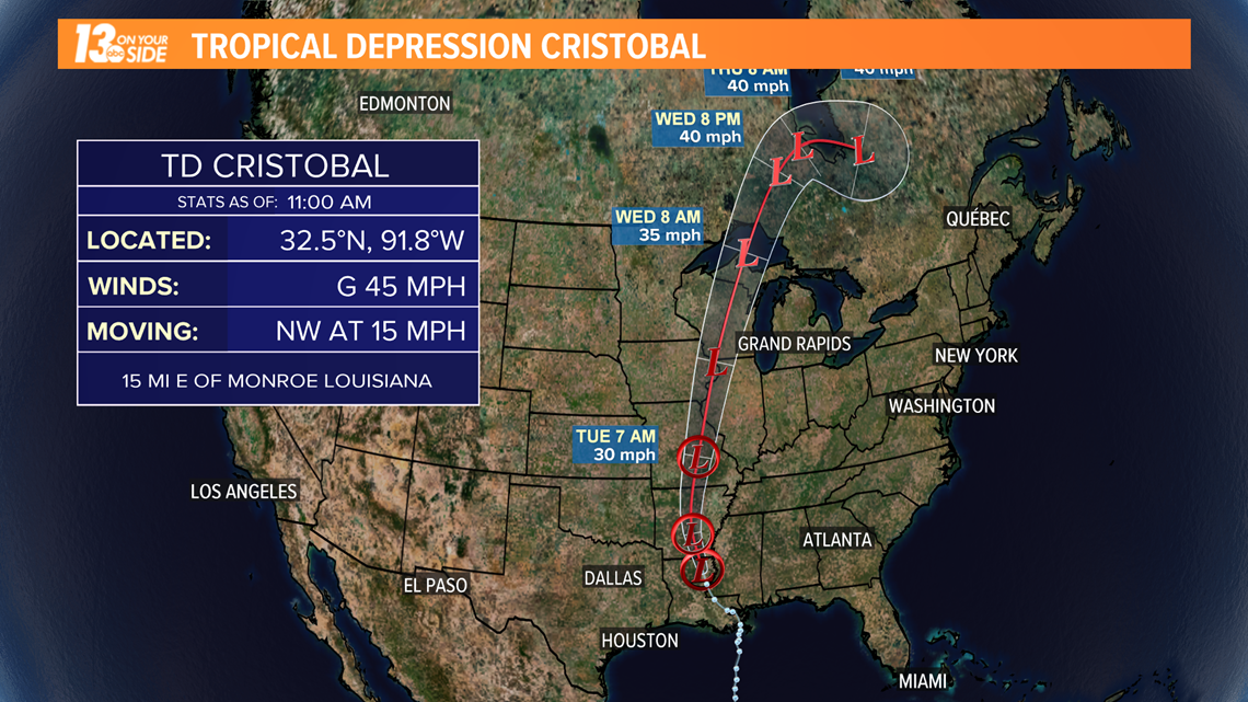
Below is the latest on what the storm could mean for our region.
Timing:
As far as the timing of the storm goes, we are expecting clouds to begin building into the region on Tuesday, along with southerly winds and toasty temperatures. Highs will reach near 90 by Tuesday afternoon.
Showers and thunderstorms start to move into the region Tuesday evening and continue into Wednesday. We are not expecting severe weather on Wednesday.
The heaviest rain will move out of the region on Wednesday, but scattered showers and clouds could linger into Thursday morning.
Impacts:
The biggest impact from this storm system will likely be gusty winds.
The risk for these events is low, but something to watch out for.
Beyond the storm related risk for wind, winds in general will be very gusty throughout Tuesday night and through Wednesday. Wind gusts could be between 30 to 50 mph Wednesday.

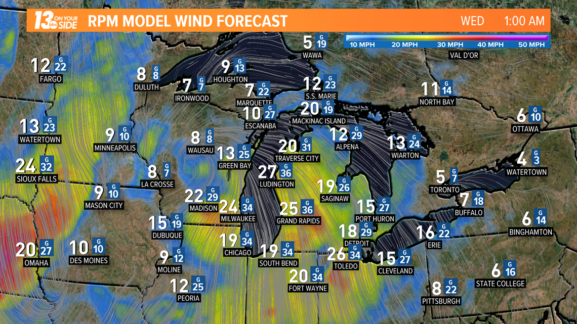
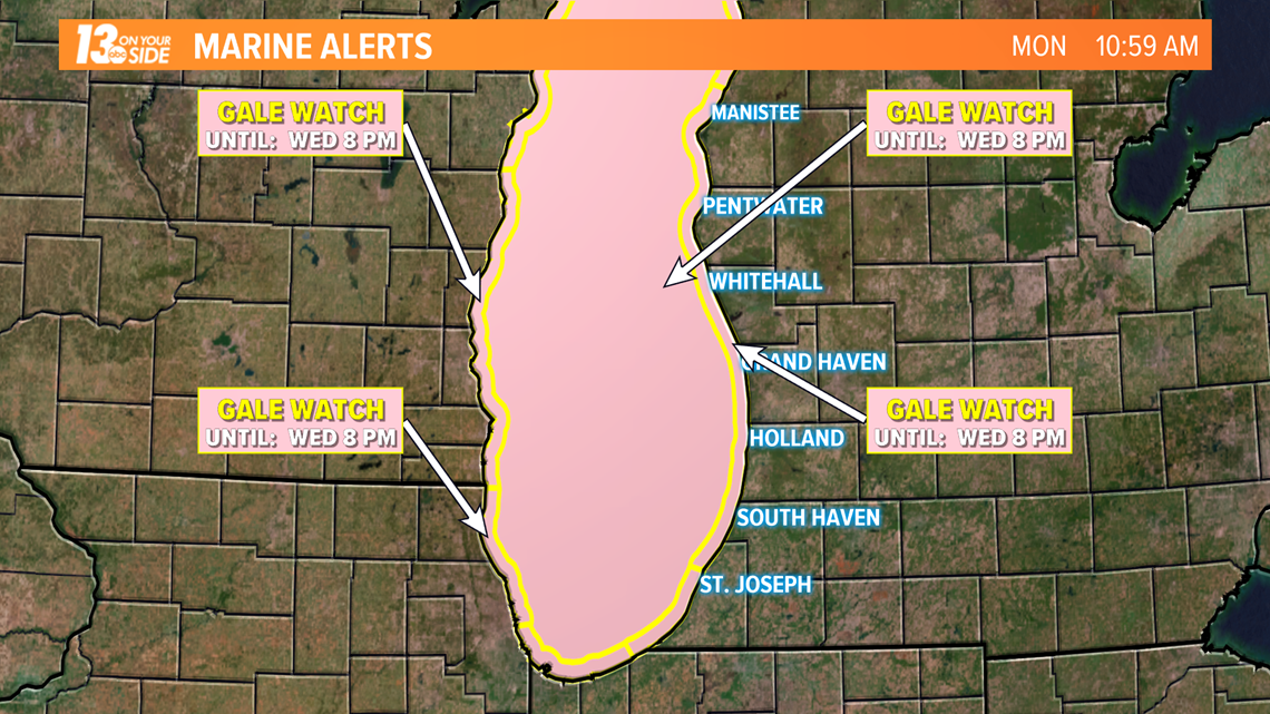
Winds could possibly reach gale force over Lake Michigan, and push up waves reaching 6 to 10 feet. As of such a Gale Watch is in place from Tuesday evening through Wednesday evening for the entirety of the lake.

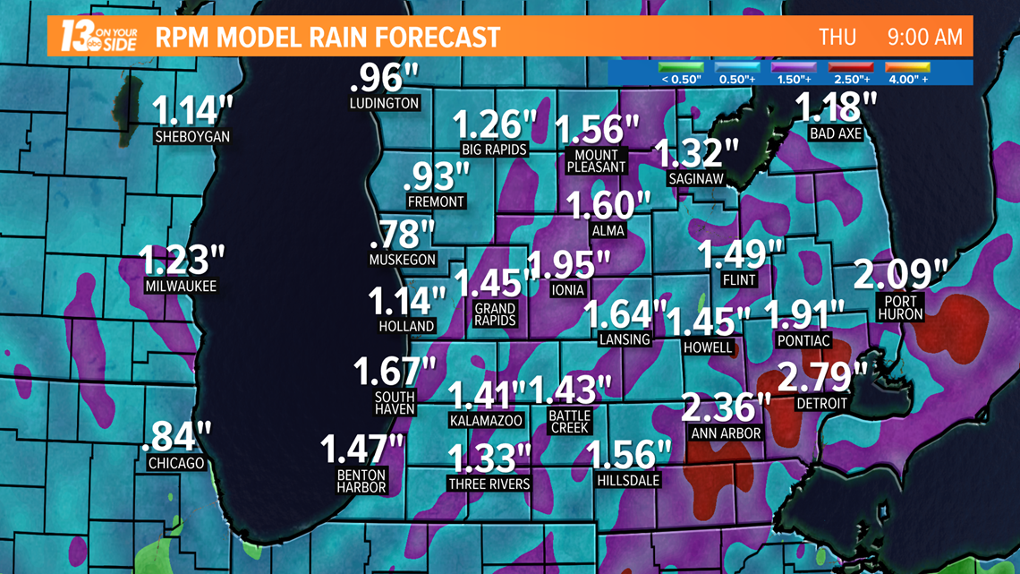
Currently, extremely heavy rain totals are not expected in West Michigan, but depending on the strength of individual storm cells, an area of 1/2 inch to 2 inches of rain could fall around the region. Locally higher totals could remain a possibility if more intense storms develop.

As the forecast continues to evolve, make sure you stay with 13 On Your Side for the latest. We've got you covered!
--Meteorologist Michael Behrens
More from 13 ON YOUR SIDE:
Contact me at: MBehrens@TEGNA.com
Follow me on Twitter @MikeBehrensWX and Facebook Meteorologist Michael Behrens
Have a 30-second video or still photo to share? We'd love to share it with everyone! Email your image to Weather@13OnYourSide.com or post it to our 13OnYourSide Facebook Page

