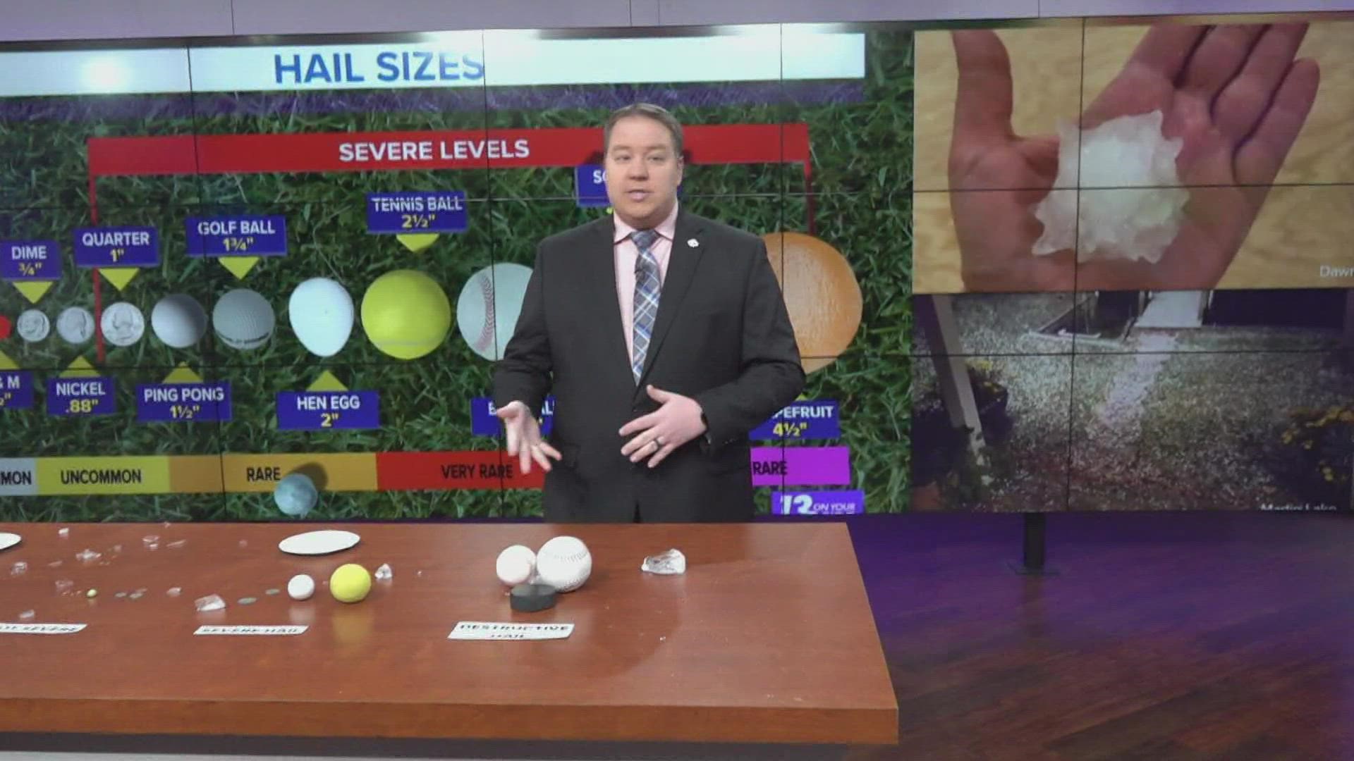
GRAND RAPIDS, Mich. — When discussing the threats of severe weather in West Michigan it would be impossible to forget about hail. From pea size to baseball, hail can range from a minor annoyance to a car and house destroying menace.
Radar can do a decent job at estimating hail size, but what we see on radar is not necessarily what can or will make it down to ground level. As a result, having timely and accurate hail reports from the public helps forecasters confirm their alerts or issue important alerts for communities who will be impacted later on.
So, with that in mind, how exactly does hail form and how should you measure and communicate your measurements to the National Weather Service or to us here at 13 On Your Side?
Hail Formation:
Hail forms when the updrafts in a thunderstorm stop a rain droplet from falling toward the surface. If the winds are strong enough, this droplet can be raised back upward into the storm and into much colder air.
This cold air can cause the rain droplet to freeze into a small hailstone. This hailstone will remain suspended and continue to grow until it reaches a weight heavier than that of which the wind can support. At that point the hailstone will fall to the surface.
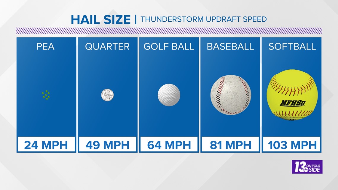
Here's a look at how strong the winds inside a storm need to be for different sizes of hail to form.

When it comes to hail formation, seeing it visually can be a lot more helpful than just hearing about the science. To help with this, Chief Meteorologist George Lessens explains hail formation in the video below.
Measuring Hail:
When it comes to measuring hail, first make sure the storm and the threat of severe weather is gone before heading outside. To take a hail measurement a ruler or measuring tape is, of course, the best way to do it. When you take a measurement, be sure to measure across the widest part of the hailstone.

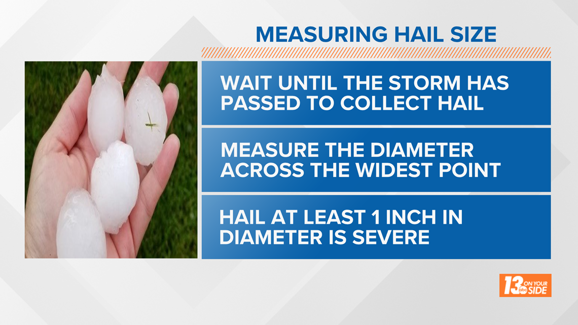
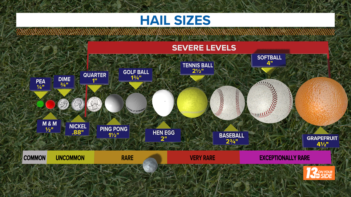
However, it is not practical to have a measuring device with you at all times, so reporting the hail compared to a known object, or photographing it with a known object, is the next best way to report hail size. You should use common objects such as coins or sports balls, something most people will know the size of, when you are reporting hail in this way.
A list of common sizes can be seen below.

When severe weather is targeting West Michigan, safely sending these reports to 13 On Your Side and the National Weather Service is an easy way to help inform and protect our communities. You can always email your pictures to news@13onyourside.com or text them to 616-559-1310.
-- Meteorologist Michael Behrens
Follow me on social media! Facebook Meteorologist Michael Behrens, Twitter @MikeBehrensWX, and Instagram @MikeBehrensWX.
Email me at: MBehrens@13OnYourSide.com
Have a 30-second video or still photo to share? We'd love to share it with everyone! Email your image to Weather@13OnYourSide.com or post it to our 13OnYourSide Facebook Page.
►Make it easy to keep up to date with more stories like this. Download the 13 ON YOUR SIDE app now.
Have a news tip? Email news@13onyourside.com, visit our Facebook page or Twitter. Subscribe to our YouTube channel.

