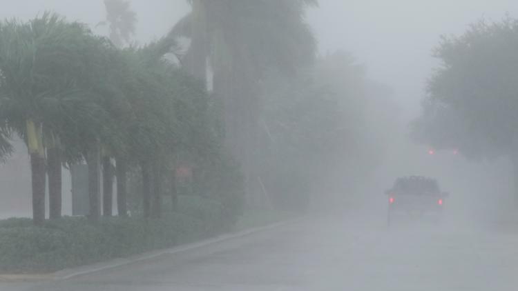
COLUMBUS, Ohio — Hurricane Milton brought powerful winds, a deadly storm surge and flooding to much of Florida after making landfall along the Gulf Coast as a Category 3 storm.
It weakened to a Category 1 storm as it moved through Florida early Thursday. Power outages were widespread and deaths have been reported from severe weather.
The cyclone had maximum sustained winds of 120 mph (205 kph) when it roared ashore in Siesta Key, south of the populated Tampa Bay region, the National Hurricane Center said. The hurricane was bringing deadly storm surge to much of Florida’s Gulf Coast, including densely populated areas such as Tampa, St. Petersburg, Sarasota and Fort Myers.
President Joe Biden, who postponed an overseas trip so he could remain at the White House to monitor Milton, said it “could be one of the worst storms in 100 years to hit Florida.”
Milton made landfall at 8:30 p.m. near Siesta Key, off the coast of Sarasota, about 70 miles (112 kilometers) south of Tampa.
It has about 5,500 residents, many of retirement age.
Florida International University professor Stephen Leatherman, a.k.a. “Dr. Beach,” named Siesta Beach the United States’ best beach in 2017, and MTV’s “Siesta Key” gave audiences a reality-show view of the place in recent years.
About 125 homes were destroyed before the hurricane made landfall, many of them mobile homes in communities for older adults. More than 1.7 million homes and businesses were without electricity, according to poweroutage.us, which tracks utility reports.
Florida’s Gulf Coast is especially vulnerable to storm surge, and Milton was bringing life-threatening high waters to densely populated areas such as Tampa, St. Petersburg, Sarasota and Fort Myers.
Helene came ashore about 180 miles (290 kilometers) north of Tampa and still caused drowning deaths in the Tampa area because of storm surges that were about 5 to 8 feet (1.5 to 2.5 meters) above normal tide levels.
With Milton, forecasters warned of a possible surge of up to 13 feet (4 meters) south of Tampa, from Anna Maria Island to Boca Grande, but downgraded its surge projection in Tampa Bay to 3- to 5-foot (0.9- to 1.5-meter).
Milton was forecast to dump as much as 18 inches (46 centimeters) of rain as it crosses the state, bringing the risk of catastrophic flooding.
Tracking Milton: Live interactive radar
Milton is just the latest system in a storm season that scientists say is the weirdest they have ever seen.
Beryl became the earliest storm on record to reach Category 5 status, but there was record quiet from Aug. 20 — the traditional start of peak hurricane season — to Sept. 23, according to Colorado State University hurricane researcher Phil Klotzbach.
Then five hurricanes popped up between Sept. 26 and Oct. 6, which is more than double the old record of two. On Sunday and Monday, there were three hurricanes at the same time, which had never happened before, Klotzback said.
In just 46 1/2 hours, Milton went from forming as a tropical storm with 40 mph winds to a top-of-the-charts Category 5 hurricane.
Some might wonder if it is possible to control extreme weather events. But scientists say hurricanes are too powerful for that, and climate change is providing more fuel than ever for storms like Helene and Milton.
Warm water fueled amazingly rapid intensification that took Milton from a minimal hurricane to a massive Category 5 in less than 10 hours.
Milton also grew so potent because it managed to avoid high-level cross winds that often decapitate storms, especially in autumn. As Milton neared Florida, it hit those winds and dropped in strength.
Airports including Tampa International and nearby St. Pete-Clearwater International have shut down.
And the tourism machine in Orlando, about 84 miles (135 kilometers) inland from Tampa, was grinding to a halt. That city's airport — the nation’s seventh busiest and Florida’s most trafficked — also ceased operations. And at least three major theme parks — Walt Disney World, Universal Orlando and SeaWorld — will close.
For some residents of storm-prone Southeastern states, the best indicator of a hurricane’s severity can be found at the local Waffle House.
If the Georgia-based restaurant chain stays open in town, neighbors are reassured that the coming storm is unlikely to cause devastation. A closed location of the diner has come to indicate impending disaster.
What might sound like silly logic has become one of the most reliable ways for Southerners and even federal officials to gauge a storm’s severity and identify communities most in need of immediate aid. The Waffle House Index was thought up two decades ago by a federal emergency management official.


