GRAND RAPIDS, Mich. — Hot temperatures and high humidity – a 13 Weather Impact Alert remains Tuesday.
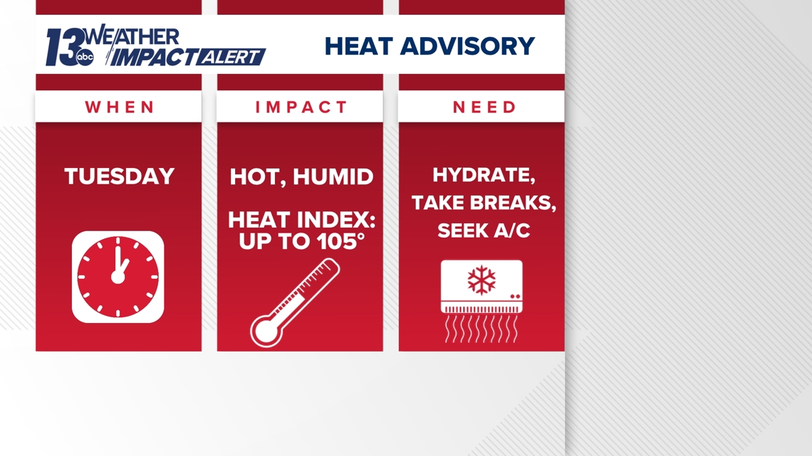
HEAT ADVISORY
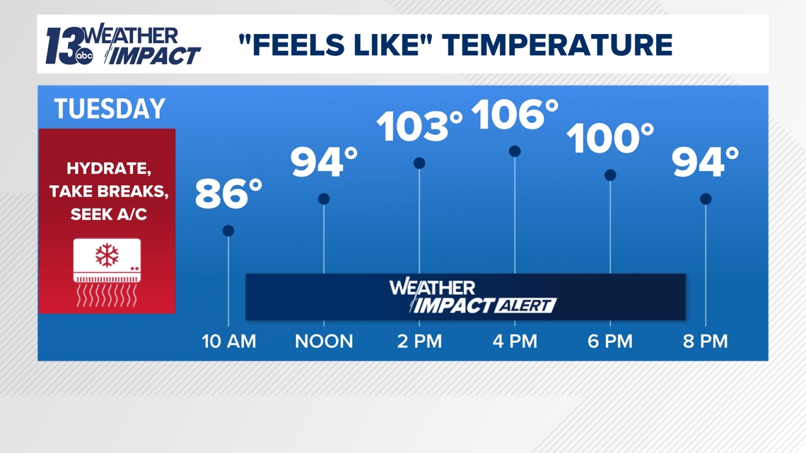
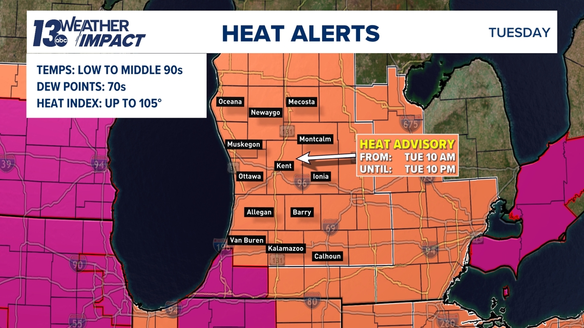
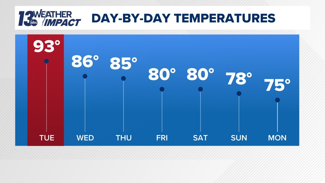
Tuesday will be the peak of the heat as high temperatures will climb into the lower to middle 90s. The only exception will be the immediate lakeshore, where the upper 80s are expected for high temperatures. There’ll be no escaping the humidity as dew points soar into the lower to middle 70s. This degree of humidity is tropical to oppressive by West Michigan standards.
Heat indices – combining the air temperature and humidity – will be more than 100° for several hours this afternoon into the early evening, potentially upwards of 105°.

The National Weather Service has issued a Heat Advisory across West Michigan – from 10 AM to 10 PM – because of the impactful heat and humidity.

If you have outdoor work and/or plans, staying hydrated, slowing down, and being in the comfort of A/C is key in battling the heat. It’s also important to check on those more susceptible to the heat - kids, the elderly, and pets.

TUESDAY SEVERE RISK
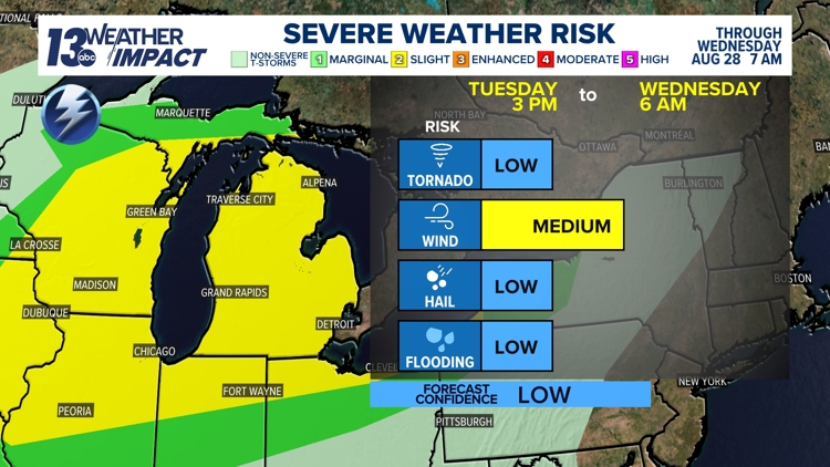
The possibility of stronger thunderstorms continues Tuesday as the Storm Prediction Center keeps West Michigan at a Slight Risk (level 2 of 5) for severe weather.
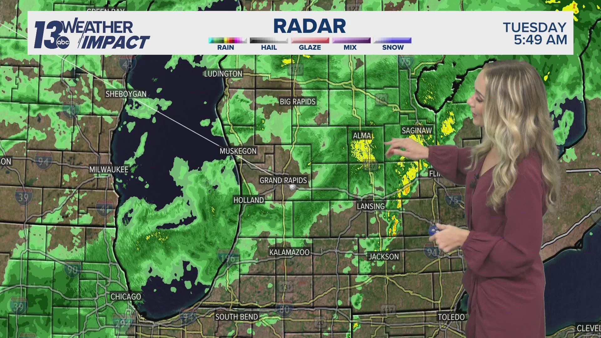
Midday thunderstorms over Wisconsin may evolve and press into West Michigan this afternoon into the early evening. That's the first opportunity of strong to severe weather.
Uncertainty remains in the evolution of these thunderstorms as the atmosphere is somewhat 'capped’ across the area, which inhibits thunderstorms from developing, despite the ample instability present with the heat and humidity (like a lid over a boiling pot of water).

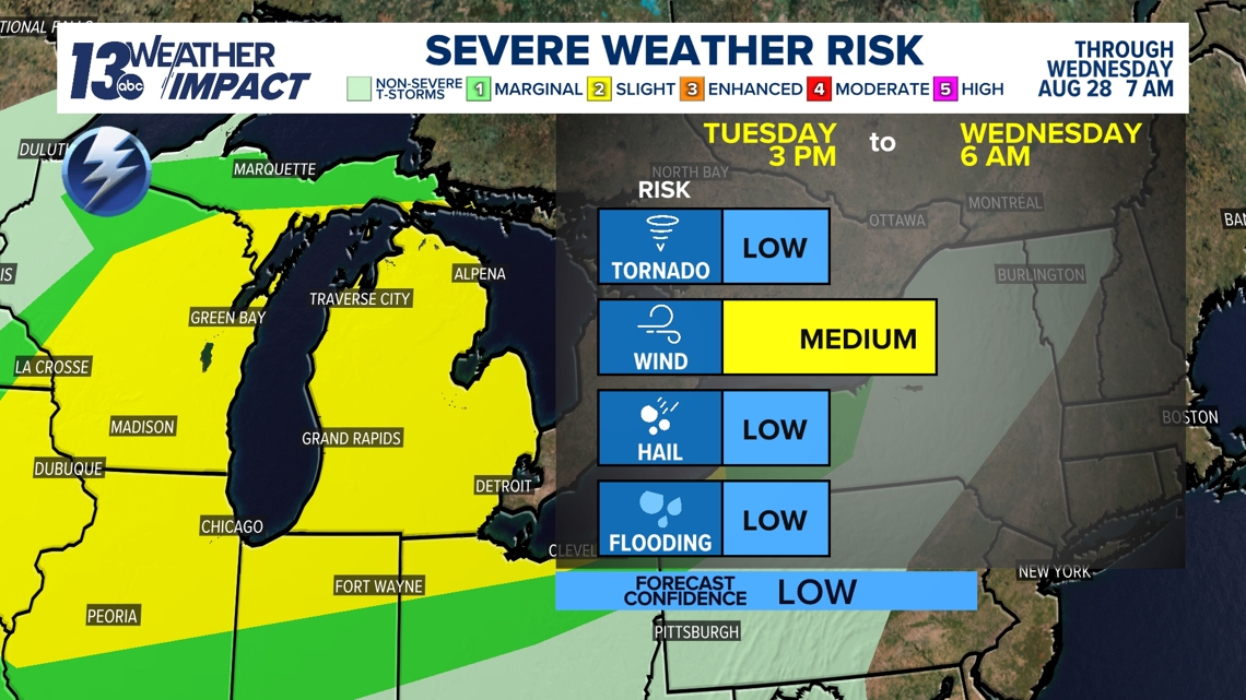
Thunderstorm potential will continue this evening into tonight as a subtle disturbance sweeps across the Great Lakes. This’ll allow a favorable environment for stronger thunderstorms to develop and potentially progress into West Michigan. Having said that, the risk is not a slam dunk as models continue to struggle with the placement of thunderstorms.
REMAINING WARM & HUMID
Temperatures will moderate Wednesday and Thursday but remain warm for late August in the middle 80s. More importantly, the high humidity will last through the end of the week. It’ll take until the weekend for complete relief of both the heat and humidity.

TEXT US
TEXT your weather photos to us at 616-559-1310.
Please include the following with your photo(s):
- Your storm photos
- Your first and last name
- Date and time of your photos
- Locations of your photos
- What’s in your photos?
13 Weather Impact Alerts highlight key times to be weather aware. Weather that has an impact on day-to-day plans will trigger an alert. The 13 Weather Impact Team will explain when to expect the weather, what impact it will have, and how to keep yourself safe and comfortable with clear, easy-to-understand graphics. See how to get these alerts here.