GRAND RAPIDS, Mich — Not many changes have been made to the forecast since yesterday. A large portion of the lower peninsula is at risk for strong to severe weather this afternoon and evening. Now, there are some unknown factors that could either increase or decrease our threat.
Here is where we stand as of 8 a.m. Wednesday morning:
WHAT
A batch of storms over Wisconsin is racing toward West Michigan. This initial batch of storms could arrive at Lake Michigan by as early as 9 a.m. These storms will really be a determining factor for how intense storms become this afternoon. If we see some thunderstorm activity before noon, we could slightly decrease our risk for severe storms in those areas. If these storms fall apart, our atmosphere will remain untapped, and severe weather becomes very likely. As of right now, both options are possible, so we will prepare for storms and hope for a little activity.
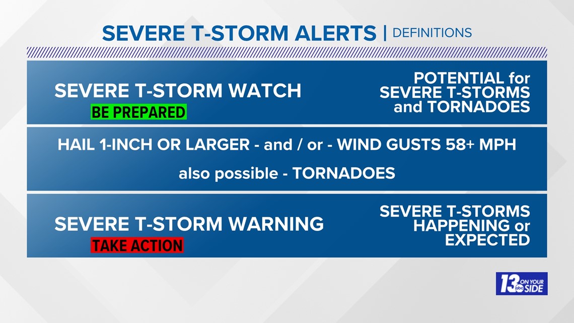
At this time we have no watch in effect. If a watch is issued, that means it is time to prepare for strong to severe storms. If a warning is issued, that means the threat is happening or will happen soon and you should seek shelter from these storms.

TIMING
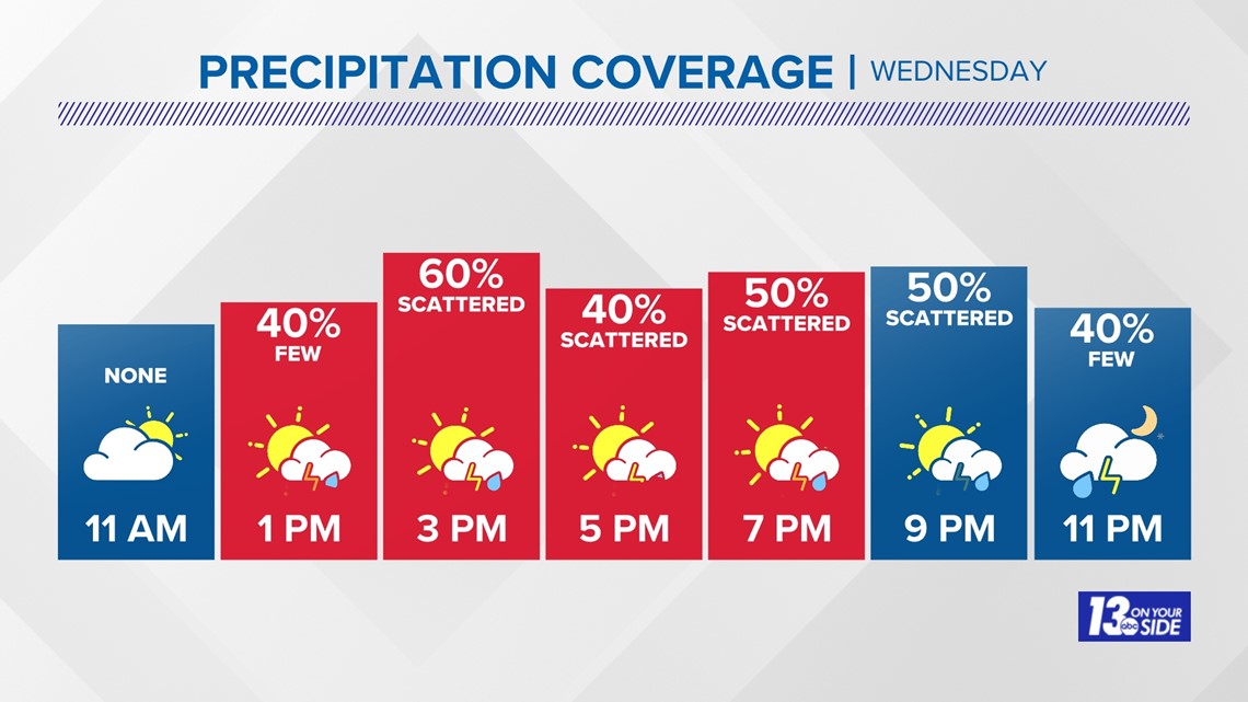
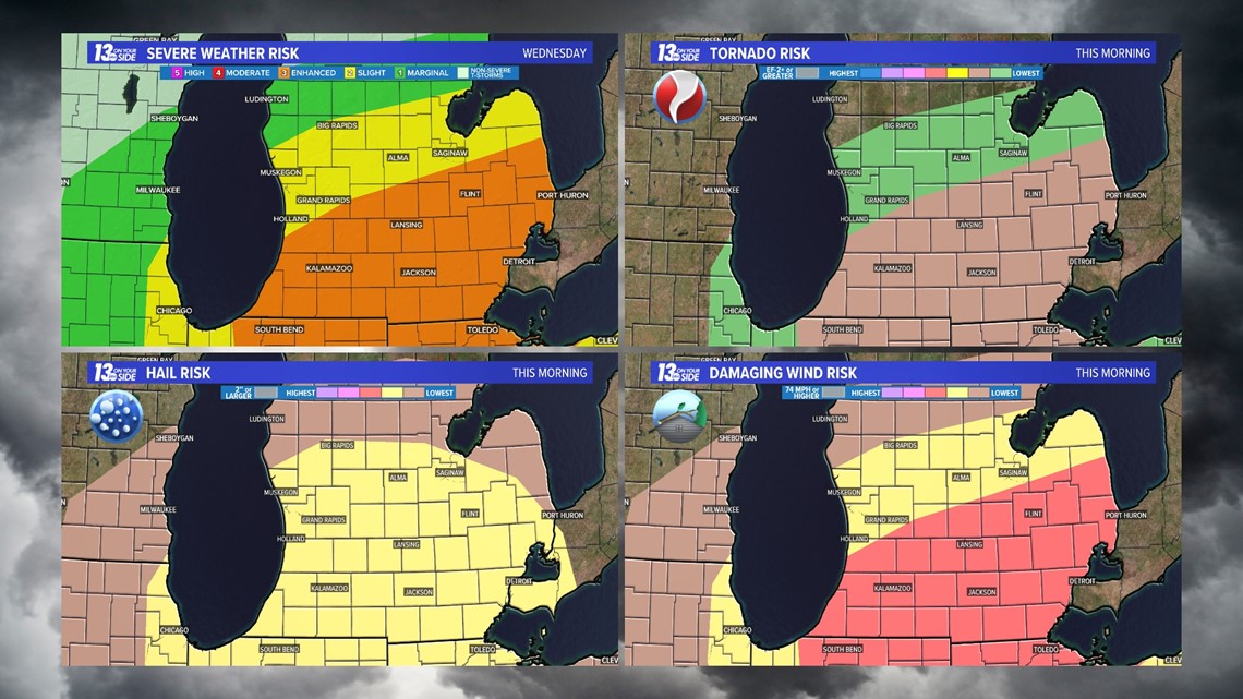
The greatest concern for severe weather remains from noon to 8 p.m., with the most intense storms during peak daytime heating. During that timeframe, all modes of severe weather will be possible. Models don't have a great agreement between storm placement, but everyone on I-96 and to the south should be prepared for storm activity all afternoon and evening long.

THREATS
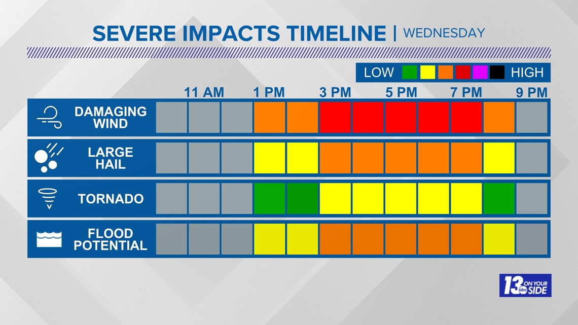
As mentioned, all modes of severe weather will be possible this afternoon and evening. The highest threat is given to strong and damaging winds at 60+ mph. Next in line would be large hail, flooding and even a few isolated tornadoes. Those under a level 3/5 threat will have the highest concern for these threats. Potential damage becomes less prominent the further north and west that you travel.


SAFETY
You should have multiple ways to stay weather aware and receive critical weather information.
There are five direct ways in which you can receive weather alerts.
1. NOAA Weather Radio
The first is NOAA Weather Radio. We often refer to them as the “smoke detector” for severe weather, because they will automatically sound an alarm in the case of a natural disaster or severe weather.
2. Local Broadcast
There is also always your local TV station. The 13 ON YOUR SIDE Weather Department streams on-air and online during an active storm.
3. Radio Station
Local radio stations should alert you if a storm is in your area. You can even set up devices like Alexa and Google Home to alert you with weather notifications.
4. Smartphone
Your smartphones also offer numerous ways to receive critical weather alerts. We have a 13 ON YOUR SIDE Weather App that will allow you to track the storm and receive alerts.
5. Outdoor Sirens
Outdoor sirens are also an option, as they will go off in the threat of immediate danger, but are only meant to be heard outdoors. So, if you are inside this should not be how you receive your severe weather alerts. Outdoor sirens can also be unreliable, difficult for those hard of hearing, and go off for other reasons beyond tornadoes.
While all of those methods are great, none of them are foolproof. So we suggest having two ways to receive alerts at all times.


►Make it easy to keep up to date with more stories like this. Download the 13 ON YOUR SIDE app now.
Have a news tip? Email news@13onyourside.com, visit our Facebook page or Twitter. Subscribe to our YouTube channel.

