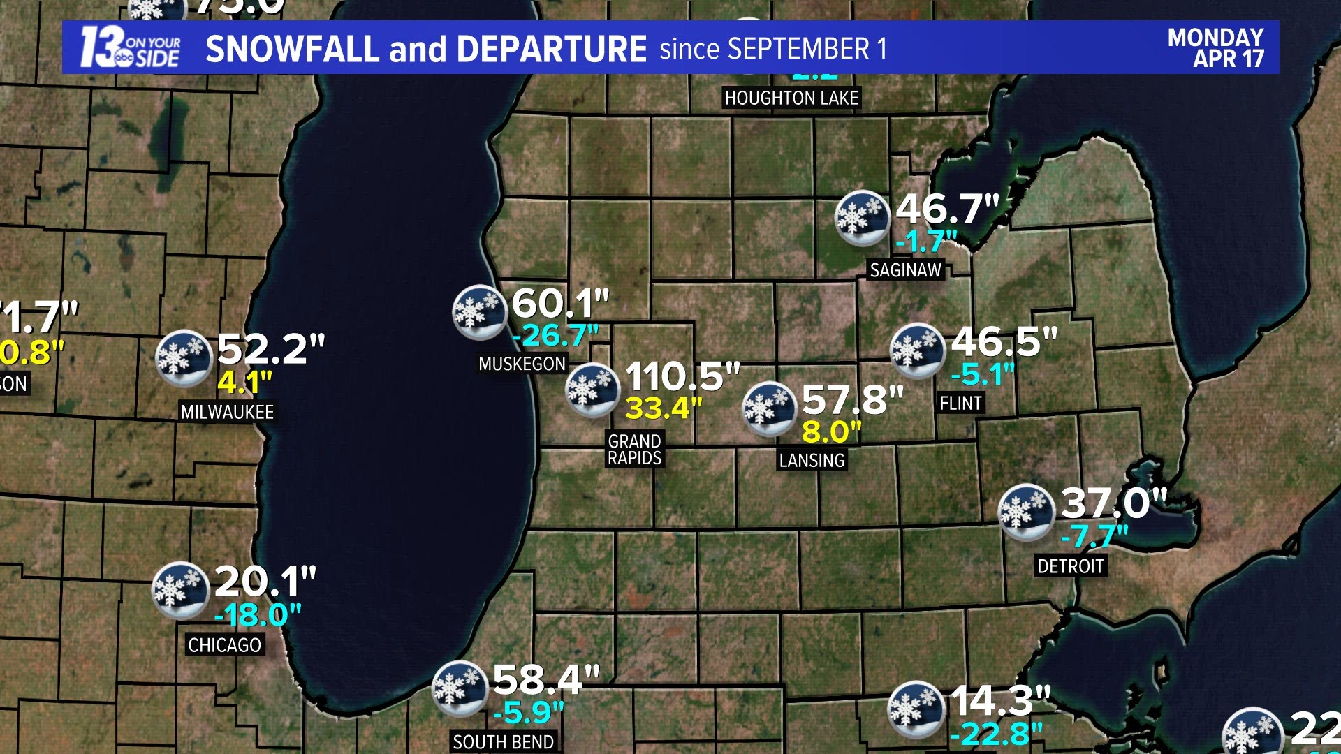
GRAND RAPIDS, Mich. — It seems to never end: the snow. It snowed again on Monday, April 17. It was only a few tenths of an inch - but it snowed. Again.

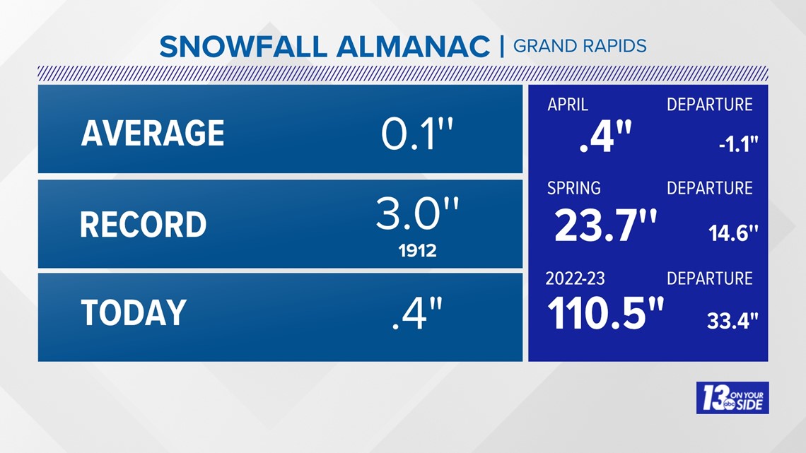
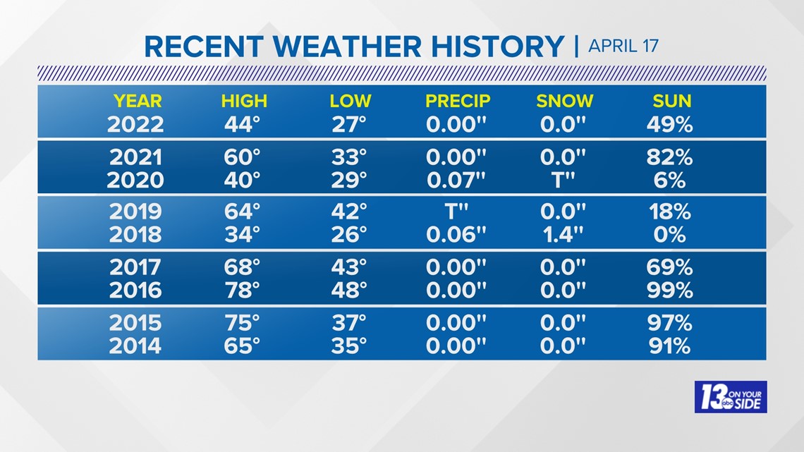
It has snowed on April 17 three times in the past six years, including a record 1.4'' in 2018. Still it seems like winter won't let go.

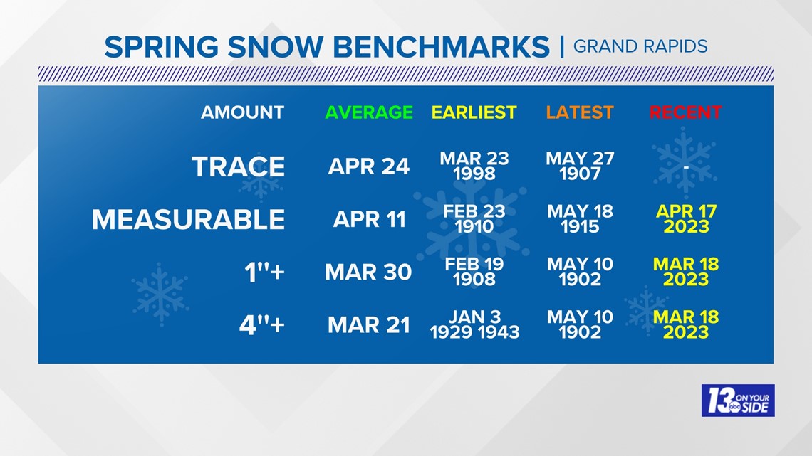
The average date of the last measurable snow (anything more than a trace) is April 11, and now we're six days beyond that.

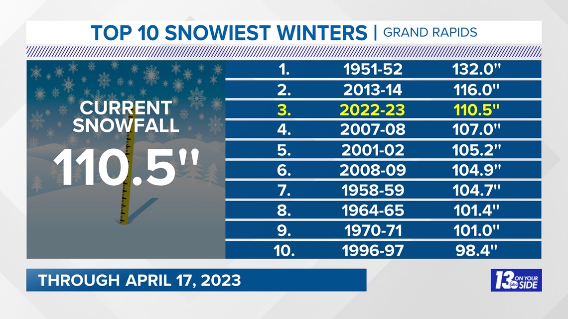
The season snowfall in Grand Rapids has reached the third highest on record, behind the winters of 2013-14 and 1951-52.

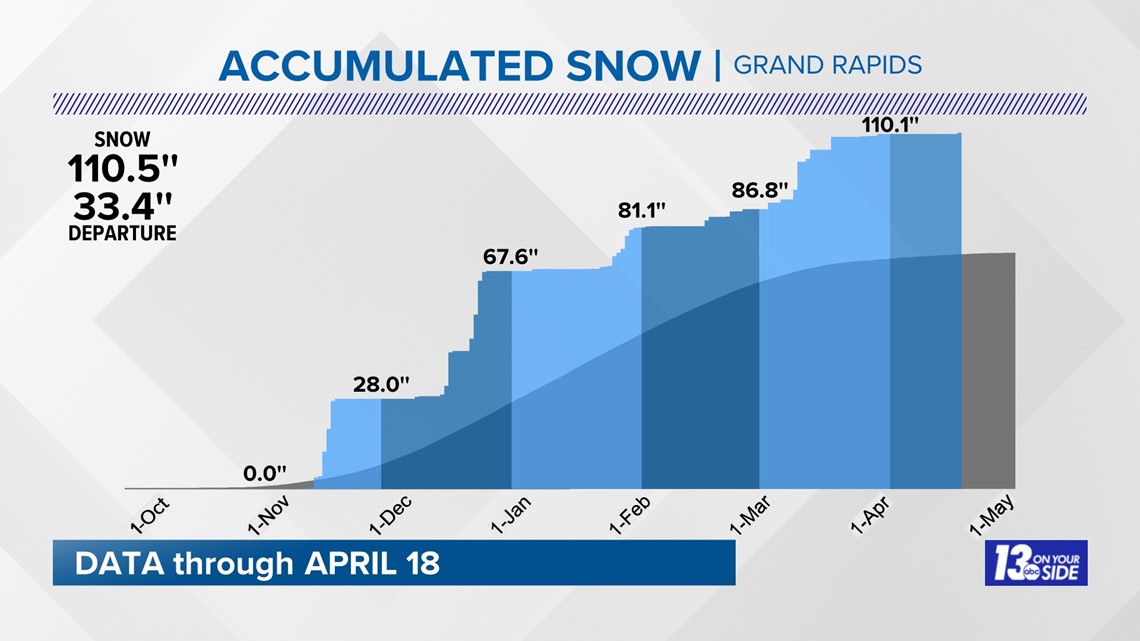
This season's snow came in bunches with a very snowy December and again in late January and early March.

Is West Michigan done with snow this season? According to the ECMWF (Euro) model snow forecast the answer is: not yet.

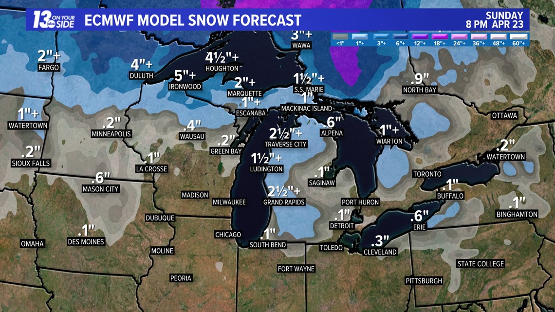
The snow is expected Saturday night ending Sunday morning, similar to this past Sunday night into Monday this week. Likely this snow will melt as it falls but just like Monday morning, it could briefly accumulate.
As with any forecast, the final amounts are likely to change. The forecast is similar to a sporting event: this is the second inning of a baseball game or the first quarter of a football game. If you leave the game early how would you know what the final score is, unless you check up frequently?
Continue to watch the 13 On Your Side team of meteorologists daily for the latest updates and forecast refinements.

Chief Meteorologist George Lessens
George is a graduate of Penn State University working for 13 On Your Side for over 42 years. He is a Certified Broadcast Meteorologist (CBM), a twelve-time MAB® Weathercast Award Winner and two-time EMMY® Award Winner.
Contact me at: GeorgeLessens@13OnYourSide.com
Follow me on Twitter @glessens and Facebook GeorgeLessensWZZM
Have a 30-second video or photo to share? We'd love to share it with everyone! Share your images by texting your name and location to 616.559.1310 or email to Weather@13OnYourSide.com or post it to our 13OnYourSide Facebook Page

