GRAND RAPIDS, Mich. — After an extended period of above-normal temperatures and no snow so far this season, all signs now point to a shift in the weather pattern that will likely bring our first snowfall just ahead of Thanksgiving. How much snow and the exact timing, well that's still up in the air, but here is what we are watching.
WHAT
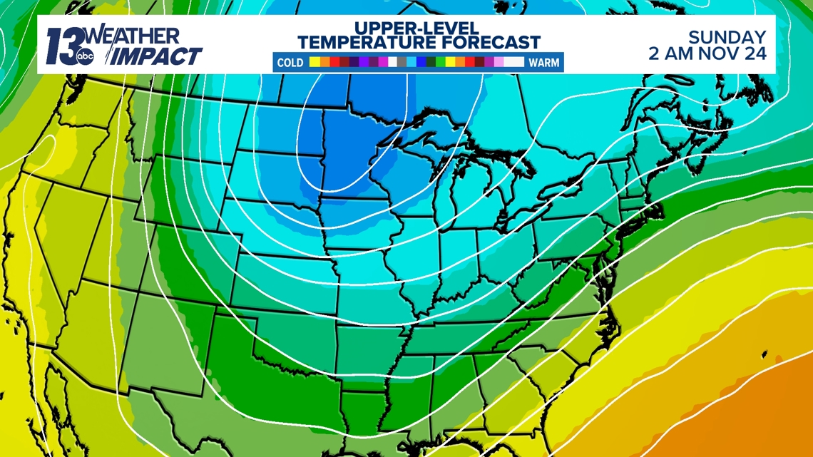
Upper-Level Cold Air: There is still some discrepancy among models on exactly when we’ll see a change in upper-level temperatures. But we can see it is coming! Once a large bubble of cold air takes over in the upper levels, it will eventually mix down to the surface, supporting a cooler forecast. This change will likely occur sometime between Thursday, November 21, and Sunday, November 24!

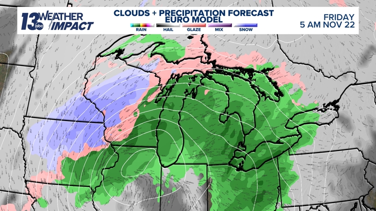
2. System Snow: A low-pressure system will move through on Thursday, bringing a mix of warm and cold air masses with it. This will likely generate rain, with a chance for snow. If the upper-level cold air doesn't move in fast enough to support the cold air within the system, we will see more rain than anything else from the system.


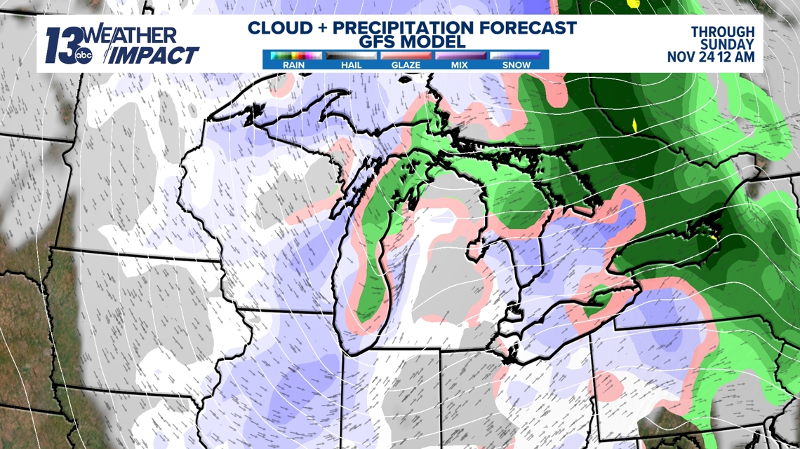
3. Next Weekend: If that colder airmass settles in, we will likely see lake-effect snow in the wake of Thursday's system. If the setup is right, there could be multiple days of snow and potentially accumulating snow.
Given that the temperature profile for the end of next week is still in flux, and with the track low-pressure system is still 7 days out, a wide range of outcomes are possible, and changes to the forecast are likely. However, we feel fairly confident saying that we will likely see snowfall between late next week and early Thanksgiving week.

IMPACT
It's too early to tell the direct impacts of this. Of course, higher snowfall totals will lead to higher impacts, but it's too early to tell totals. In terms of initial accumulation, our ground is still very warm, in the 40s, so it will take some time for the snow to start sticking.

NEED
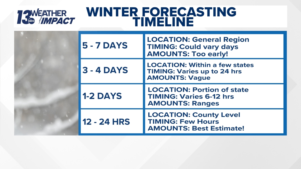
It's important to remember the typical timeline for a winter storm forecast:
5 to 7 Days Out: Meteorologists can identify the general region of the storm, but timing may still vary, and it’s too early to predict snowfall amounts.
3 to 4 Days Out: The storm's location becomes more specific, generally narrowing down to a few states. Timing is clearer but could still shift by 12 to 24 hours. Snowfall amounts remain vague.
1 to 2 Days Out: At this stage, we can identify the specific states that will be impacted, and timing is more precise, within a 6 to 12-hour window. General ranges of snow totals can be given.
12 to 24 Hours Out: A detailed county-level forecast becomes available, and the timing is accurate within a few hours. Snowfall amounts are now close to the final estimate.

Be cautious of social media hype about winter storms days or even weeks in advance. Forecasting is an active process and the information you receive will change. Rely on trusted sources for weather updates, like the 13 OYS weather team, and stay current on the latest forecasts.
Have a 30-second video or photo to share? We'd love to share it with everyone! Share your images by texting your name and location to 616.559.1310 or email to Weather@13OnYourSide.com or post it to our 13OnYourSide Facebook Page


