GRAND RAPIDS, Mich. — Another strong seasonal storm is heading for West Michigan this week. And yes, some travelers will face rough weather before sitting down for a feast with family.
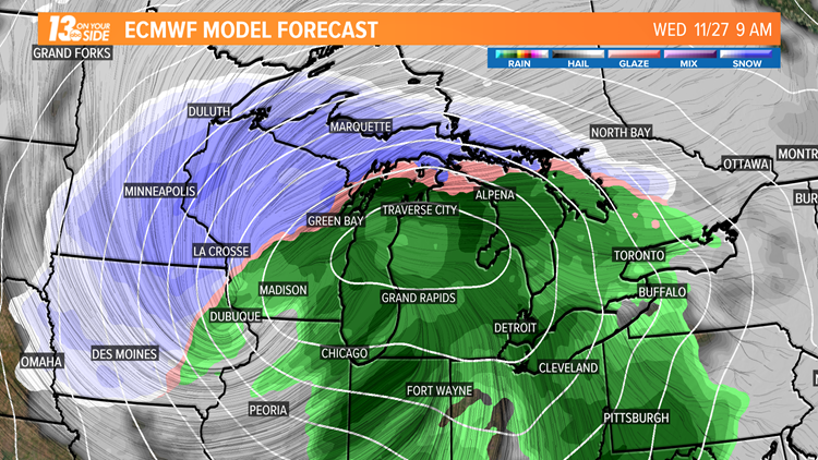
Rain will arrive after sunset Tuesday, although the worst of the weather will come Wednesday with soaking rain and gusty winds. Colder air wraps into the Great Lakes throughout the day and by the evening, northern areas may see rain transition to a wintry mix.
If the placement of the center of low pressure drifts south, the chances of accumulation snow grow.
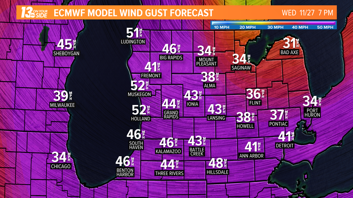
Winds may gust close to 50 mph as the storm moves through.


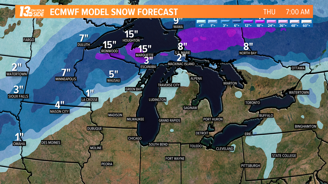
If you are traveling to the north Wednesday, you may want to adjust the timing of your travel. Several inches of snow are possible in the northern Lower Peninsula and the Upper Peninsula.


The storm will exit to the east Wednesday evening and by Thanksgiving, dry and cool air are in place.
With this storm still several days away, the storm path and timing could change. Stay up-to-date with the forecast for the latest developments.
RELATED: TSA's top Thanksgiving travel tips
►Make it easy to keep up to date with more stories like this. Download the 13 ON YOUR SIDE app now.
Have a news tip? Email news@13onyourside.com, visit our Facebook page or Twitter. Subscribe to our YouTube channel.


