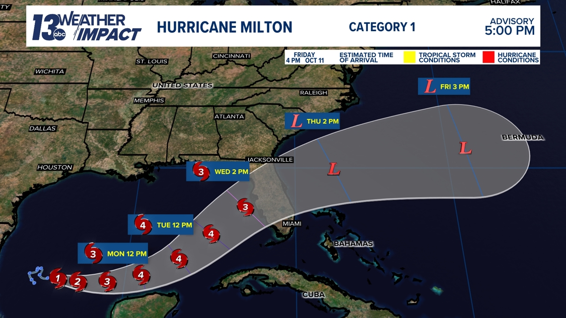
FLORIDA, USA — Hurricane Milton strengthened rapidly on Sunday afternoon, achieving category 1 status as of 4:00 p.m. EDT.
The storm currently sits in the western Gulf of Mexico with tropical storm conditions to impact the Yucatan Peninsula of Mexico starting Monday. Much of this area is already under hurricane watches as well as tropical storm watches and warnings.
Milton will move east over the next couple of days, strengthening as it nears the Gulf Coast of the Florida Peninsula.


Heavy rain and flash flooding are likely to impact portions of Florida well ahead of landfall. The threat of storm surges is continually increasing.
Landfall looks likely to be sometime on Wednesday with Milton then continuing east out to the Atlantic Ocean into the end of the week.
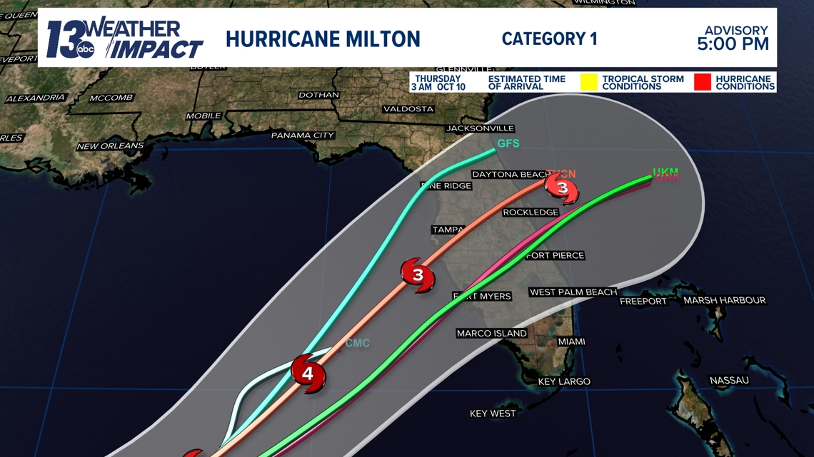
The exact timing and location of landfall are still uncertain with many details that could change over the coming days.
Models range from seeing landfall as far north as Cedar Key and as far south as Fort Myers.


Although it's too soon to determine where the greatest impacts will be felt, much of Florida is preparing for the worst with evacuation orders already underway for the Tampa Bay area, Anna Maria Island and more.
An interactive map is provided by the Florida Division of Emergency Management detailing evacuation zones across the state and what order zones are expected to be evacuated in.
This tropical system comes on the heels of Hurricane Helene which left much of Florida as well as multiple other states devasted by life-threatening storm surges, flash flooding and damaging winds.
Keep an eye on Hurricane Milton's path with this tracker.


