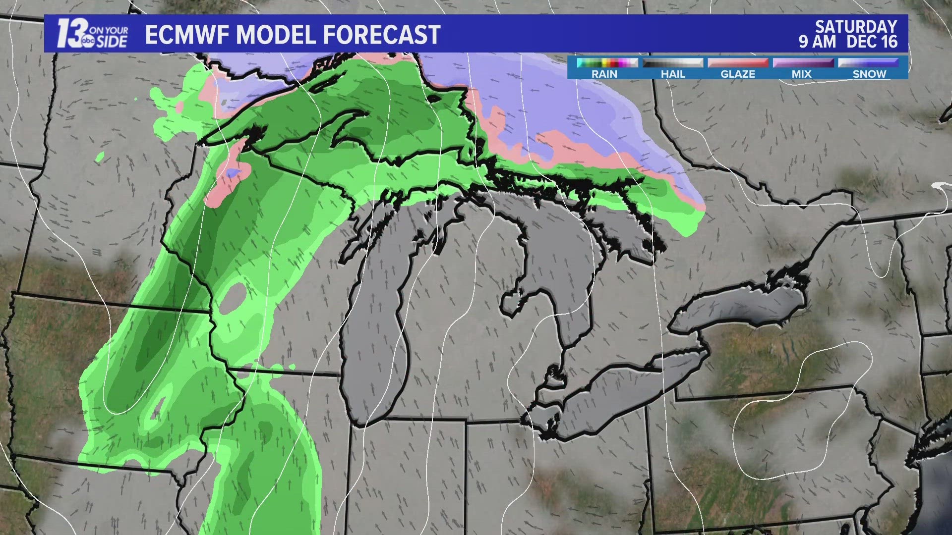
GRAND RAPIDS, Mich. — No blasts of cold air and little to no snow to speak of – Old Man Winter continues to take a back seat as December rolls on. With less than two weeks to go, the odds of a white Christmas are waning across West Michigan.
WEATHER PATTERN TOWARD CHRISTMAS
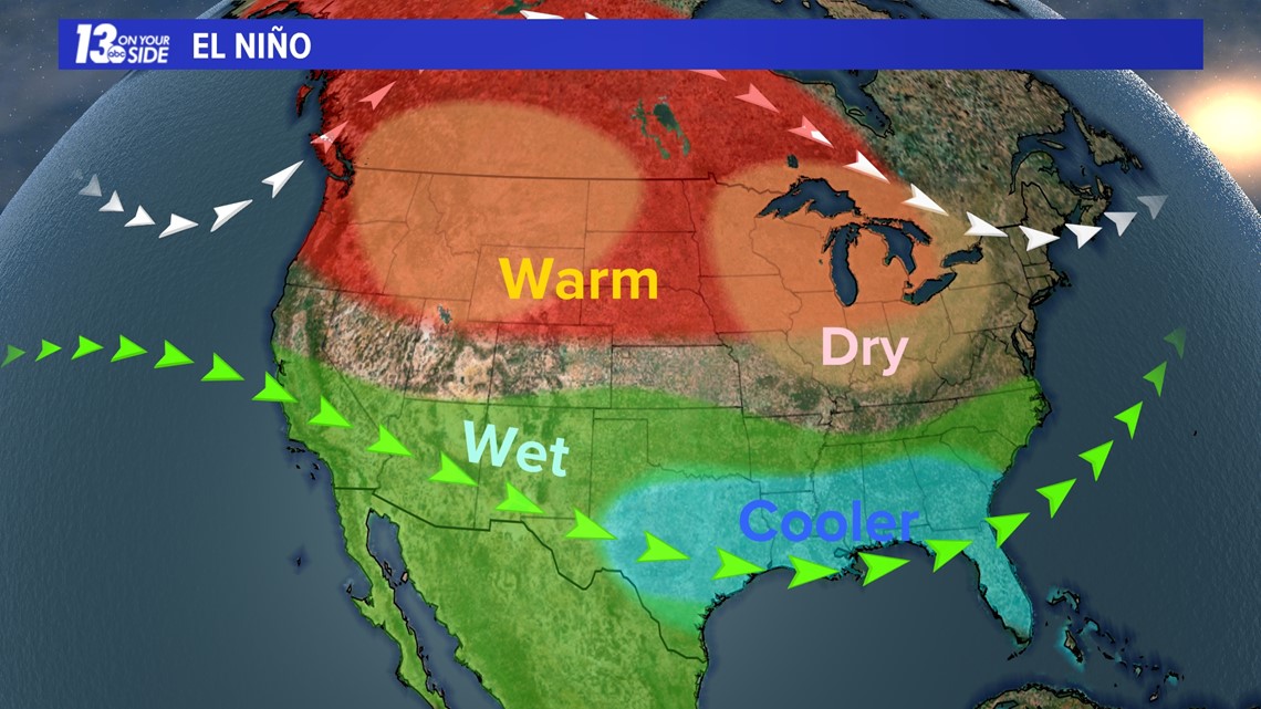
Through Christmas, above-average temperatures and drier-than-average precipitation are favored across the Great Lakes, including West Michigan. This is textbook of an El Niño pattern, which is the current phase of the ENSO cycle.

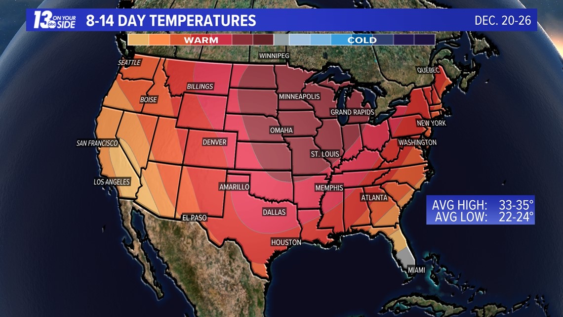

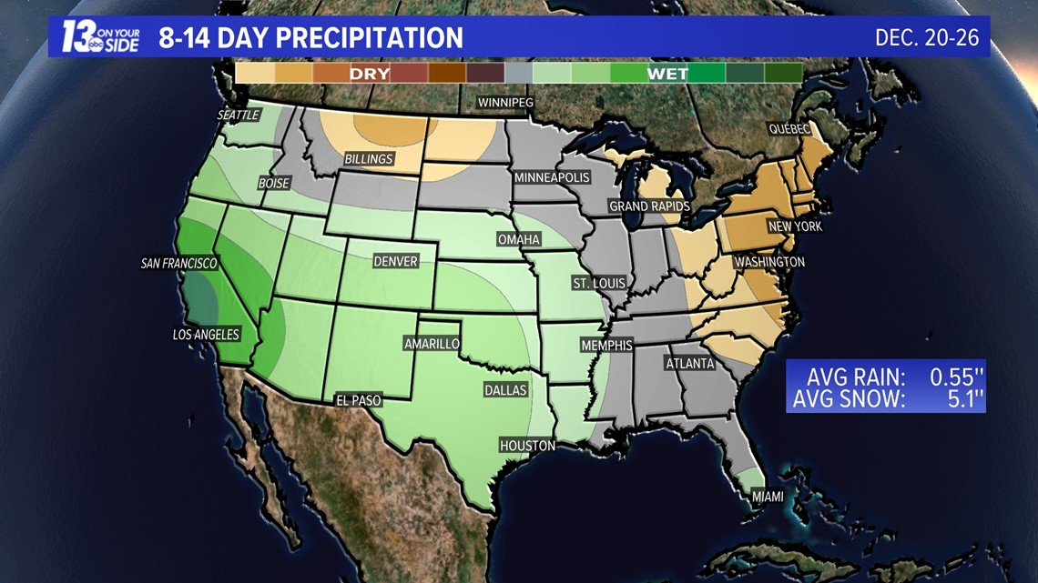
Putting this in perspective, average high temperatures settle in the middle 30s as Christmas arrives around West Michigan. Even without the factor of a drier pattern, this mild outlook makes it difficult to see accumulating snow, let alone a snowpack to develop.
It is important to note that these extended outlooks look more at the overall trend, rather than day-to-day specifics. It remains possible for snow to return by Christmas, but the window is shrinking as confidence grows of this continued stretch of mild and dry days.
WHITE CHRISTMAS ODDS/HISTORY
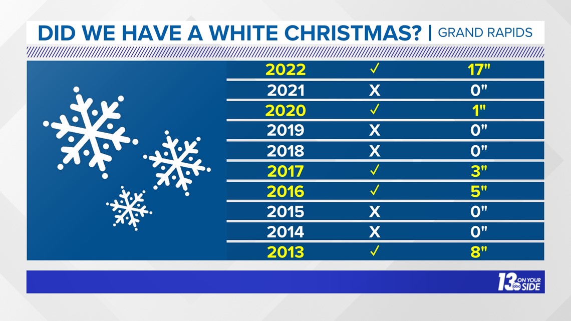
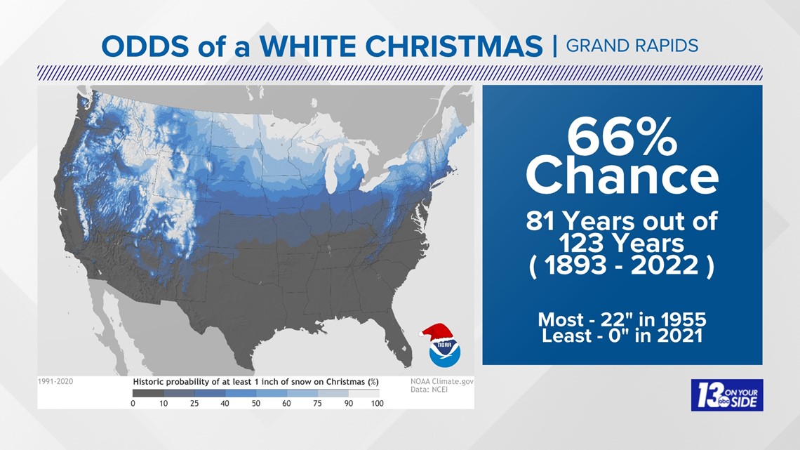
Defined as 1” or more of snow on the ground, Grand Rapids has experienced a white Christmas 66% of the time since the 1890s. Muskegon is just behind at 62%.
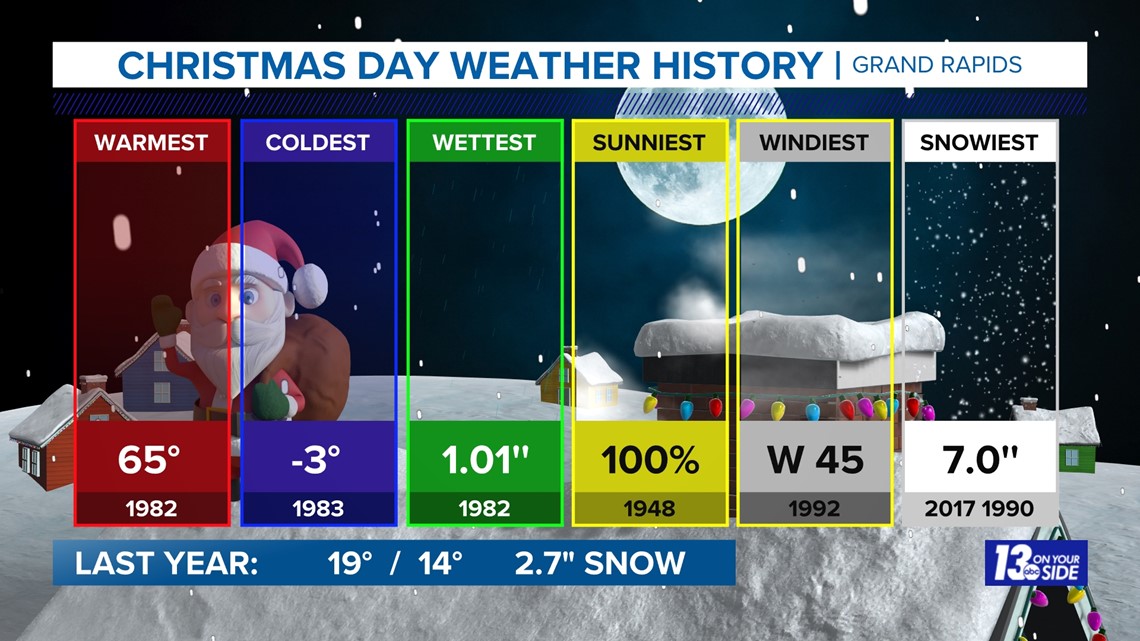
Over the past 10 years, there’s been a large range in the snow depth on Christmas, ranging from no snow several years to 17 inches on the ground last year.



OTHER TIDBITS
Through nearly two full weeks, this has been the warmest start to December (averaging high and low temperatures) since 2015 for both Grand Rapids and Muskegon. There hasn’t been one day this month where the high temperature failed to reach the freezing mark of 32 degrees Fahrenheit.
In turn, snowfall has been lackluster this season. Grand Rapids has only recorded 2 inches of snow this season, roughly 12 inches below average at this point of the season. The only communities that are sitting near to slightly above average for snowfall this season is a portion of the lakeshore, including Muskegon, which benefited from record-setting snow on Halloween.
RECAP OF EL NINO
El Niño is when the Pacific trade winds along the equator weaken, allowing sea surface water to move toward South America.

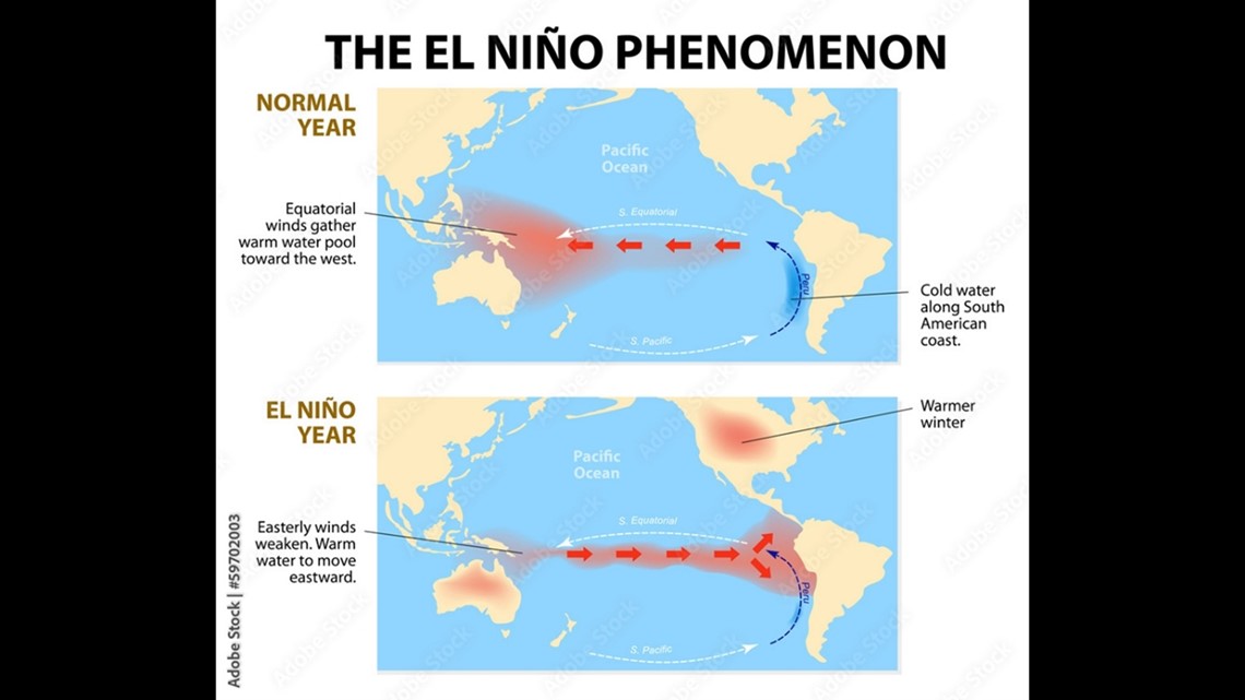
This pulls the jet stream further south, keeping more precipitation along the southern United States, leaving the northern U.S. drier than average. Meanwhile, the polar jet stream remains north with fewer cold air intrusions reaching the lower 48. As a result, the weather for West Michigan trends warmer and drier than average during El Niño winters.

►Make it easy to keep up to date with more stories like this. Download the 13 ON YOUR SIDE app now.
Have a news tip? Email news@13onyourside.com, visit our Facebook page or Twitter. Subscribe to our YouTube channel.
Watch 13 ON YOUR SIDE for free on Roku, Amazon Fire TV Stick, and on your phone.

