GRAND RAPIDS, Mich. — Rinse and repeat, another round of lake effect snow is on the way. Since Thursday, snowfall totals of over a foot have fallen in spots around West Michigan, and more snow remains throughout a chunk of the weekend forecast.
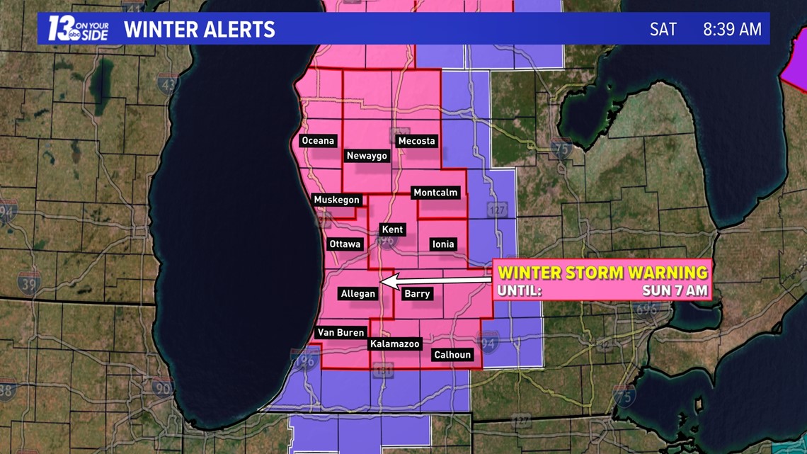
Winter Storm Warnings are in effect across West Michigan, with all counties under the alert in until 7 a.m. on Sunday. Accumulating snow is expected, along with blustery winds and frigid wind chill temperatures.
Here are the details:

WHAT
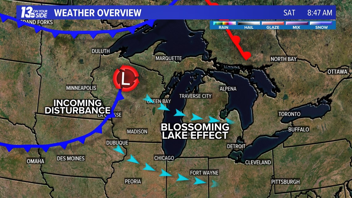
An incoming disturbance, a cold front, will allow the lake effect machine to blossom again throughout the day. Snow showers will increase in coverage throughout the morning hours, from the northwest to southeast across West Michigan, becoming widespread by afternoon. Bands of lake effect snow will take over by evening, before gradually diminishing overnight into Sunday.

These snow bands will be heavy at times, likely creating rapidly changing visibilities, even to whiteout conditions. As a result, continued travel issues will be widespread with snow-covered/icy roadways. Before the snow ends by Sunday, several more inches of snowfall are expected.
See the latest forecast hour-by-hour below:
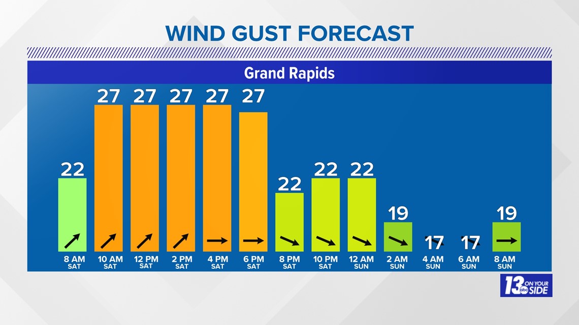
Blustery winds will become an issue, with gusts exceeding 30 MPH all of Saturday into the overnight hours. This will lead to blowing and drifting snow, causing additional travel issues, even in times when the snow is light or not falling. Winds will start out of the southwest in the morning before turning to the northwest by this evening. North/south roads will be most impacted.
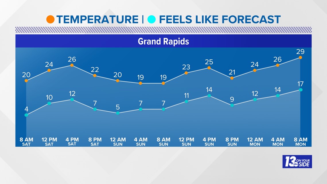
Temperatures will settle in the 20s Saturday, well below average for this time of year. This, combined, with the blustery winds, will cause wind chill values to plummet into the single digits by the end of the day.


WHERE
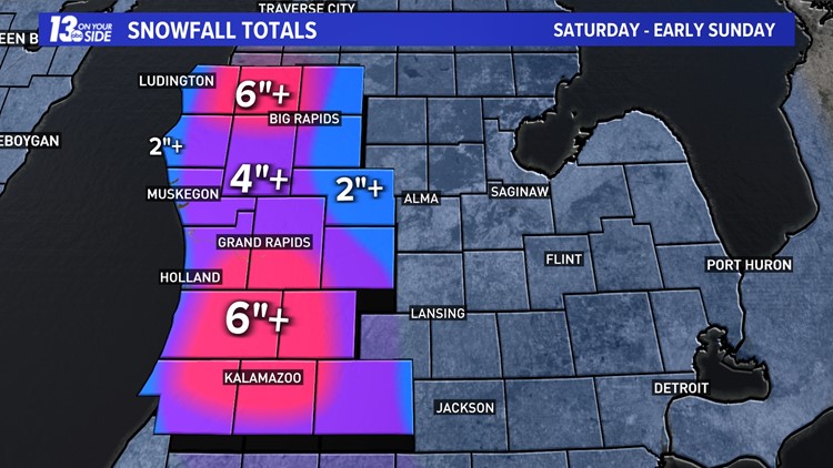
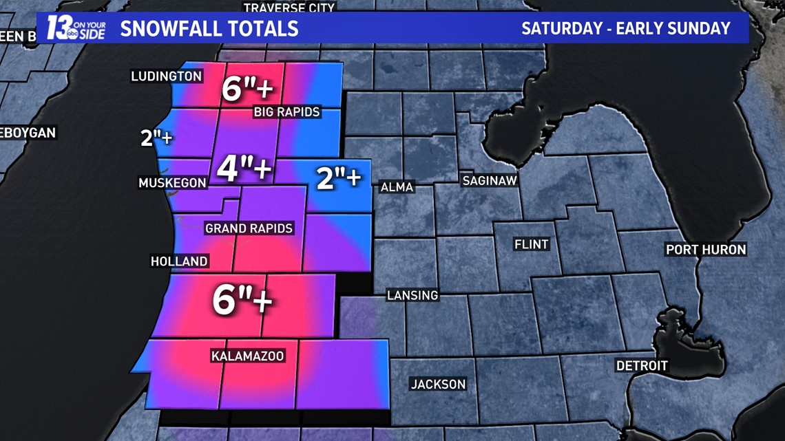
Nearly all of West Michigan will deal with another 4”+ of additional snowfall Saturday into early Sunday. The areas highlighted in pink are going to see the greatest impacts, bringing an additional 6+ inches of snowfall by the morning hours of Sunday. This includes those near US-131 from Grand Rapids to Kalamazoo, and near US-10 from Scottville to Reed City. About 6” will be the low end of the range, with the (+) sign indicating higher amounts possible.
Along our immediate lakeshore communities and eastward of M-66 (Mecosta, Stanton and Ionia Counties), snowfall amounts will be less, but still enough to cause impacts.

IMPACTS
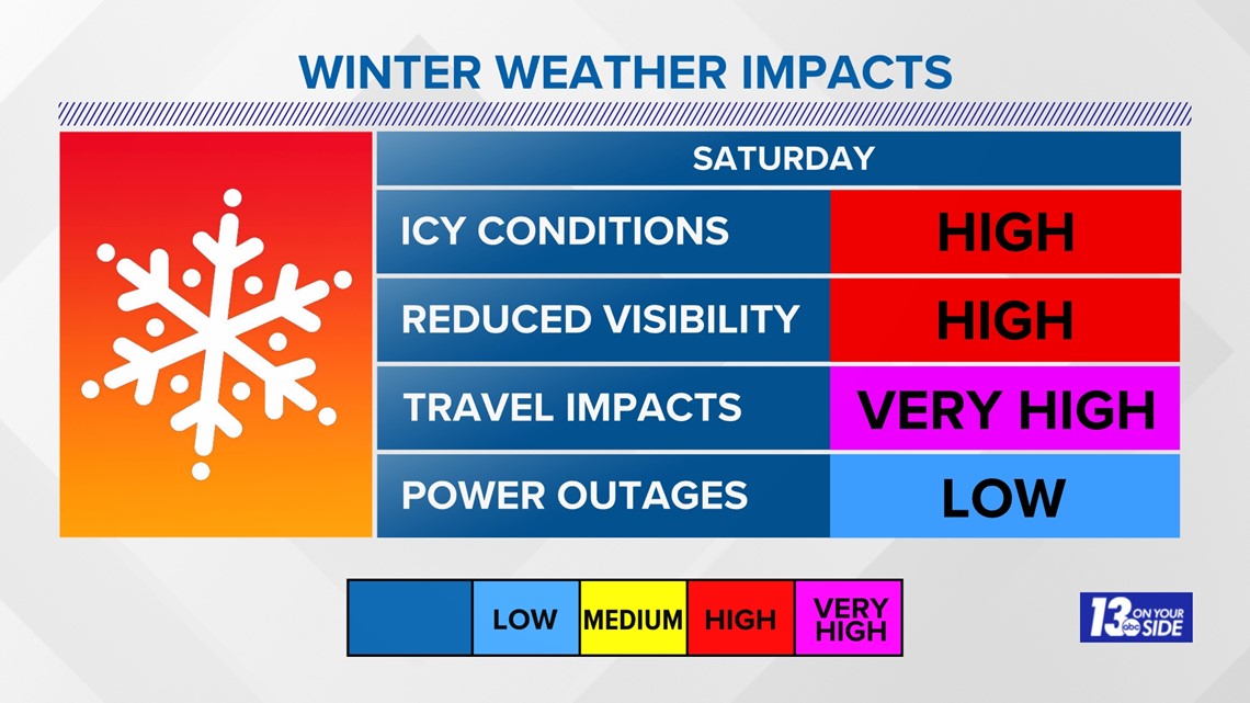
No matter your location, there will be impacts — some greater than others, and conditions will likely improve or deteriorate in quick periods of time. If driving on the roads, be sure to slow down, give yourself extra time and prepare for a lot of congestion. Also, there will be periods of whiteout conditions and icy spots.
As mentioned above, blustery winds will create drifting snow, which will exacerbate road conditions.

Improving conditions arrive on Sunday as the lake effect weather finally comes to an end, allowing West Michigan to dig out all the snow.
Make sure you stick with 13 ON YOUR SIDE for the latest snow forecasts and traffic updates through this storm. Download the 13 ON YOUR SIDE News & Weather Apps for the latest radar and traffic information as well!
►Make it easy to keep up to date with more stories like this. Download the 13 ON YOUR SIDE app now.
Have a news tip? Email news@13onyourside.com, visit our Facebook page or Twitter. Subscribe to our YouTube channel.


