GRAND RAPIDS, Mich. — Ever since the major outbreaks of arctic air in 2014, the term "polar vortex" has become inseparable from online posts in winter any time the weather takes a turn for the colder. Even though many are aware of this term, more often than not it appears to be misunderstood.
Firstly, it is important to state that the polar vortex is not new or rare and it has been impacting winter weather in the northern hemisphere long before anyone had the ability to forecast it.
So what is it and why does it matter to our conditions here in West Michigan?
Let's take a look.
What Is The Vortex?
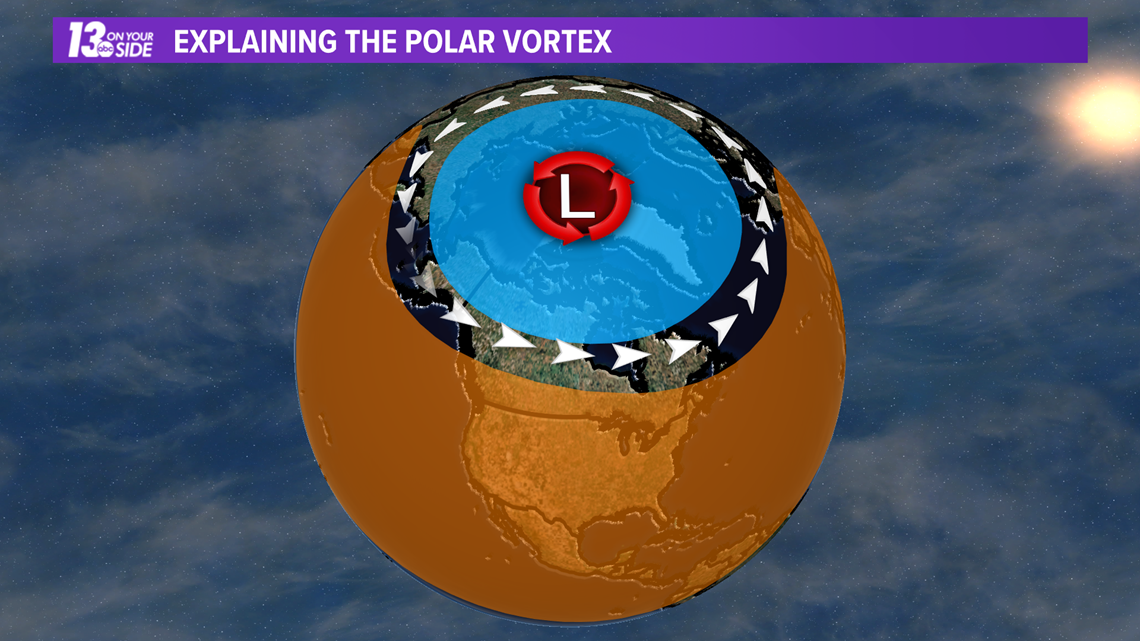
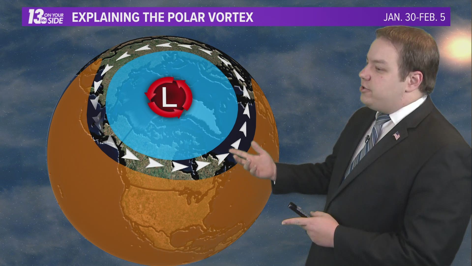
In simple terms the polar vortex is just a low pressure system located over the north pole. Air rotates counter-clockwise around this low pressure system, creating the so called vortex.
These winds form a jet stream, and when the vortex is strong and stable, this jet stream keeps the coldest air up to the north.


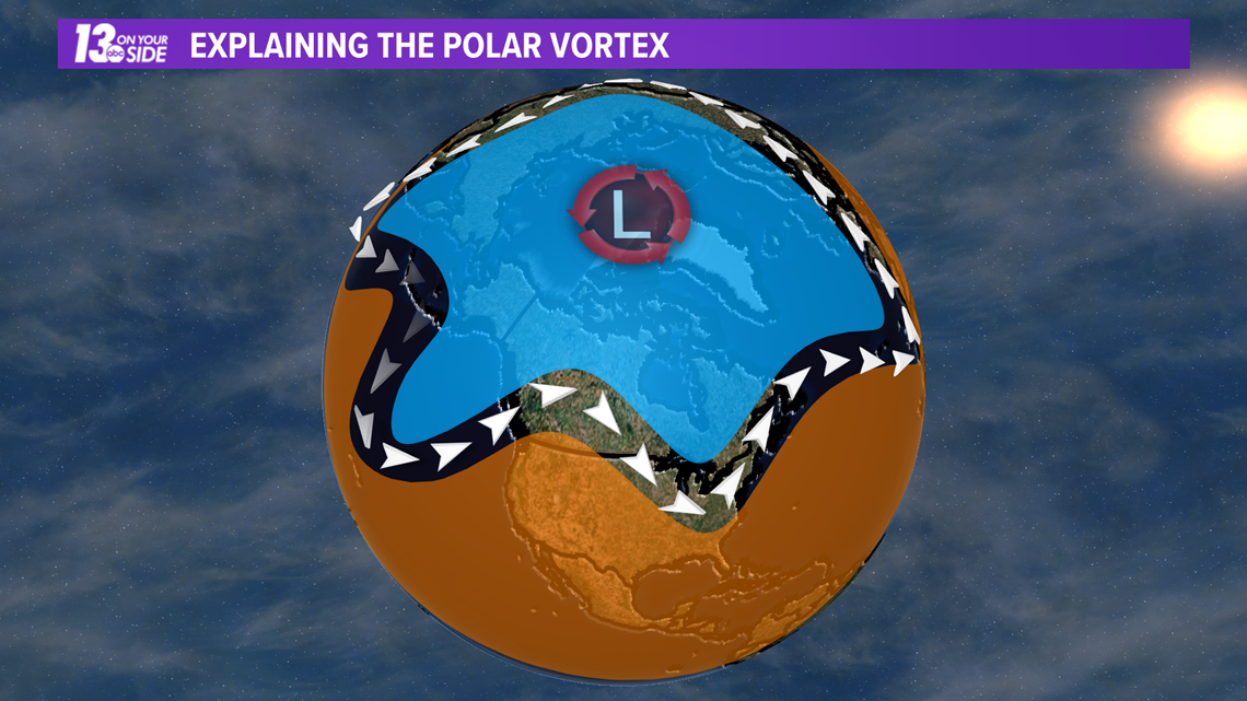
When warmer air infiltrates the north and weakens this polar vortex the jet stream starts to take on a wavy pattern and extends further to the south. While this allows some areas further north to see warmer than usual temperatures, it also allows unseasonably cold air to drop further south as well.
It is in these situations that we can see outbreaks of arctic air here in West Michigan.


What's Happening Now?
So is our current colder than average weather related to the polar vortex?
Yes, but it's not looking so bad!
The current pattern with the jet stream around the polar vortex is a wavy one, and areas of cold air are making their way further south. However, the short term forecast for West Michigan keeps us along the border of the sagging jet stream, to just a little bit on the colder side. By late next week we will drift back into the warmer side of this pattern.
This doesn't mean a blast of arctic air and a more aggressive winter couldn't be on our horizon though. With the wavy pattern in place, we will have to watch conditions in the coming weeks to see for sure if the artic air will continue to stay off to the north or drop down into our neck of the woods!
Of course 13 On Your Side will have you covered with the latest forecast if and when that happens!
-- Meteorologist Michael Behrens
Follow me on social media! Facebook Meteorologist Michael Behrens, Twitter @MikeBehrensWX, and Instagram @MikeBehrensWX.
Email me at: MBehrens@13OnYourSide.com
Have a 30-second video or still photo to share? We'd love to share it with everyone! Email your image to Weather@13OnYourSide.com or post it to our 13OnYourSide Facebook Page.
►Make it easy to keep up to date with more stories like this. Download the 13 ON YOUR SIDE app now.
Have a news tip? Email news@13onyourside.com, visit our Facebook page or Twitter. Subscribe to our YouTube channel.

