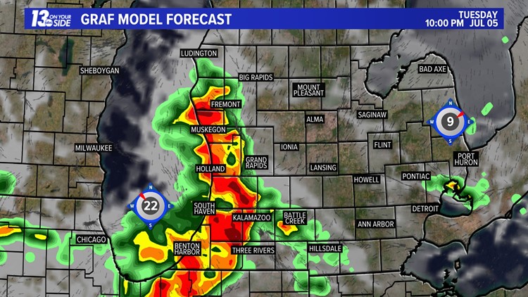
GRAND RAPIDS, Mich. — It has been a great 4th of July holiday so far in West Michigan, but before the celebrations come to an end storms are set to return to our neck of the woods!
It's not all bad news for the holiday though. In fact, most of the daytime hours will be dry on Monday as temps rise into the 90s with rising humidity as well. In fact, we should largely stay dry anytime before 6 pm Monday evening.
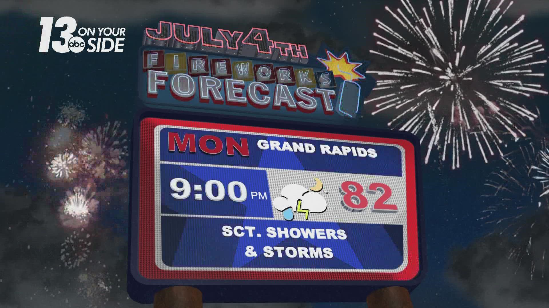
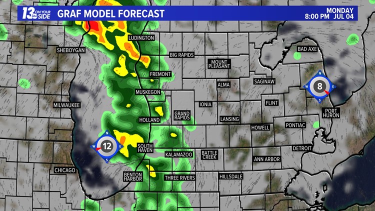
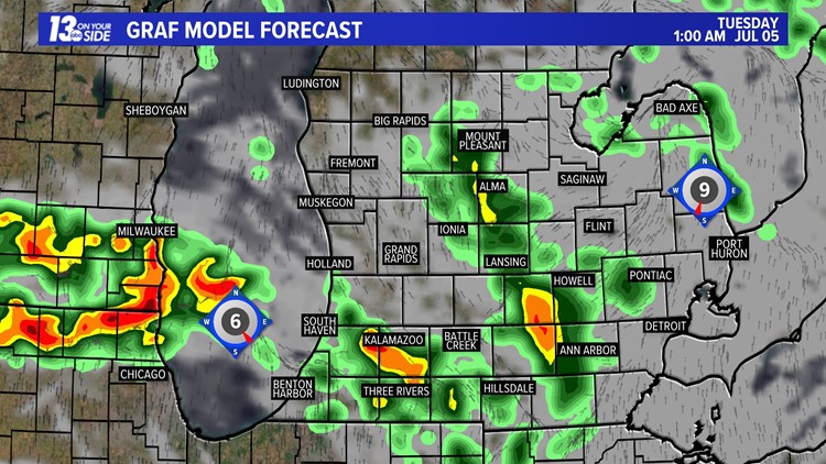
Leading up to 6 pm we will be watching storms develop to our west and start to head out over the lake. These storms will then push into West Michigan as we head into the evening hours. The possibility for damaging winds and hail exists with some these storms. An isolated tornado may also be possible.

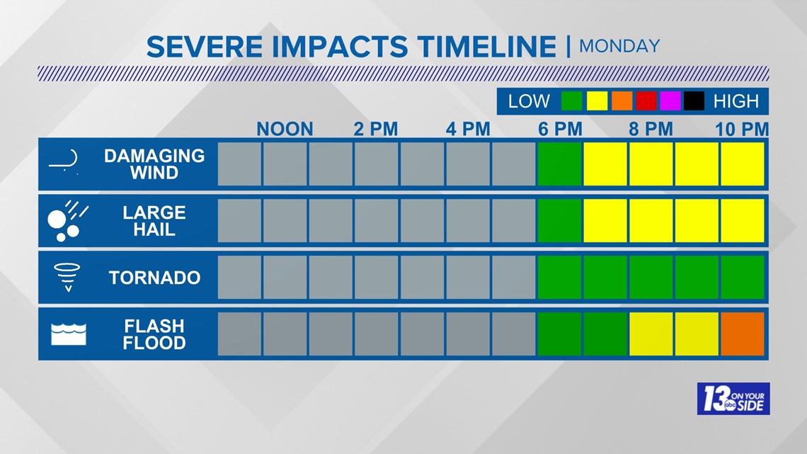
Some good news is that the overall threat for severe weather is on the smaller end. Most of West Michigan is only under a marginal, level 1 of 5, risk for severe storms on July 4th, but the lakeshore was upgraded to a level 2 of 5 risk as of Monday morning.

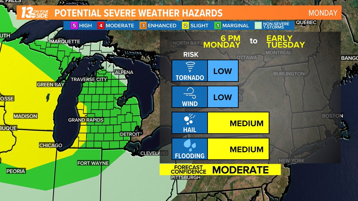
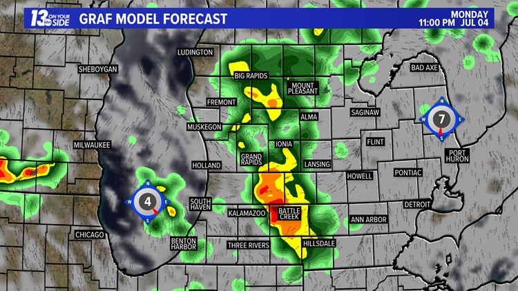
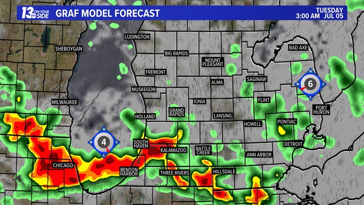
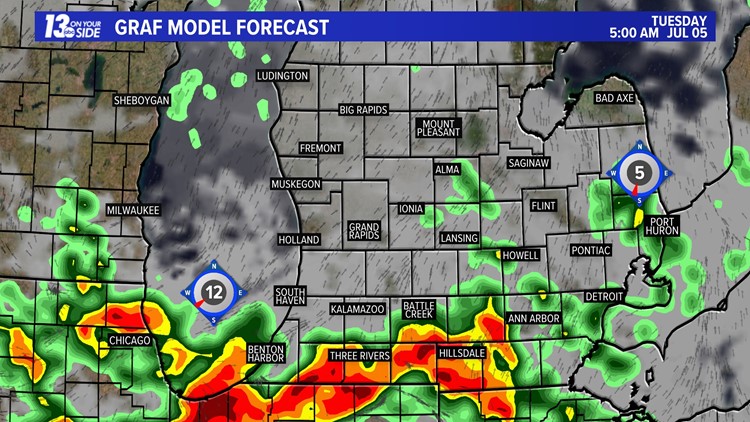
The highest severe weather risk will be for flooding rains, especially in areas south of I-96. Some areas in the I-94 corridor could pick up as high as 2 to 3 inches of rain on Monday night into early Tuesday.

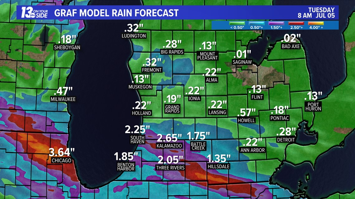
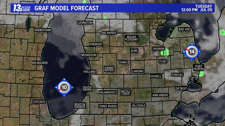
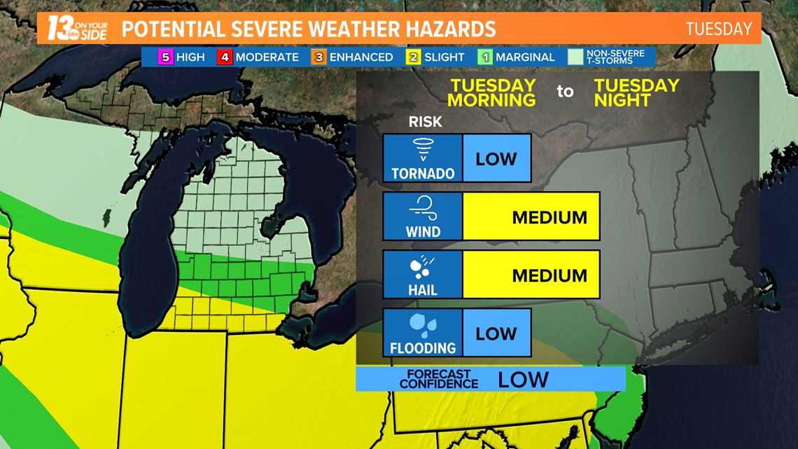
Storms will continue to exit as we head into Tuesday morning, with some additional storms possible through the day and into the evening. Some of these storms may be strong to severe as well, and an additional level 1/5 risk for severe weather will be in place on Tuesday in West Michigan, with our southern region under a level 2 of 5 risk.

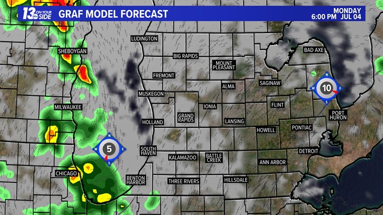
The exact placement and timing of storms can still change between now and Monday evening, but below you can see the latest hour-by-hour prediction as of Sunday night.
4th of July Storms - Hour-By-Hour.
Make sure you have 13 On Your Side's News & Weather Apps downloaded on your phones for the 4th of July with push and weather alerts turned on.
Stay weather aware with 13 On Your Side's Weather Team for the latest details as we head throughout the day!
-- Meteorologist Michael Behrens
Follow me on social media! Facebook Meteorologist Michael Behrens, Twitter @MikeBehrensWX, and Instagram @MikeBehrensWX.
Email me at: MBehrens@13OnYourSide.com
Have a 30-second video or still photo to share? We'd love to share it with everyone! Email your image to Weather@13OnYourSide.com or post it to our 13OnYourSide Facebook Page.
►Make it easy to keep up to date with more stories like this. Download the 13 ON YOUR SIDE app now.
Have a news tip? Email news@13onyourside.com, visit our Facebook page or Twitter. Subscribe to our YouTube channel.

