GRAND RAPIDS, Mich — Despite a slow beginning to the winter season, the 10-day forecast features snowfall each day, with some days expected to have more significant impacts than others. We are on round one of this work week's snowfall, with two additional rounds Wednesday night into Thursday and Friday afternoon through Saturday. It will be followed by lake effect snow into next week.
While we will have a considerable amount of snow on the ground by this time next week, it will not all come at once, giving road crews time to clean things up between events.
NEXT 24-HOURS
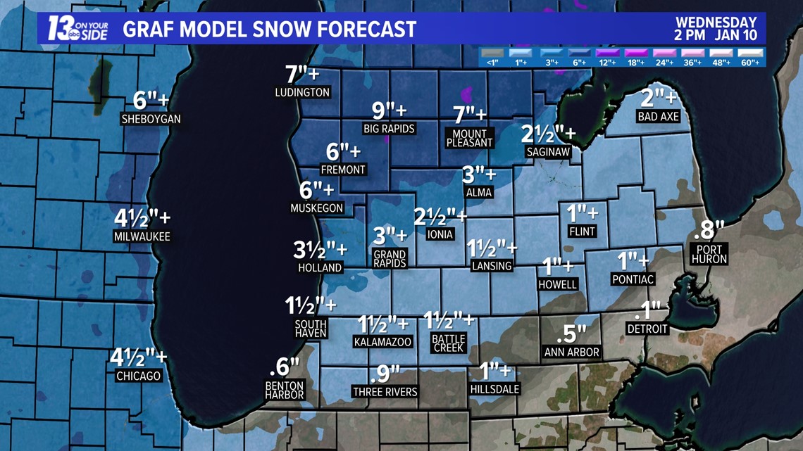
I-96 and South will switch to rainfall this afternoon and system snow will continue north of I-96 through 9 p.m. Once the system exits our region, minor lake-effect snow will wrap in later Tuesday night through Wednesday morning, bringing a few additional inches of snowfall to our lake-effect belts. Below are the snowfall totals through Wednesday afternoon.

UPCOMING SYSTEMS
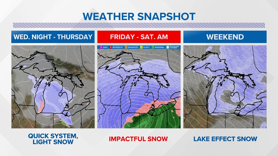
After Tuesday, here are the details for our next three waves of weather:
- Wednesday night into Thursday will have the lowest impact
- Friday night through Saturday is a noteworthy system, expected to bring the highest snowfall totals of the season to the entire region.
- The weekend will feature northwest lake-effect snow belts, but it is too soon to determine the extent of impacts from the lake-effect snow.

WEDNESDAY NIGHT - THURSDAY MORNING
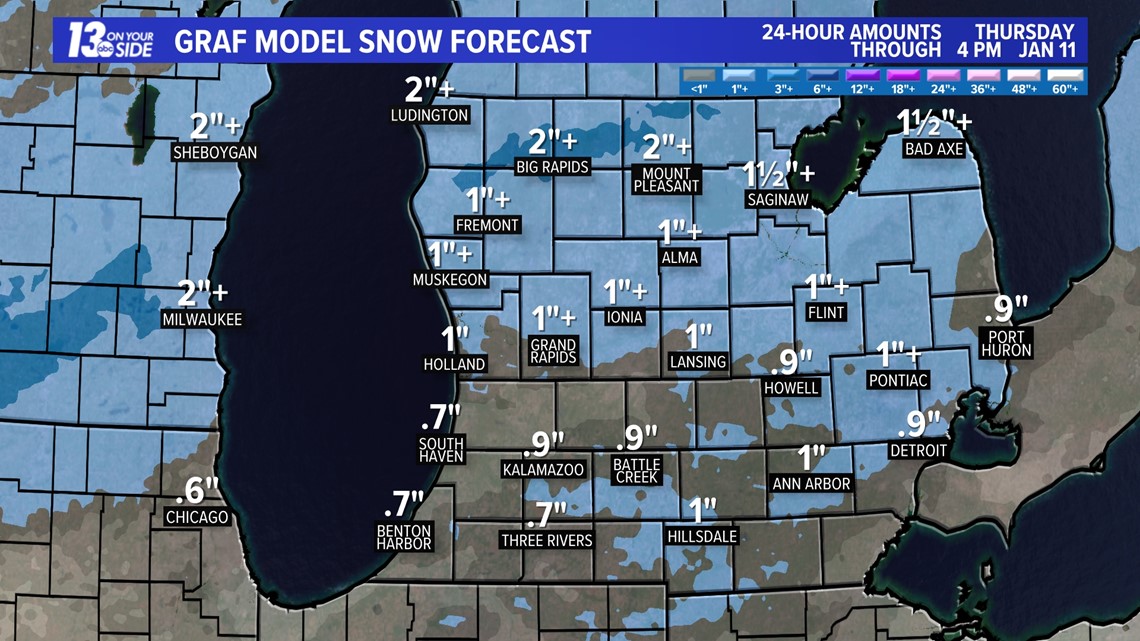
Wednesday night into Thursday morning will bring a quick system through West Michigan, with brief impacts anticipated, primarily affecting Thursday morning's commute. Below are the snowfall totals expected from this system.

FRIDAY AFTERNOON - SATURDAY AFTERNOON
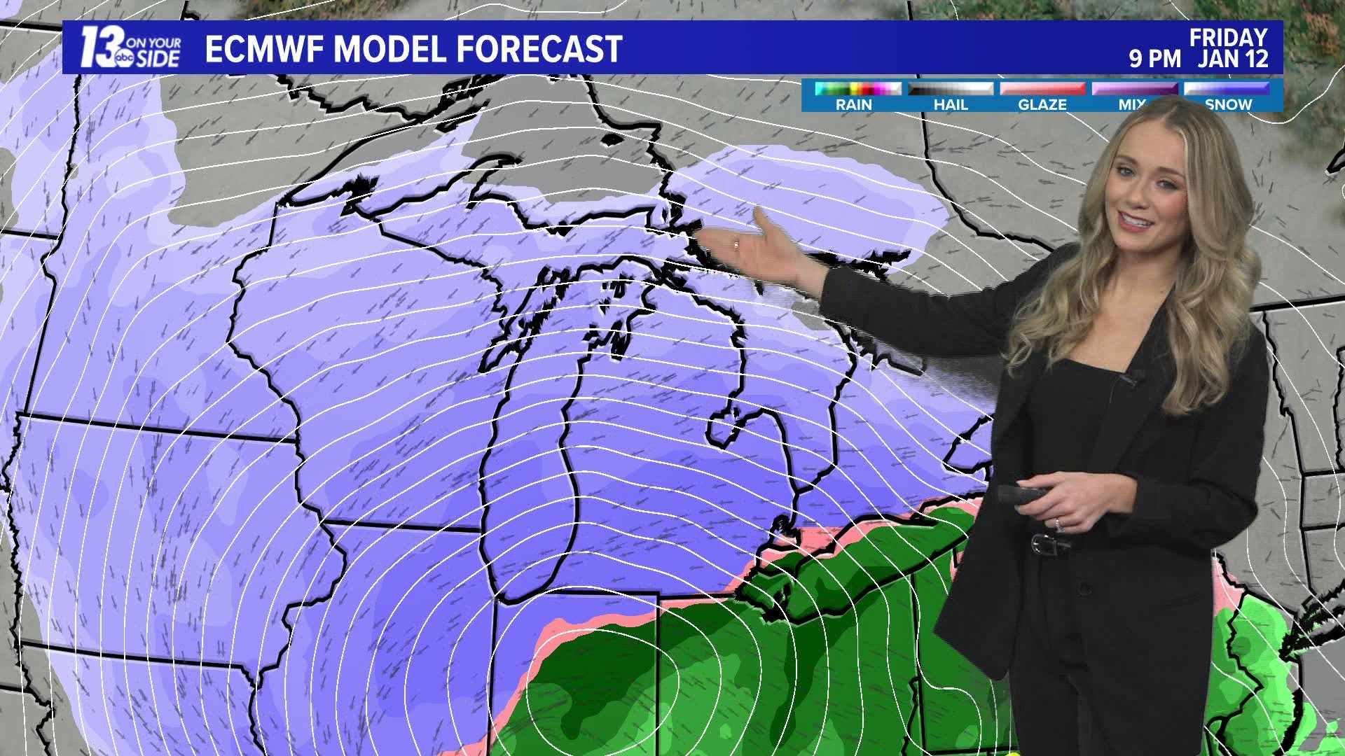
Confidence is increasing in the likelihood of a high-impact winter storm beginning Friday afternoon and extending into the early part of the weekend. This system seems to be moisture-rich, and the most significant snowfall is currently anticipated over Michigan. Strong winds are expected with this storm. While snowfall totals are not firmly established, here is a glimpse at the current snowfall projections from two models.

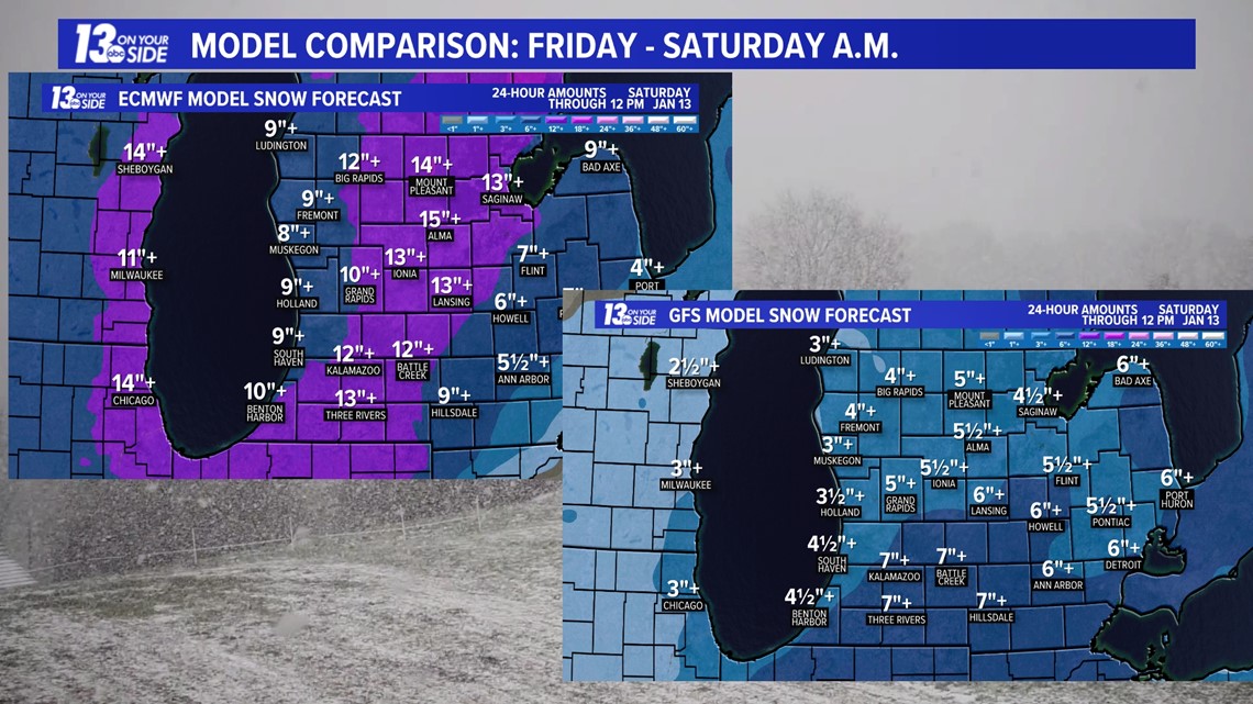
They are clearly showing some discrepancy in totals, although, impacts can be expected in both cases. The trajectory of this system still has the potential to shift, so it is advisable to keep checking for further details.
►Make it easy to keep up to date with more stories like this. Download the 13 ON YOUR SIDE app now.
Have a news tip? Email news@13onyourside.com, visit our Facebook page or Twitter. Subscribe to our YouTube channel.
Watch 13 ON YOUR SIDE for free on Roku, Amazon Fire TV Stick, Apple TV and on your phone.

