GRAND RAPIDS, Mich — Ditch the hats and gloves from last weekend and bust out the t-shirts!
It will feel more like September than early November as we approach the end of the week.
This comes as our upper-level pattern produces persistent southwesterly winds due to strong high pressure over the Mid-Atlantic states, dragging warm air into our forecast.
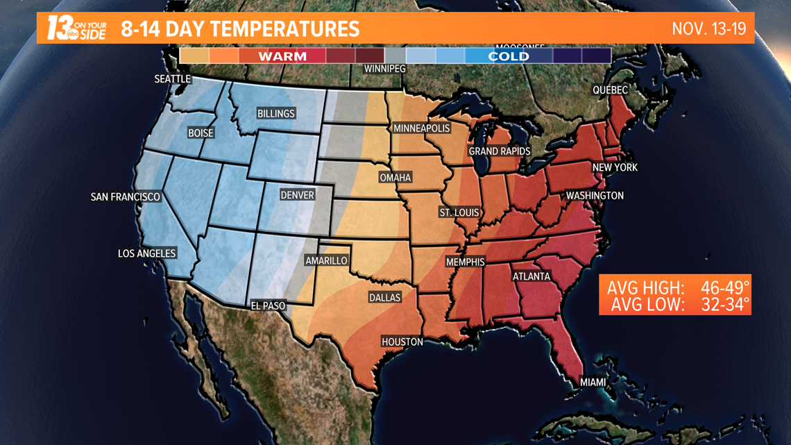
Highs this week have already climbed well above seasonal averages in the past few days. The average high this time of year is 52°.


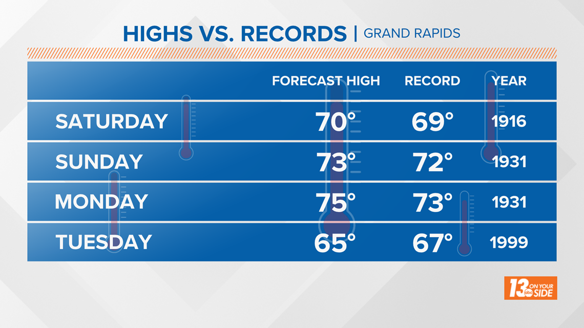
69° holds the record for November 7th from back in 1916. Our forecast high is at 70°. November 8th trends even warmer, with a forecast high of 73° and the record set at 72° in 1931. Monday is forecast at 75° with the long-standing record at 73°.
Tuesday will not be as likely of breaking a record, but temperature highs will still come close.


Not only has the warmth moved in, skies have been abundantly sunny this week! November 3 and 4 recorded 100% sunshine. The last time Grand Rapids saw back-to-back full sunshine in November was in 2015.
The latest forecast can always be found here.
RELATED VIDEO:
►Make it easy to keep up to date with more stories like this. Download the 13 ON YOUR SIDE app now.
Have a news tip? Email news@13onyourside.com, visit our Facebook page or Twitter. Subscribe to our YouTube channel.


