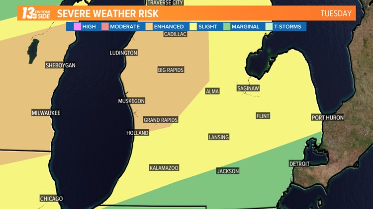
GRAND RAPIDS, Mich. -- The Storm Prediction Center has placed parts of West Michigan, including Grand Rapids and Muskegon, in the 'enhanced' risk area for severe storms starting late Tuesday.
This is the first time that has occurred in 2018. The update reflects an increasing confidence in West Michigan's chances for large hail and damaging wind gusts.
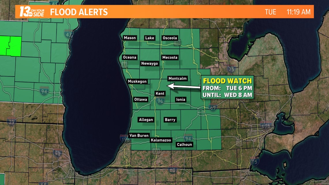
The main threats will be from heavy rain and frequent lightning. Parts of Muskegon County received more than 8 inches of rain since Sunday night. This next round will heighten the flooding concerns around West Michigan so the National Weather Service issued a flood watch starting late Tuesday.


The storms will begin to arrive after 6 PM Tuesday. There is the potential for multiple rounds of thunderstorms to impact the area into the early morning hours on Wednesday. The strongest storms have the potential to produce large hail and damaging wind gusts over 60 MPH.
Cooler and less humid weather will return behind the system late Wednesday. By Thursday, it will be noticeably cooler and less muggy.
Have a photo to share? We’d love to share it with everyone! Email your image to weather@wzzm13.com or post it to our Facebook page.


