GRAND RAPIDS, Mich. — Editor's Note: The risk for severe weather has ended in West Michigan and there is no longer a threat to the region.
Original Story:
We are tracking potential strong to severe storms from now lasting until after midnight Monday.
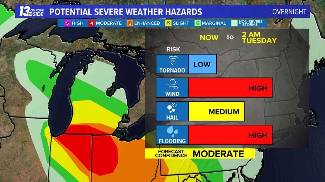
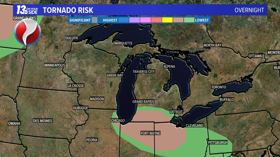
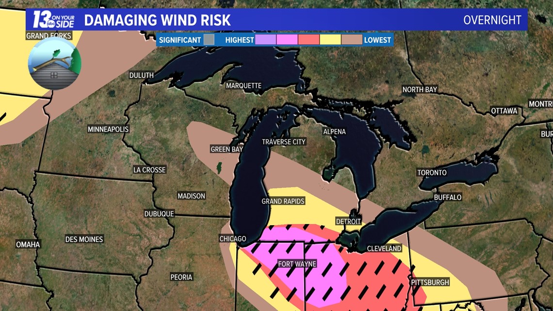
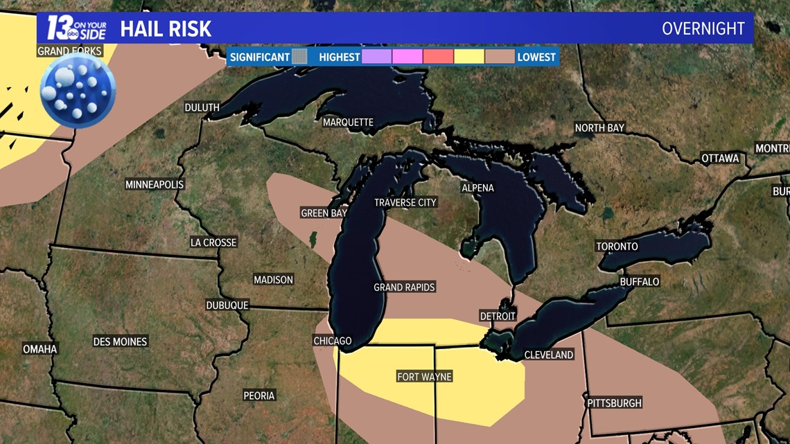
The main impact of these storms will be damaging winds, potentially at 70+ mph, large hail, and the potential for heavy flooding rains overnight. An isolated tornado or two will also be possible.
Areas along and south of I-96 are under a level two out of five threat for severe weather, with areas along and south of I-94 under a level four out of five risk. The risk decreases as you travel further to the north.

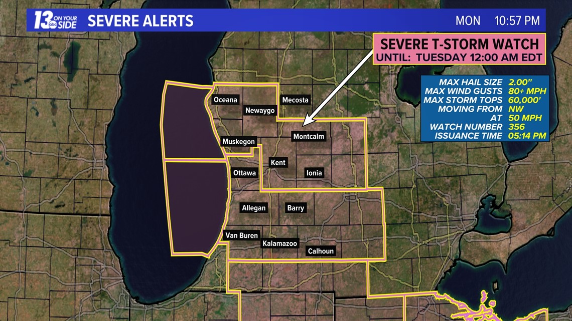
As of 11 pm almost all of the 13 On Your Side viewing area remained under a severe thunderstorm watch, which is set to expire at midnight.

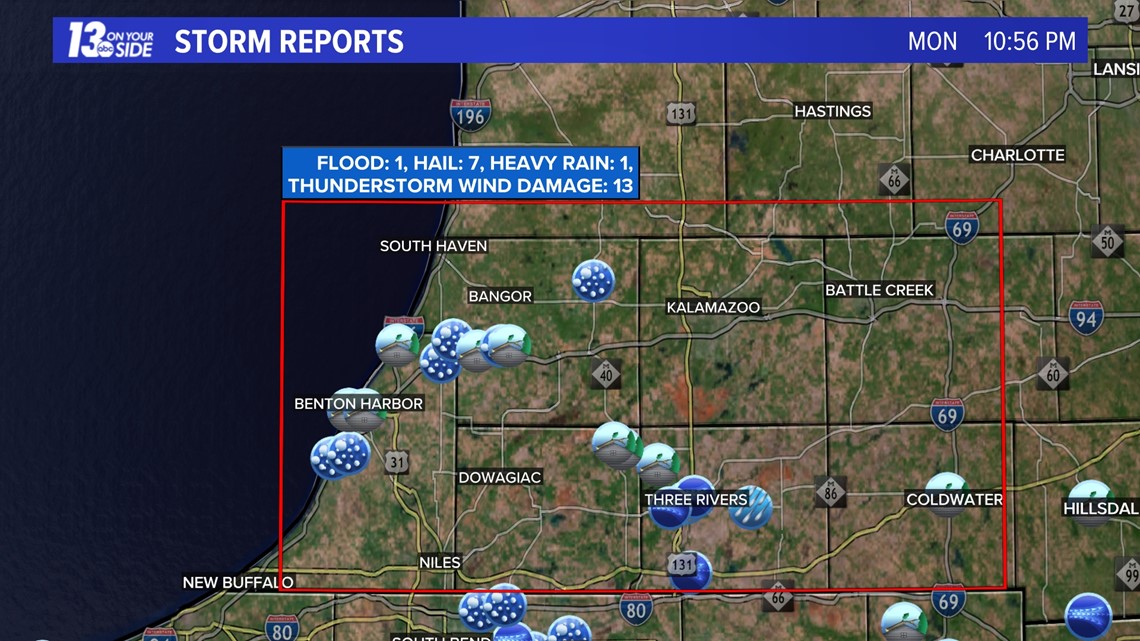
Our southern counties in the level 4/5 risk have a higher chance for damaging winds, large hail, and a tornado or two. That is where we have seen almost all of our storm reports this evening as well.

The threat for severe weather remains in place, but is lower than earlier today. The individual threat outlooks are listed below.


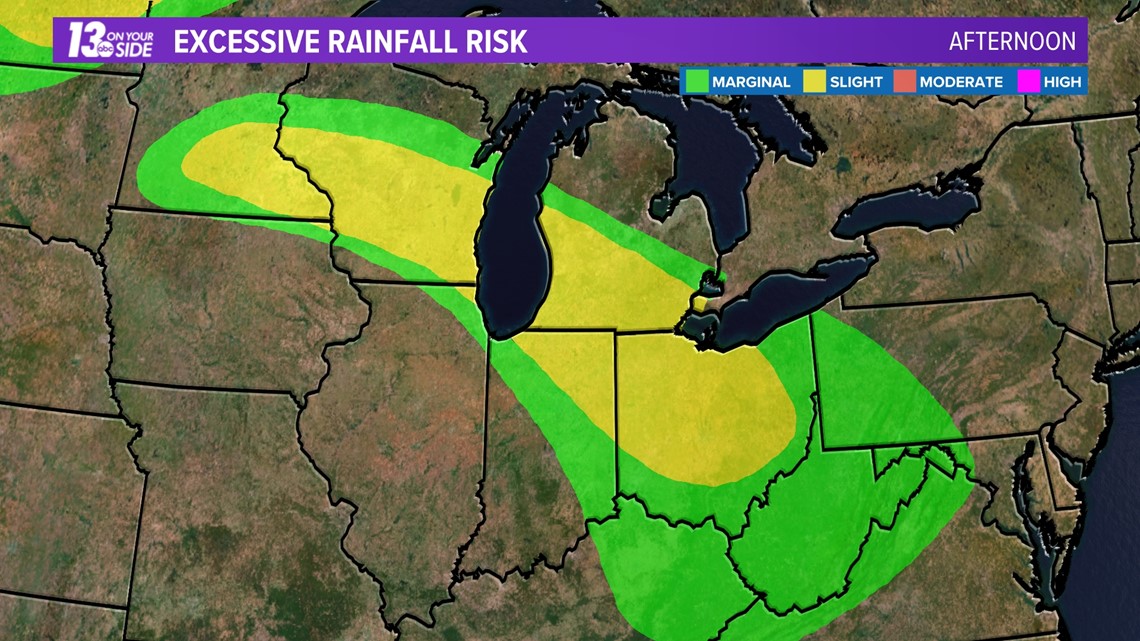
The other threat we are following more broadly across West Michigan is heavy flooding rainfall. We can expect to see upwards of 2 inches in some spots in the next few hours, so if you live near a low lying that usually collects water or floods be prepared for this possibility.
There is a slight risk for excessive rainfall and flooding across West Michigan on Monday night.

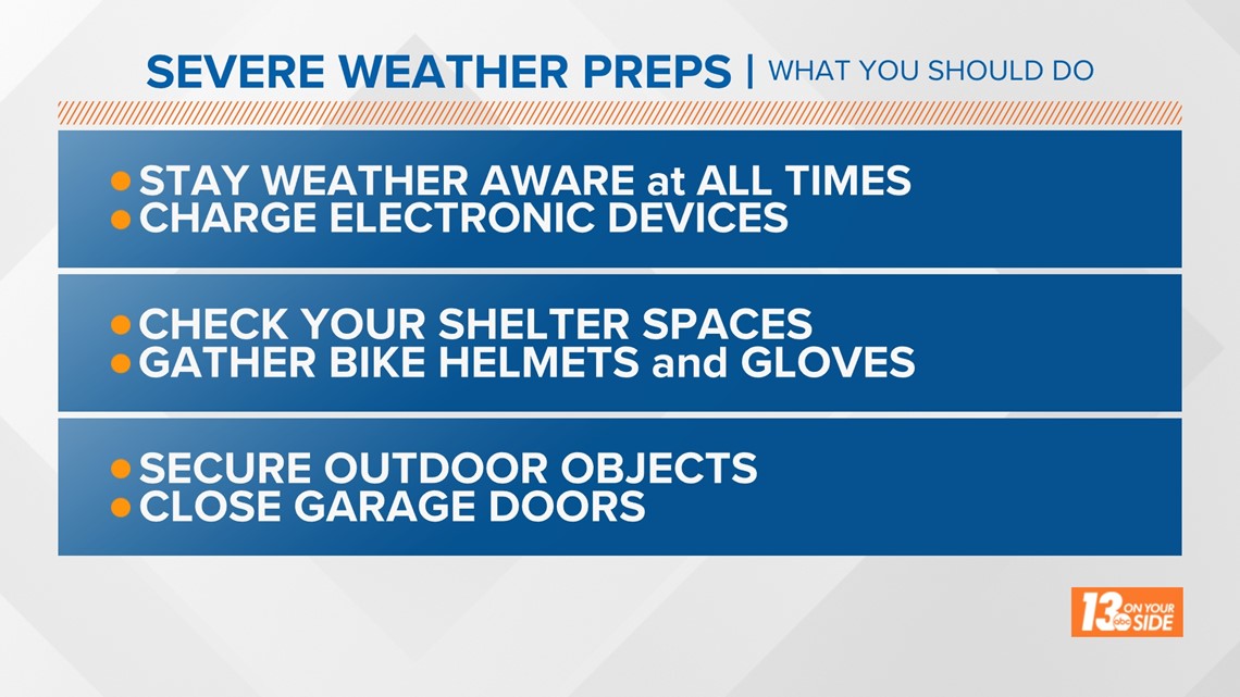
The time is now to prepare for these storms. Here are ways in which you can:

You should have a way to receive weather alerts that will wake you up if necessary, such as an NOAA weather radio.
If you have an iPhone, go to:
- Settings
- Notifications
- Scroll to the bottom to Government Alerts
- Turn on Emergency Alerts and Public Safety Alerts
Storms will move out of West Michigan as we head into the early morning hours Tuesday, and the weather for the rest of the day is expected to be dry. That doesn't mean the weather will be pleasant though, as that is when high levels of heat and humidity move in.
On Tuesday and Wednesday, we should expect to see temperatures in the 90s with dew points in the 70s. These conditions will push "feels like" temperatures up into the upper 90s and low 100s. It will be important to take breaks, stay cool and drink plenty of water if working outside or in areas without air-conditioning.
-- The 13 On Your Side Weather Team
Have a 30-second video or still photo to share? We'd love to share it with everyone! Email your image to Weather@13OnYourSide.com or post it to our 13OnYourSide Facebook Page.
►Make it easy to keep up to date with more stories like this. Download the 13 ON YOUR SIDE app now.
Have a news tip? Email news@13onyourside.com, visit our Facebook page or Twitter. Subscribe to our YouTube channel.