
MISSISSIPPI, USA — May 20th, 2019. This was the last time the Storm Prediction Center (SPC) had issued a high risk for severe weather. That was until today.
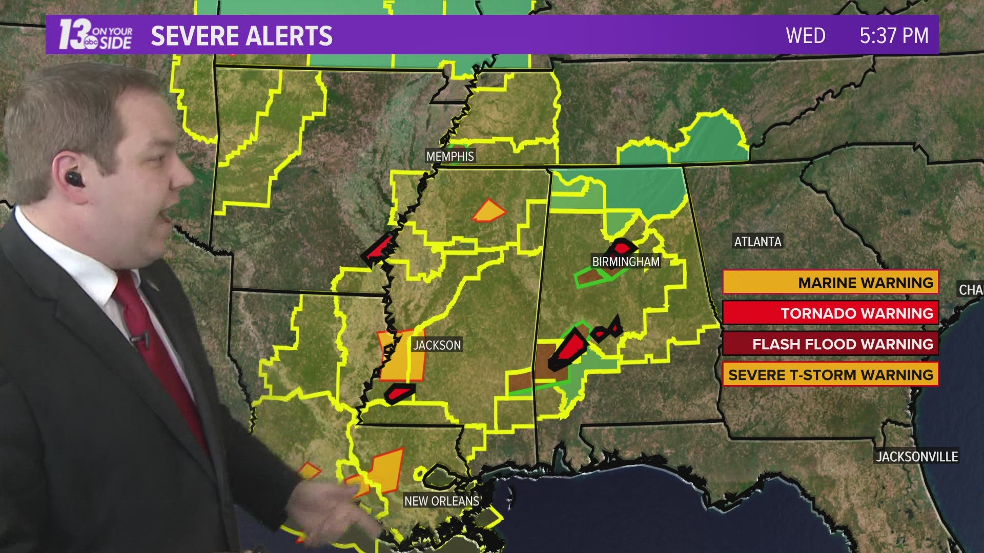
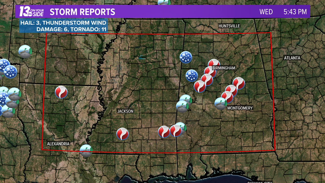
On that day 39 tornadoes were reported around the southern Great Plains, and as of 5:43 pm EDT, 11 tornadoes were reported across parts of the Deep South Wednesday. Sadly, this is an outbreak that is only just beginning.
The high risk for severe weather, a level 5/5, covers portions of Louisiana, Mississippi, and Alabama, while a moderate risk, level 4/5, covers more of Louisiana, Mississippi, Alabama, Tennessee, and Arkansas.
The outlook can be seen below.

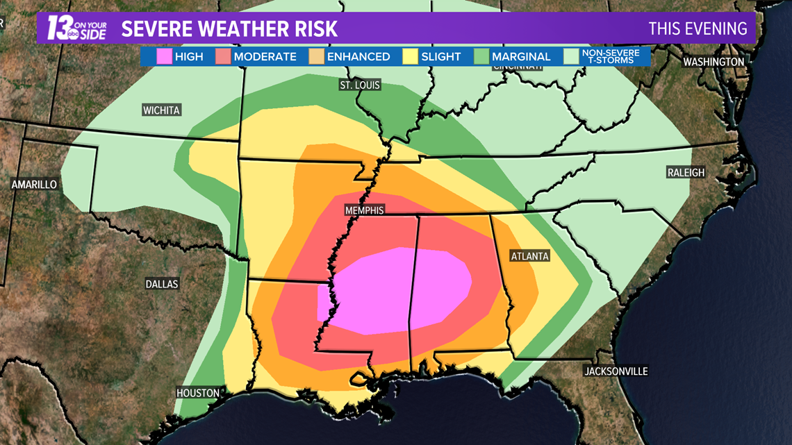
What makes this outlook particularly concerning, as with almost all high risk outlooks, is the enhanced risk for tornadic development.
Forecasters for the SPC only issue these outlooks when they are rather confident in the potential for severe weather. That certainly describes the outlook issued for today.
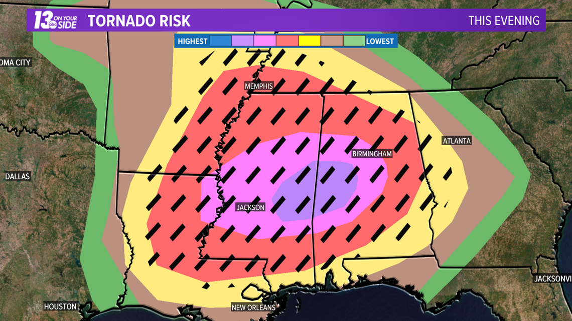
In the map below, the hatched area represents a zone where EF-2 to EF-5 tornadoes are more likely, greater than 10% risk. The purple area from just east of Jackson, MS to southwest of Birmingham, AL represents a 45% probability for a tornado within 25 miles of a given point.

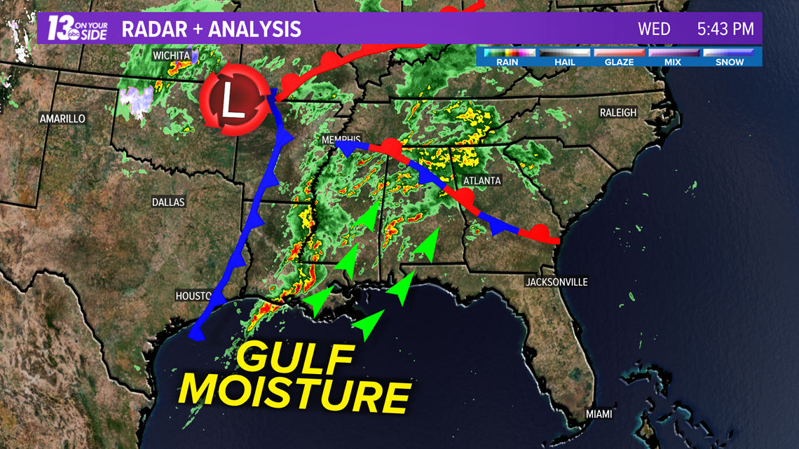
As of 5:43 pm EDT 11 tornadoes had already been reported across Louisiana, Mississippi, and Alabama. That number will likely rise in the coming hours.

This outbreak is being fueled by a low pressure system back toward Arkansas, and strong gulf moisture and a strong low level jet flowing into the Deep South. This setup is pulling in ample moisture and creating strong shear and upper level support for rotating thunderstorms.

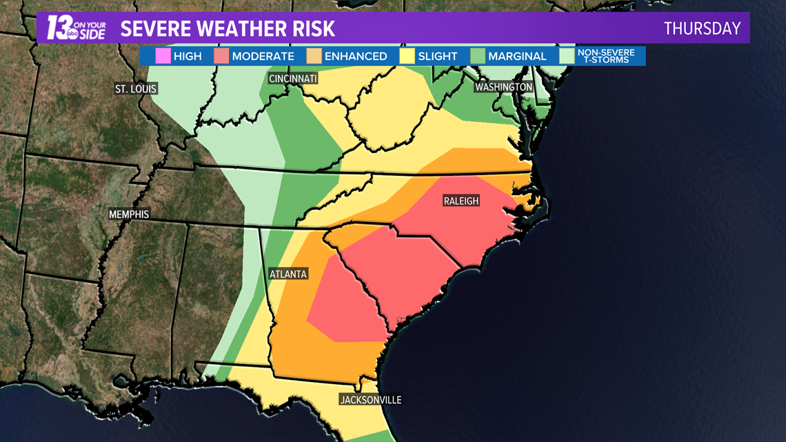
This system will continue to progress eastward heading into Thursday, and will prompt another round of severe weather for much of the central and southern east coast. A moderate, level 4 of 5, risk for severe weather has already been issued for Thursday.

If you have friends or family in either the region under the gun tonight or Thursday, make sure they are staying weather aware and have their severe weather plans in place. If you are traveling through this region please take precautions and have a way to get targeted weather alerts.
The 13 On Your Side Weather App can be configured to give you alerts for your location. Just set your location to "follow me" and make sure you click the settings next to this location and enable notifications. From there configure your weather notification types as normal in the main settings menu.
-- Meteorologist Michael Behrens
Follow me on social media! Facebook Meteorologist Michael Behrens, Twitter @MikeBehrensWX, and Instagram @MikeBehrensWX.
Email me at: MBehrens@13OnYourSide.com
Have a 30-second video or still photo to share? We'd love to share it with everyone! Email your image to Weather@13OnYourSide.com or post it to our 13OnYourSide Facebook Page.
►Make it easy to keep up to date with more stories like this. Download the 13 ON YOUR SIDE app now.
Have a news tip? Email news@13onyourside.com, visit our Facebook page or Twitter. Subscribe to our YouTube channel.