GRAND RAPIDS, Mich. — Our spring-like forecast continues this week with new chances for strong to severe storms Tuesday night through late Wednesday morning.
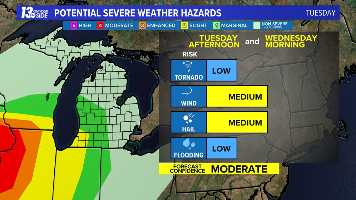
This all comes as a low-pressure system moves into our area during the overnight hours Tuesday into Wednesday, first bringing a strong warm front overnight followed by a cold front late Wednesday morning. This will bring two solid chances for strong to even severe storms.
The first timeframe is 8 p.m. to 6 a.m. Tuesday night into Wednesday, as the warm front builds through. This will take our temperatures overnight into the 60s and cause enough instability for storms to fire up. During this timeframe, we are under a level 1 out of 5 threat for strong to severe storms. That is the lowest level threat issued by the Storm Prediction Center. The main concerns are damaging winds, large hail and localized flooding.


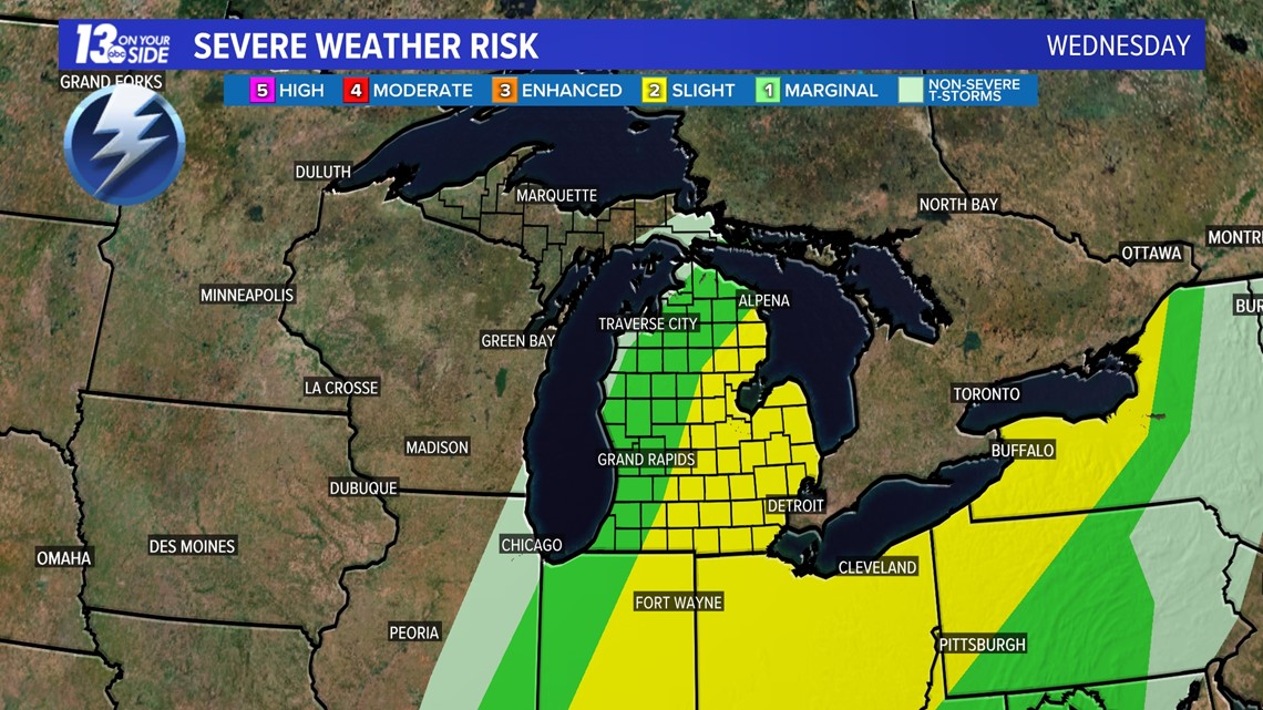
The second round of storms comes ahead of the cold front from 9 a.m. to noon. This batch of storms will likely be strongest east of US-131. As of now, winds and hail still look to be the predominant threat with a spin-up weak tornado possible.


Be sure to stay weather aware and tune in for more details as we head into this active pattern.
Check back for the latest in the coming days!
Have a 30-second video or photo to share? We'd love to share it with everyone! Share your images by texting your name and location to 616.559.1310 or email to Weather@13OnYourSide.com or post it to our 13OnYourSide Facebook Page
►Make it easy to keep up to date with more stories like this. Download the 13 ON YOUR SIDE app now.
Have a news tip? Email news@13onyourside.com, visit our Facebook page or Twitter. Subscribe to our YouTube channel.


