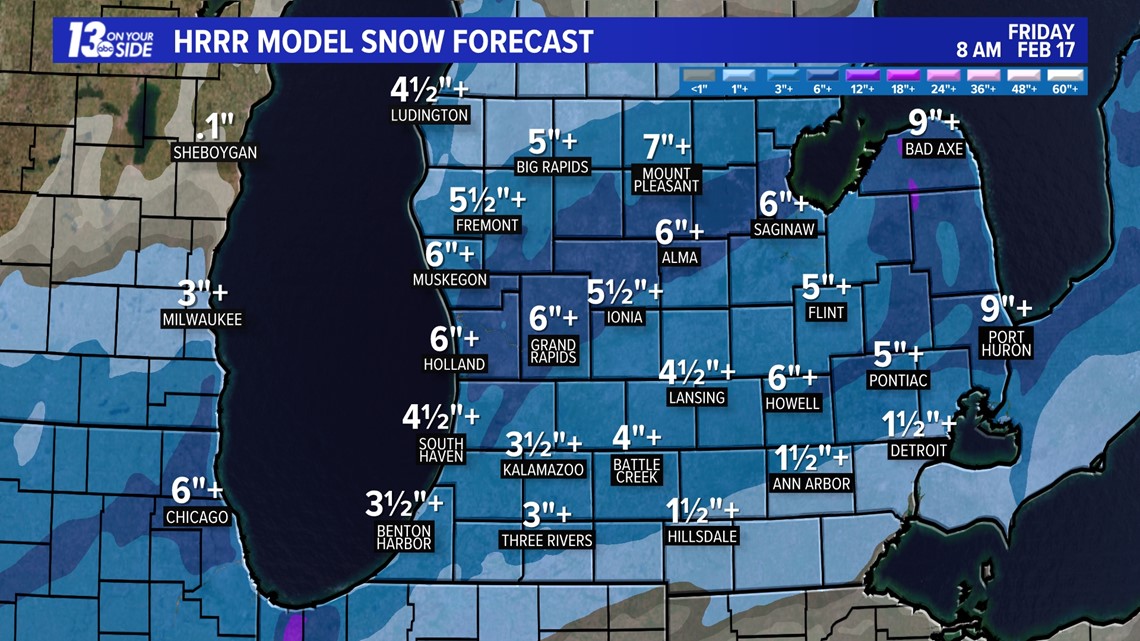
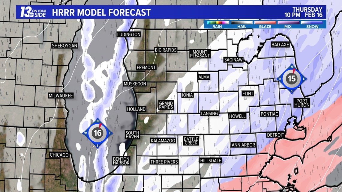
GRAND RAPIDS, Mich. — Confidence is increasing surrounding tomorrow's afternoon system. The latest guidance suggests that the track of the low is shifting south, leaving a majority of West Michigan on the cold edge of this system, resulting in snowfall as the main precipitation type. There will be periods of sleet and freezing rain mixing in south of I-96.
Most areas north of I-94 through US-10 will near 6+ inches of snowfall, but if we see extended periods of mixing, totals could be closer to 4+ inches along and south of I-96. The uncertainty of the forecast still remains in how long any mixing will be sustained. Models are in close agreement on snowfall totals overall, with a glaze of ice south of I-96.


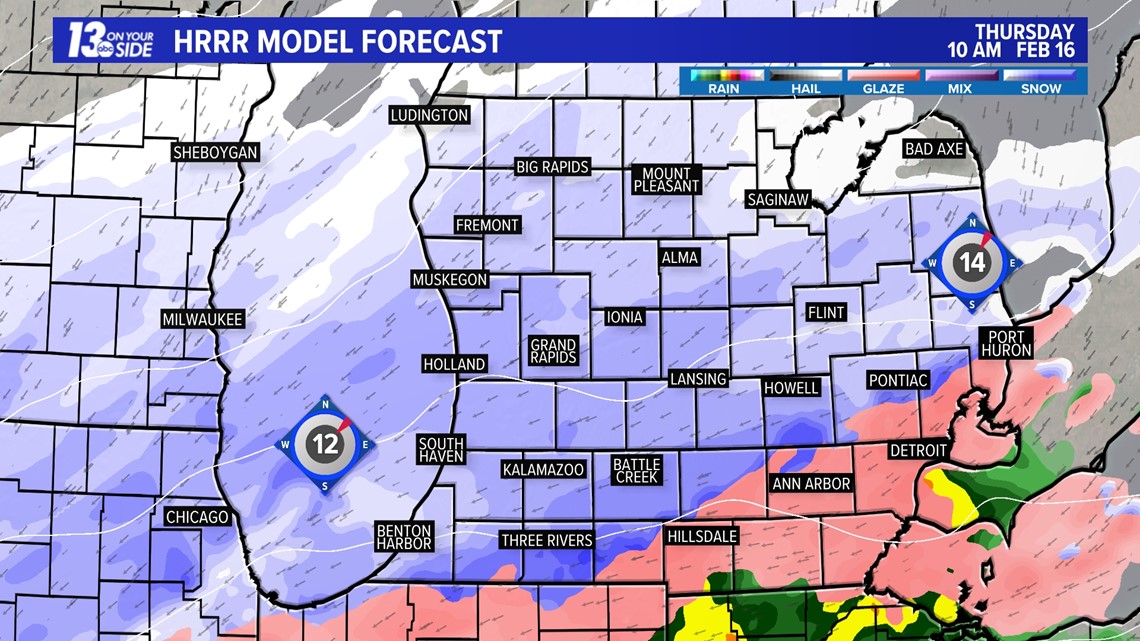
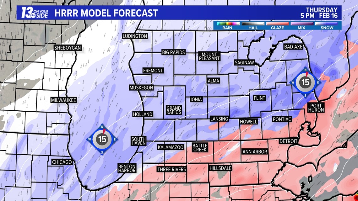
The system looks to arrive in the area during the late morning to early afternoon hours, becoming widespread throughout the evening commute, and exiting the region by 10 pm. Impacts will likely be greatest during the evening commute timeframe.
Here is a look at the modeled forecast for 10 am tomorrow morning.

Here is a look at the modeled forecast for 5 pm tomorrow afternoon.

Here is a look at the modeled forecast for 10 pm tomorrow night.

In terms of impacts, they will be slightly limited by how warm our atmosphere has been over the last several days. Because our ground has warmed up, some of the snow might melt upon contact with the surface for the first couple of hours. This will help with travel concerns, but snowfall rates will still be intense and will reduce visibility.

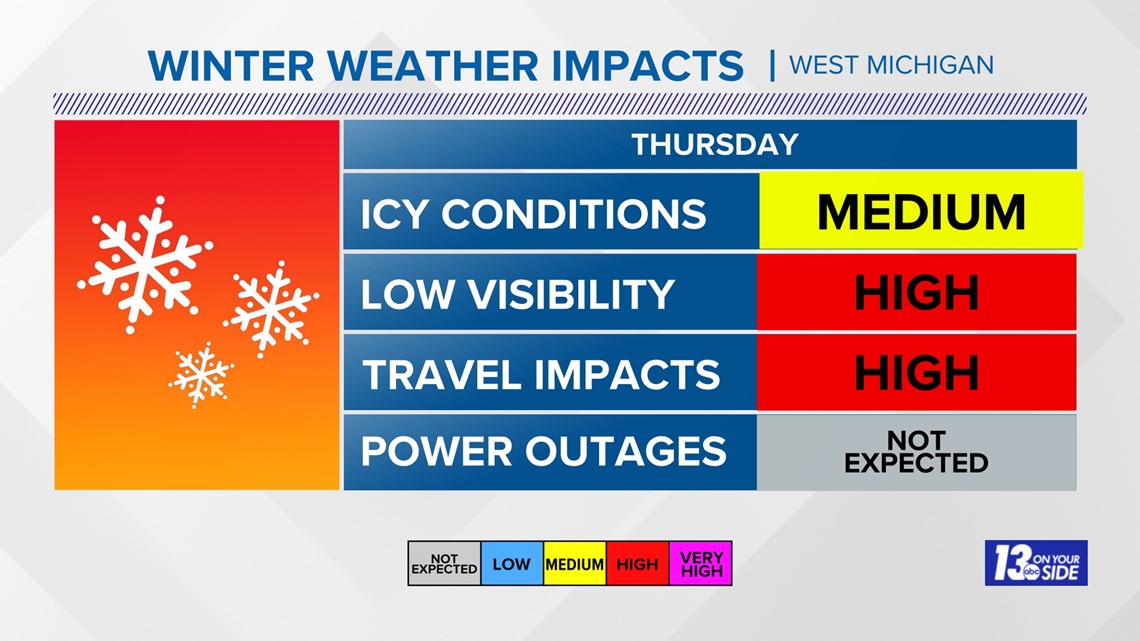
The National Weather Service will likely issue alerts of some nature in the coming hours regarding this system, so continue to check in for updates.
Have a 30-second video or photo to share? We'd love to share it with everyone! Share your images by texting your name and location to 616.559.1310 or email to Weather@13OnYourSide.com or post it to our 13OnYourSide Facebook Page