GRAND RAPIDS, Mich. — Snow remains in the forecast! Confidence is increasing that much of West Michigan will see the snow fly Wednesday night into Thursday, with the potential of accumulation.
A major/high-impact storm is NOT expected, but it’s that time for all of us to get back into the winter mindset as inconvenient weather remains possible.
TIMELINE: WEDNESDAY – THURSDAY
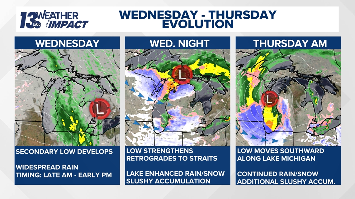
A low-pressure system will develop in the lower Great Lakes region (somewhere in the vicinity between Lake Erie and Lake Huron) Wednesday, intensifying rapidly throughout the day.
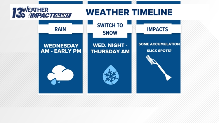
On Wednesday, rain will develop, primarily in the morning to early afternoon hours. Temperatures will be in the 40s, meaning precipitation will remain all rain.


Low pressure will then retrograde (move east to west) overnight Wednesday into Thursday morning, meandering from Lake Huron to the Straits of Mackinac. It’s an unusual setup, allowing warmer air to be on the northern side of the low and colder air pushing in on the southern side. The placement of low pressure has been the greatest forecast challenge of this event, which has caused a wide variety of snowfall outcomes.
In West Michigan, lake-enhanced rain and snow will develop Wednesday night (off a westerly wind), likely switching over to all snow by daybreak Thursday as colder air continues to funnel into the region.
The low-pressure system will shift southward across Lake Michigan throughout Thursday, keeping rain and snow showers around before tapering off late in the day.
IMPACTS/ACCUMULATION
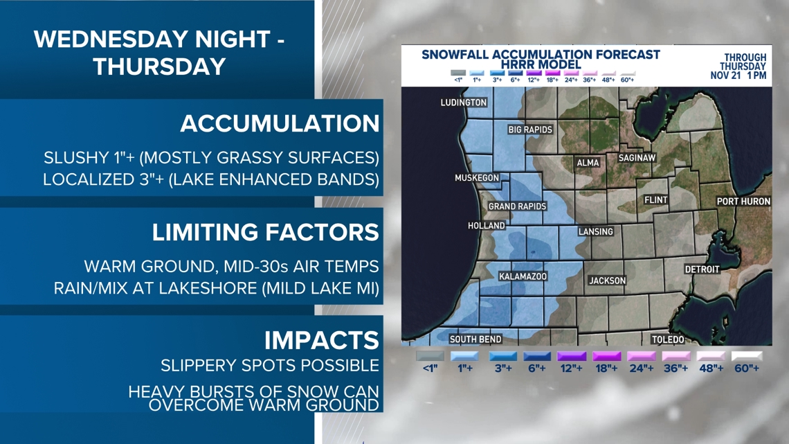
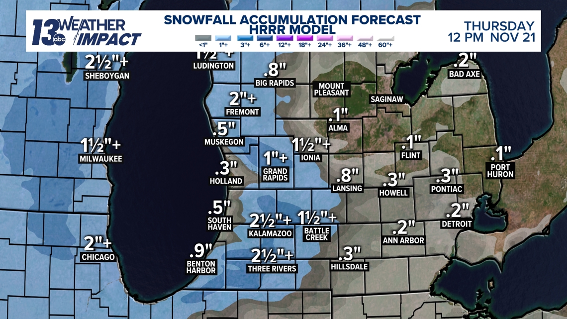
The potential exists for 1”+ of accumulation across West Michigan, primarily accumulating on grassy and colder surfaces. Depending on how lake enhancement sets up overnight Wednesday into early Thursday, there is the potential of localized 3”+ in the heaviest snow bands.


The immediate lakeshore is unlikely to contend with accumulating snow as the influence of the relatively warmer waters of Lake Michigan will modify temperatures. This'll cause much of the precipitation to be rain, or a brief rain/snow mix.
Limiting the amount of accumulation is the fact that ground temperatures are very warm in the upper 40s, which will allow melting to continuously occur. Air temperatures will remain slightly above freezing throughout the entirety of this event, adding to the melting.
However, if the snow falls heavily and quickly in a short burst, it could overcome the warm ground and accumulate on pavement, leading to some slippery spots during the Thursday morning commute.


One impact that is appearing less likely is the opportunity of strong winds Wednesday into Thursday. While remaining breezy, strong gusts are not favored due to the placement of low pressure.


