GRAND RAPIDS, Mich. — While meteorological spring arrived last week, winter weather is still a player in the forecast with yet another snow storm bearing down on West Michigan Thursday evening through Friday afternoon.
Track and Timing
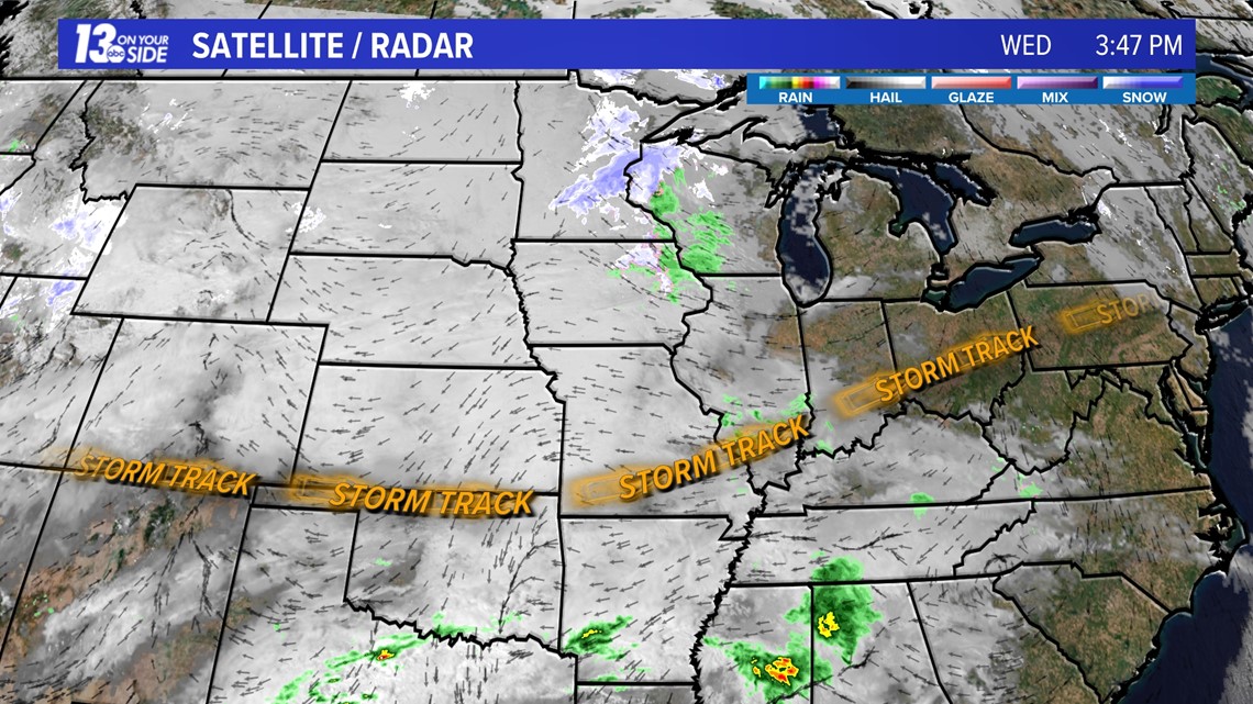
The forecast storm track remains virtually unchanged with a low pressure system moving from the Oklahoma Panhandle to western Pennsylvania between Wednesday evening and Friday evening. This places West Michigan solidly in the cold air and accumulating snow.

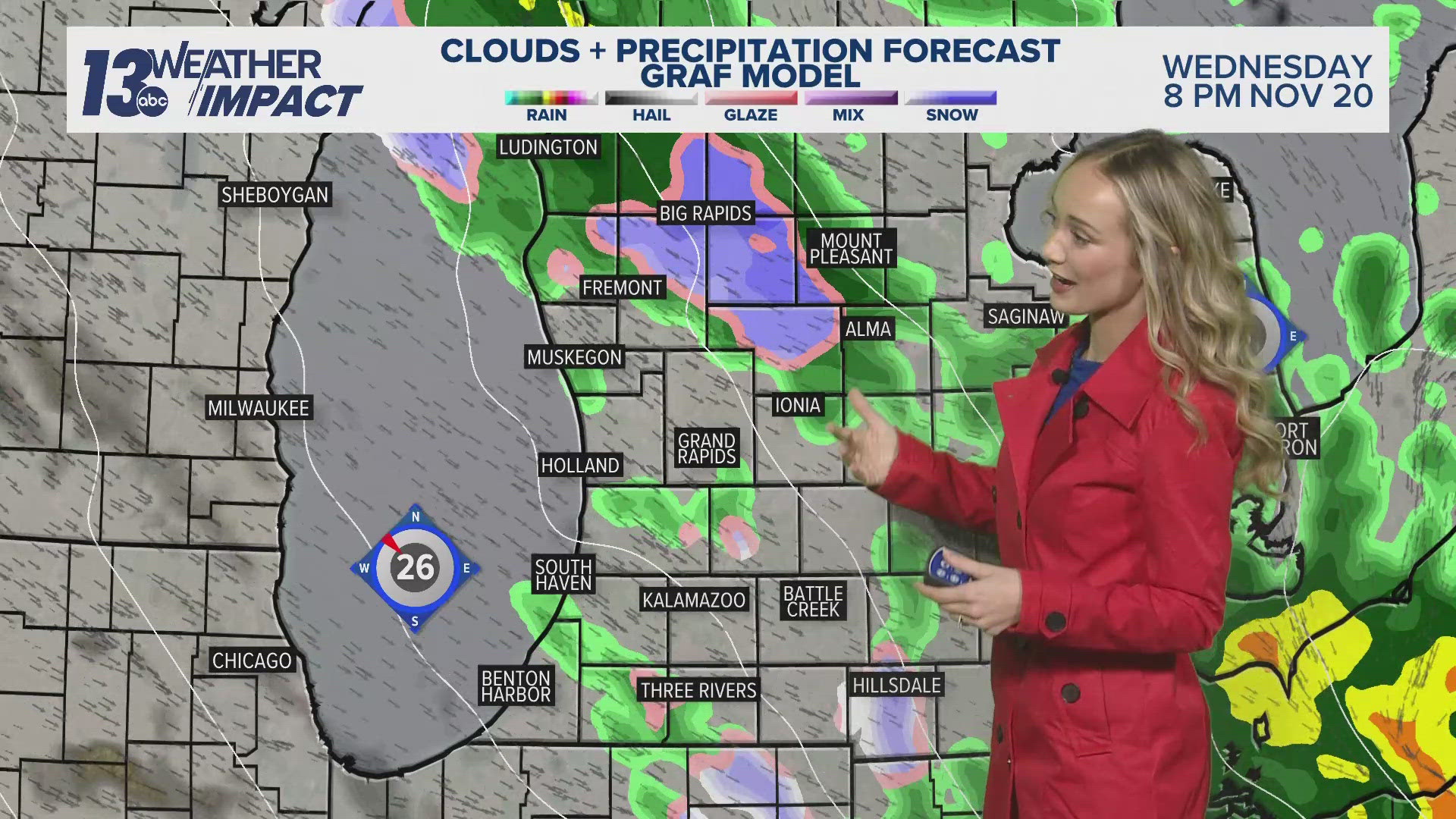
The snow is expected to begin Thursday evening around 8 p.m. along the lakeshore and quickly spread inland through 10 p.m. Snow will fall steadily at the rate of about ½'' per hour eventually ending between about 2-4 p.m. Friday.
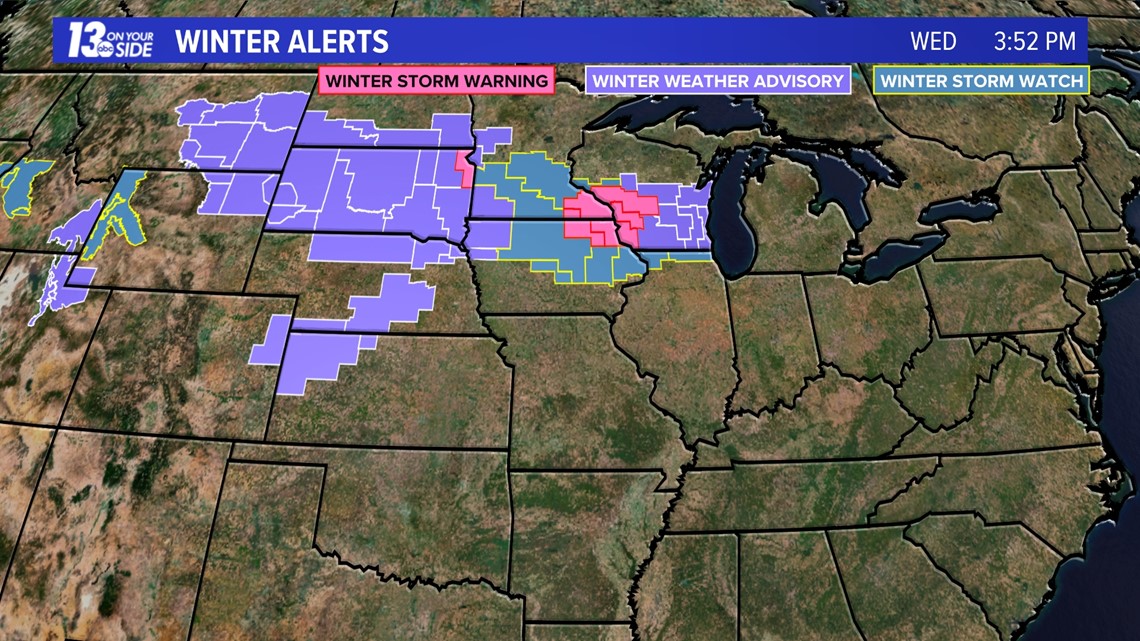
As of 4 p.m. Wednesday, winter weather alerts have yet to be issued by the NWS Grand Rapids office. I am thinking that at minimum a Winter Weather Advisory should be issued, although a Winter Storm Warning is possible.

Snow will be falling for the morning commute and lunch hour Friday with residual impacts for the evening commute. This snow will accumulate everywhere with limited melting, including roads as temperatures will be in low to mid 30s.

Amounts and Impacts
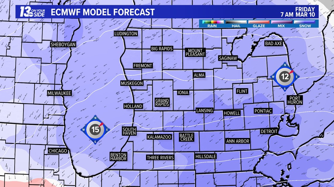
Models are in good agreement showing when and where the snow will fall, affecting all of West Michigan.
Most models agree that 3-4"+ amounts are likely north and 5-7"+ amounts south.

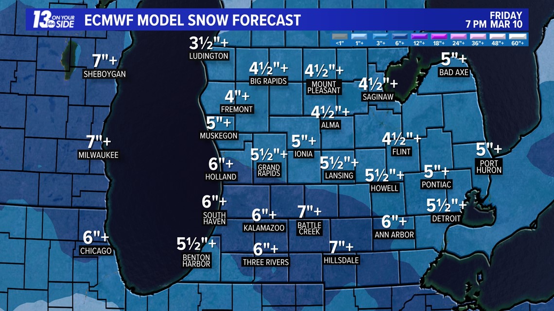

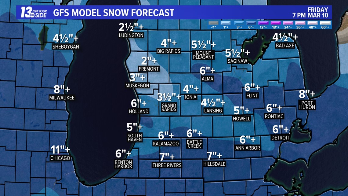
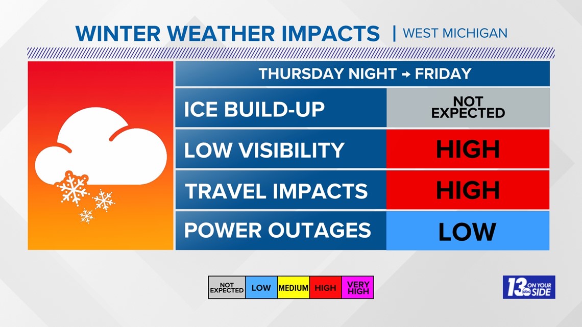
High impacts will be on travel for the morning commute and lunch hour as visibilities will be low during the height of the snow.

Recovery Weather
Skies will quickly clear Friday night with temperatures rapidly falling below freezing limiting the amount of time for easier clearing of roadways, sidewalks and driveways. Temperatures will barely climb above freezing over the weekend so the snow that has fallen will stick around for a while.
Remember to check back for frequent updates from the 13 ON YOUR SIDE Weather Team Thursday.
Document your winter experience with us by sharing horizontal video and photos of the event and we'll share them on-air and online.

Chief Meteorologist George Lessens
George is a graduate of Penn State University working for 13 On Your Side for over 42 years. He is a Certified Broadcast Meteorologist (CBM), a twelve-time MAB® Weathercast Award Winner and two-time EMMY® Award Winner.
Contact me at: GeorgeLessens@13OnYourSide.com
Follow me on Twitter @glessens and Facebook GeorgeLessensWZZM
Have a 30-second video or photo to share? We'd love to share it with everyone! Share your images by texting your name and location to 616.559.1310 or email to Weather@13OnYourSide.com or post it to our 13OnYourSide Facebook Page
►Make it easy to keep up to date with more stories like this. Download the 13 ON YOUR SIDE app now.
Have a news tip? Email news@13onyourside.com, visit our Facebook page or Twitter. Subscribe to our YouTube channel.


