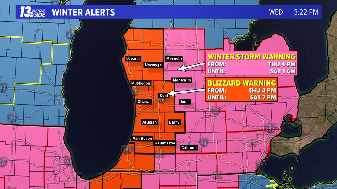
GRAND RAPIDS, Mich. — UPDATE: As of Wednesday afternoon most of West Michigan has been placed under a Blizzard Warning, set to go into effect at 4 pm on Thursday. This includes the counties of Van Buren, Allegan, Ottawa, Muskegon, Oceana, Newaygo, Kent, Barry, and Kalamazoo. This will go until 7 pm on Saturday.
Mecosta, Montcalm, Ionia, and Calhoun will be under a Winter Storm Warning starting at 4 pm on Thursday and running through 1 am on Saturday.
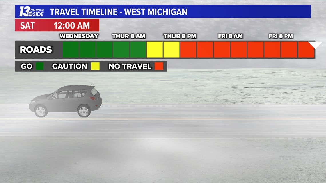
Travel may become very difficult to impossible at times Thursday night through Saturday. Make plans now to stay at home or travel early. Stay with 13 On Your Side for the latest details!


Here are our projected totals for the system snow. That's Thursday night through Friday night. Adjustments tonight and tomorrow morning are likely.
Additional lake effect is expected Saturday, bringing several locations nearly 2 feet of snowfall.
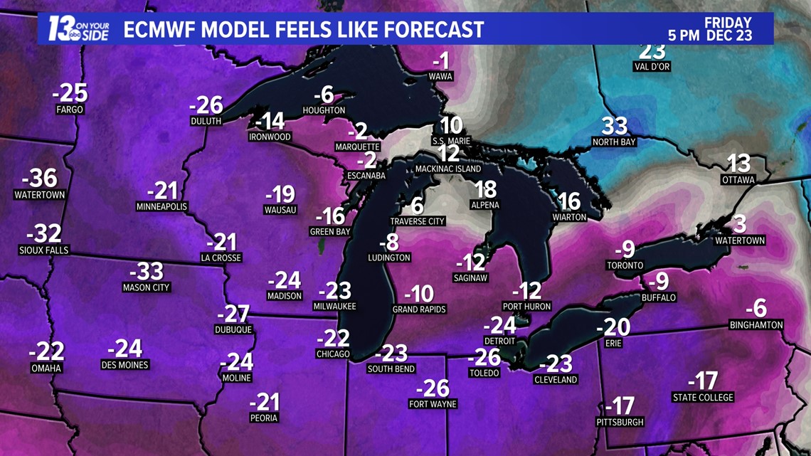
It's important to note that snow is not the only concern for this event. Strong winds and arctic air will bring major impacts as well.
Let's time things out.
Thursday Afternoon
Snow begins on Thursday afternoon and will intensify overnight Thursday into Friday morning. As of now, accumulations could be from 4 to 8 inches by 8 a.m. Friday morning. It's at this time that you will not want to be on the roadways and will want to have all your last-minute errands done.


Friday
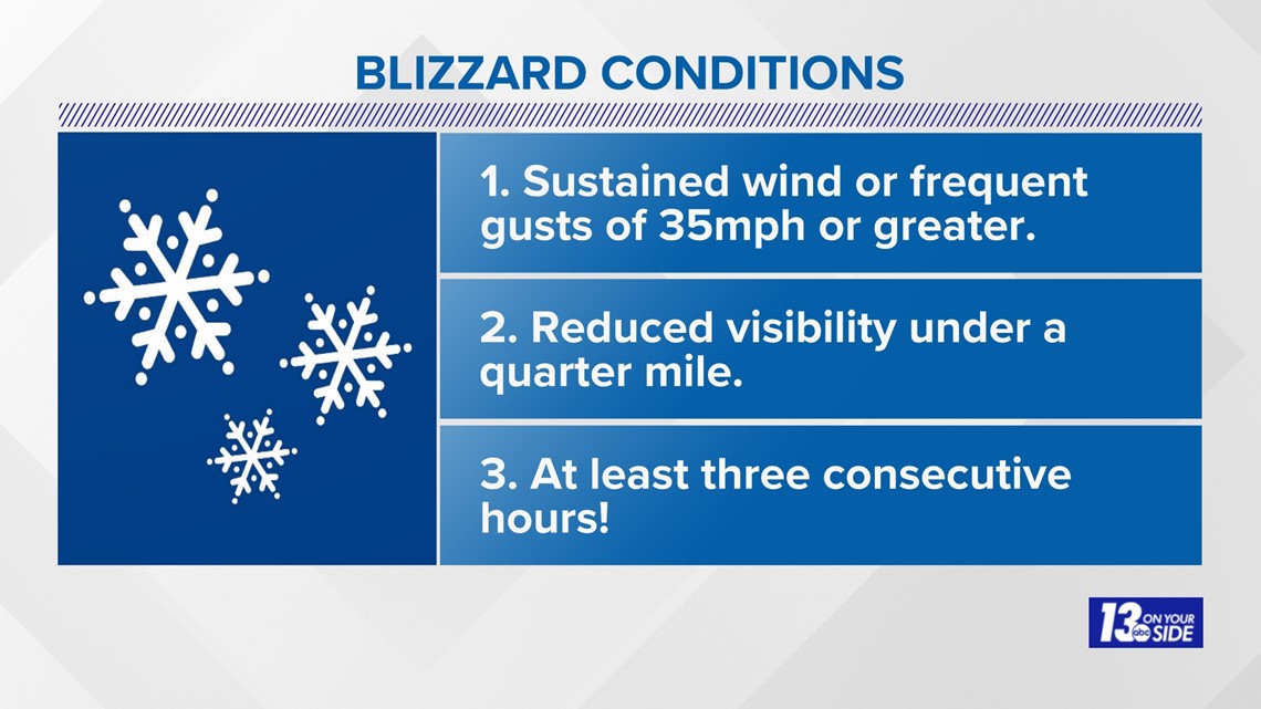
Friday is when conditions are expected to be the worst. Heavy and consistent snowfall will persist all day long, with 45 to 55 mph wind gusts, and subzero feels-like conditions. The wind and the heavy snow will cause blizzard-like conditions. That means sustained wind or frequent gusts of 35 mph or greater, considerable falling and/or blowing snow reducing visibility to under a quarter mile, and these conditions must continue for at least three consecutive hours!


Not only will winds cause near-blizzard conditions, but also could cause isolated to scattered power outages and very cold conditions. Wind chill values will be o to -10 degrees.


Saturday
The system will begin to exit the region on Saturday, but that does not mean an end to the snowfall. Rounds of lake effect snow are expected Saturday afternoon. This snow will be fine in texture, leading to blowing and drifting snow. It will be difficult to see at times and likely extend far inland. It will also be difficult to determine the snowfall totals during this timeframe.
While winds will not be as strong as Friday, we will still have gusts near 40+ mph, keeping the possibility of power outages and near zero wind chill values.
All in all, we are thinking of nearly 2 feet of snow by the end of the weekend.
Please stay safe and tailor your plans according to the weather.
-- The 13 On Your Side Weather Team
Have a 30-second video or still photo to share? We'd love to share it with everyone! Email your image to Weather@13OnYourSide.com or post it to our 13OnYourSide Facebook Page.
►Make it easy to keep up to date with more stories like this. Download the 13 ON YOUR SIDE app now.
Have a news tip? Email news@13onyourside.com, visit our Facebook page or Twitter. Subscribe to our YouTube channel.

