MICHIGAN, USA — Start celebrating, West Michigan! Spring weather settles in by Easter Sunday, and will last throughout the entirety of next week.
EASTER WEEKEND
Friday will be the last ‘cool’ day of the forecast for quite some time, with daytime temperatures climbing near 50° - a few degrees below average for early April. Making up for the slightly cooler temperatures, sun-filled skies will be the rule of thumb.
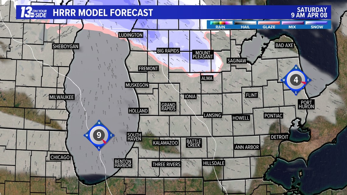
The only wrinkle in the forecast comes late Friday night into Saturday morning as a weak disturbance passes through the Great Lakes. It’ll be enough for a brief swath of precipitation, primarily snow, near and northward of US-10. Impacts will be limited, at best, with only a light accumulation on grassy surfaces expected.

Temperatures start their climb this weekend, with 50s on Saturday, and lower 60s on Easter Sunday. Cloudiest skies of the weekend will be during the morning hours of Saturday. Increasing sunshine takes over late in the day Saturday, with abundant sunshine expected Sunday.

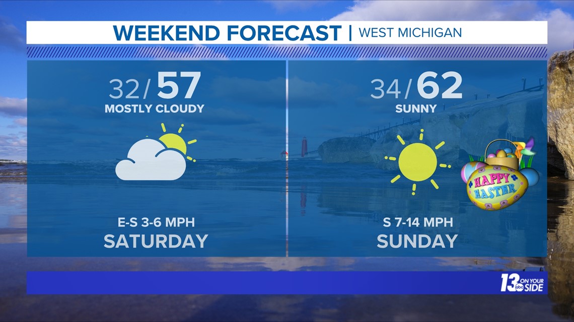
If you have travel plans on Easter Sunday, conditions will be tranquil all across the state of Michigan!
One caveat to the warming temperatures – locations along Lake Michigan will likely remain a few degrees cooler than those inland due to the influence of the chillier lake temperatures.
NEXT WEEK
It’s all about spring warmth, and a lack of precipitation, as next week progresses. A combination of an upper-level ridge and surface high pressure is textbook for tranquil weather, and that’ll be the setup across West Michigan/Great Lakes.

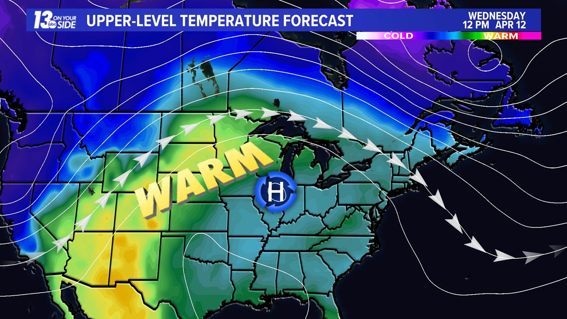
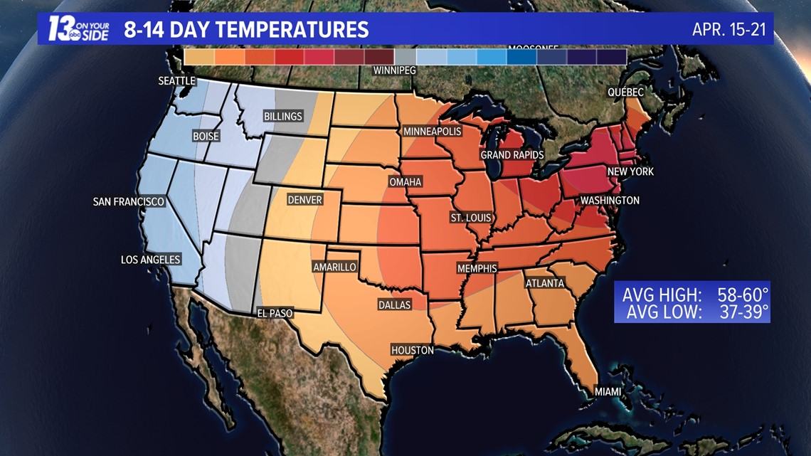
Kickstarting the week, 60s are expected Monday and Tuesday. By Wednesday, daytime temperatures will reach the lower 70s! This’ll last, 70s for high temperatures, the rest of the week into next weekend. Humidity will remain low, as well. Overnight lows in this stretch will be in the 50s.

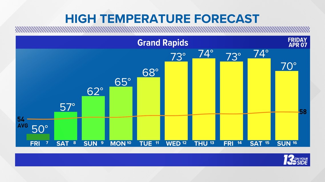
Looking further ahead, there's a higher probability that above-average temperatures remain beyond the 10-Day Outlook.

RIVER LEVELS
Despite the drying and warming conditions, certain river locations around West Michigan remain dangerous.
Specific spots along the Grand River that are contending with high water levels are at Comstock Park, Ada, and Lowell. The Thornapple River at Caledonia and Hastings are other areas of concern.
More information of river levels of concern across West Michigan can be found HERE.
STICK WITH THE FORECAST
Have a 30-second video or photo to share? We'd love to share it with everyone! Share your images by texting your name and location to 616.559.1310 or email to Weather@13OnYourSide.com or post it to our 13OnYourSide Facebook Page
►Make it easy to keep up to date with more stories like this. Download the 13 ON YOUR SIDE app now.
Have a news tip? Email news@13onyourside.com, visit our Facebook page or Twitter. Subscribe to our YouTube channel.


