GRAND RAPIDS, Michigan — Our unusual weather continues, with two rounds of severe weather possible overnight tonight into Tuesday morning and Tuesday evening. This is all due to a low-pressure system that moves through overnight.
ROUND ONE
First, the warm front will pass through overnight tonight into early Tuesday morning. The timeframe is midnight to 8 am. Some uncertainty remains on the development of these thunderstorms, but a few isolated strong to severe storms will be possible. If strong storms do develop, hail looks to be the strongest concern. Because of this threat, the Storm Prediction Center has placed us under a 1/5 (lowest/highest) threat for severe weather.
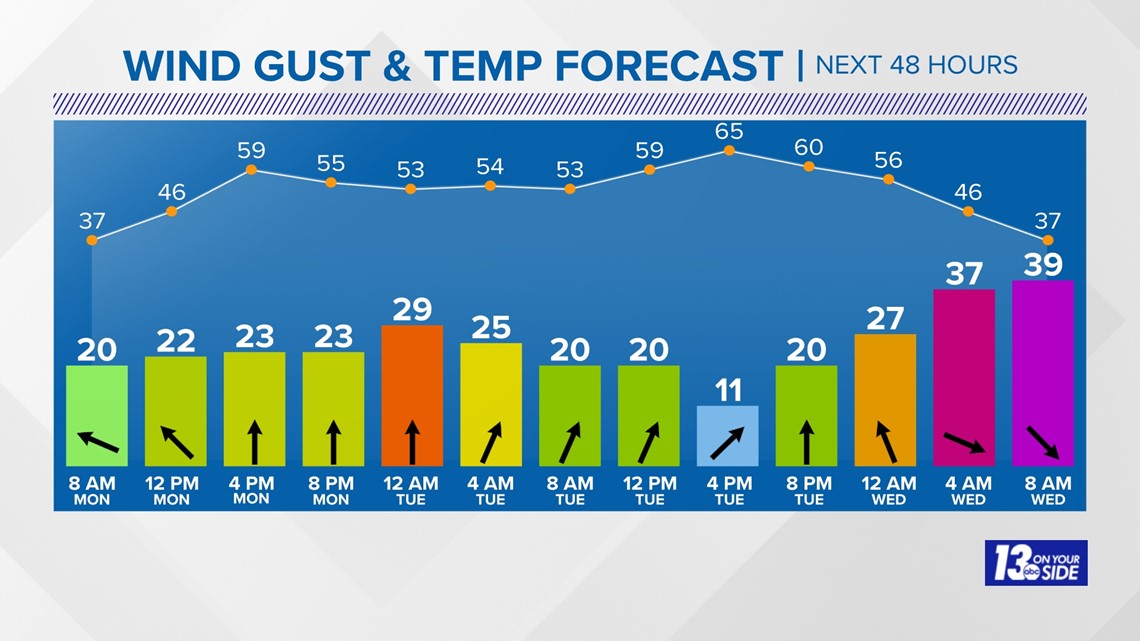
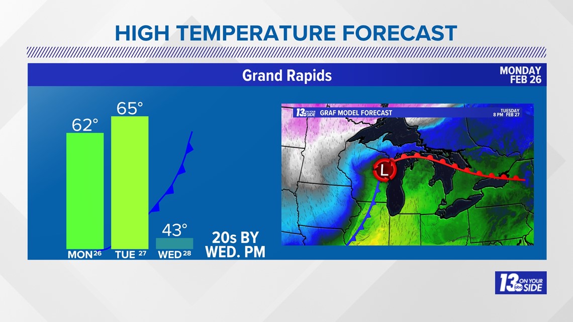
The weather will be quiet from 8 a.m. to 5 p.m. before our second storm batch moves in. During this timeframe, winds will be breezy and temperatures will climb to potential record-breaking heat. It will be mostly cloudy, breezy, and warm with a high of 65°. Winds will be breezy out of the south at 10-20 mph.

ROUND TWO
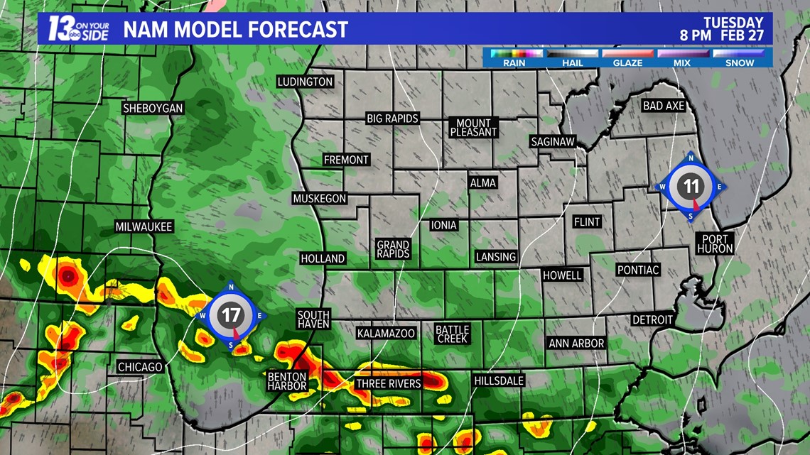
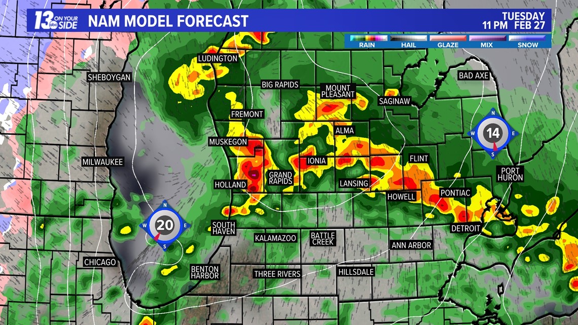
The second round of storms arrives late Tuesday evening through Tuesday night. This batch has a higher chance of being strong to severe, with the Storm Prediction Center placing us under a level 2/5 risk I-96 and to the south. While we could see some storms before 7 pm, most of the strong storms won't arrive until after 7 pm. Main hazards include strong winds, hail, and even an isolated tornado.


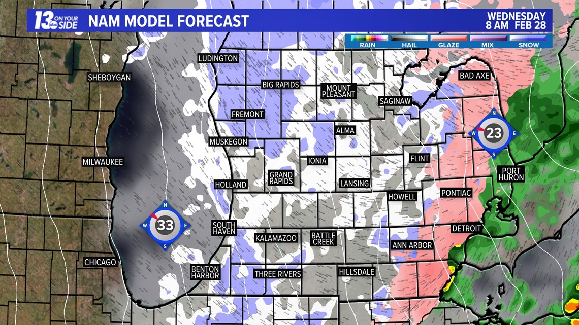
Everything changes following the storms. Winds shift to out the NW and drag down a much cooler airmass. Dropping out temperatures from 60s to the low 30s by Wednesday evening. Even causing light snowfall to develop Wednesday. This cooldown will be short-lived as temperatures climb right back to the 50s and 60s by the weekend.

SAFETY
You should have multiple ways to stay weather aware and receive critical weather information.
There are five direct ways in which you can receive weather alerts.
1. NOAA Weather Radio
The first is NOAA Weather Radio. We often refer to them as the “smoke detector” for severe weather, because they will automatically sound an alarm in the case of a natural disaster or severe weather.
2. Local Broadcast
There is also always your local TV station. The 13 ON YOUR SIDE Weather Department streams on-air and online during an active storm.
3. Radio Station
Local radio stations should alert you if a storm is in your area. You can even set up devices like Alexa and Google Home to alert you with weather notifications.
4. Smartphone
Your smartphones also offer numerous ways to receive critical weather alerts. We have a 13 ON YOUR SIDE Weather App that will allow you to track the storm and receive alerts.
5. Outdoor Sirens
Outdoor sirens are also an option, as they will go off in the threat of immediate danger, but are only meant to be heard outdoors. So, if you are inside this should not be how you receive your severe weather alerts. Outdoor sirens can also be unreliable, difficult for those hard of hearing, and go off for other reasons beyond tornadoes.
REPORT
Have a 30-second video or photo to share? We'd love to share it with everyone! Share your images by texting your name and location to 616.559.1310 or email to Weather@13OnYourSide.com or post it to our 13OnYourSide Facebook Page