GRAND RAPIDS, Mich. — We are in for a windy, warm, and sometimes wet couple of days in West Michigan.

RAIN CHANCES
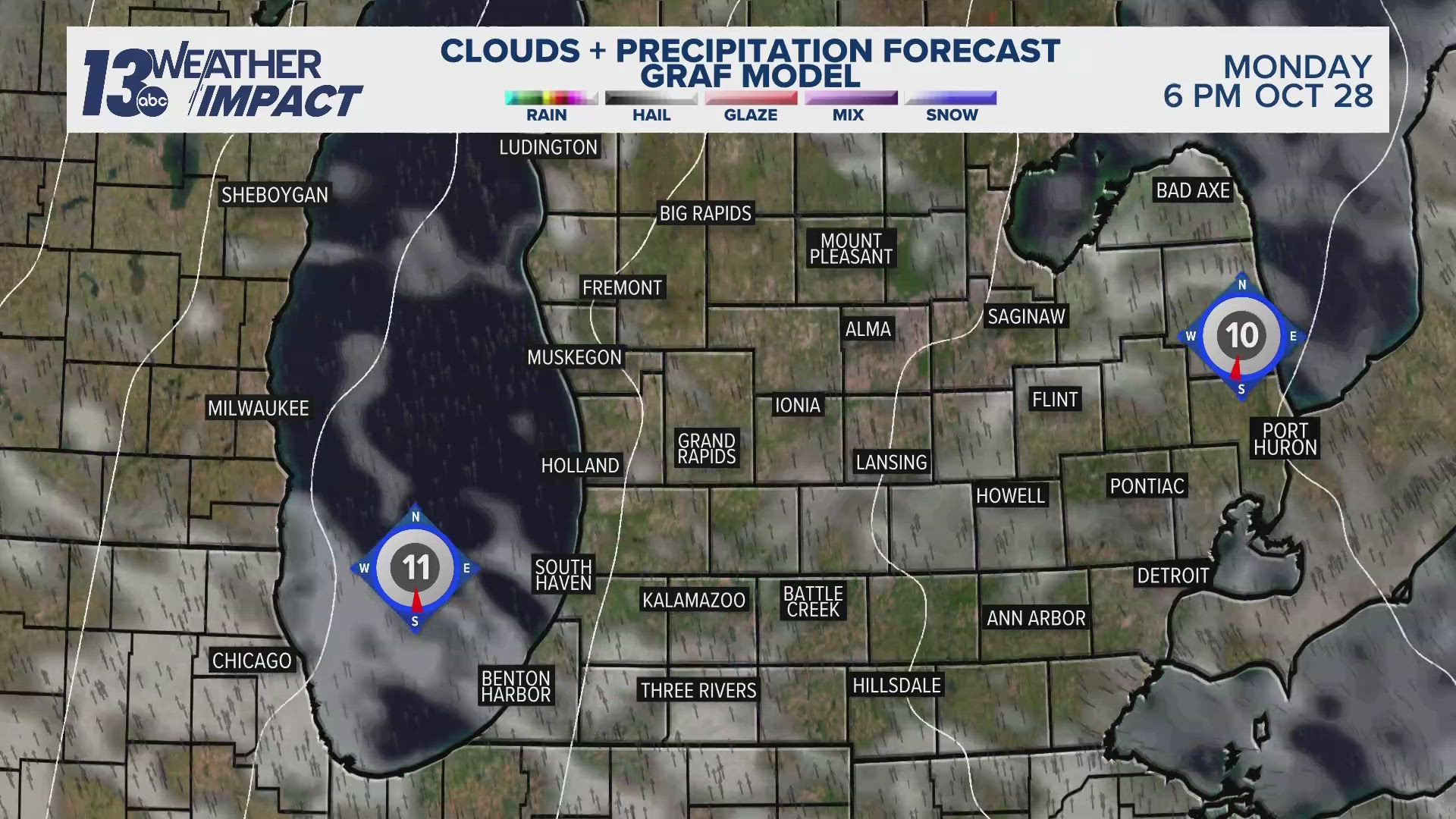
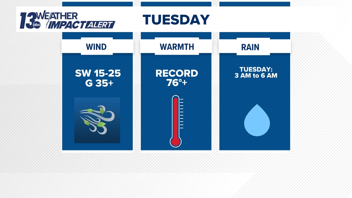
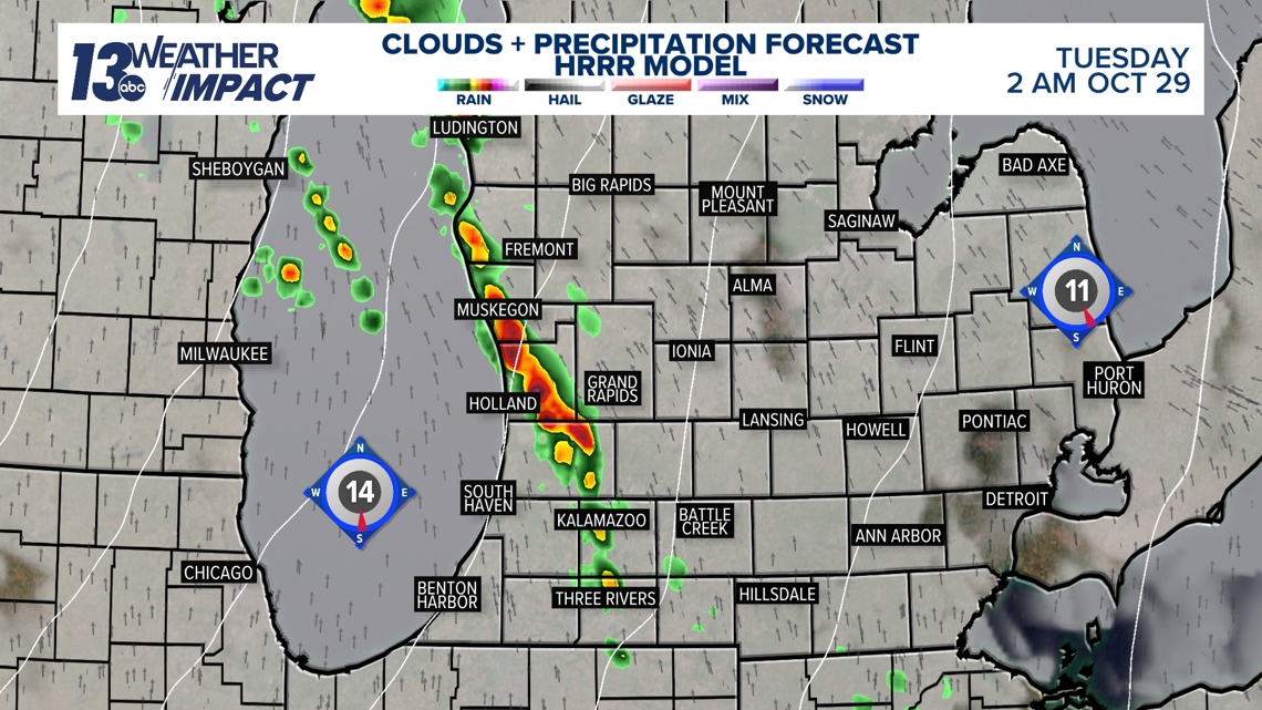
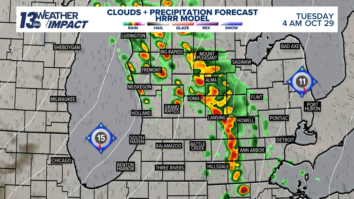
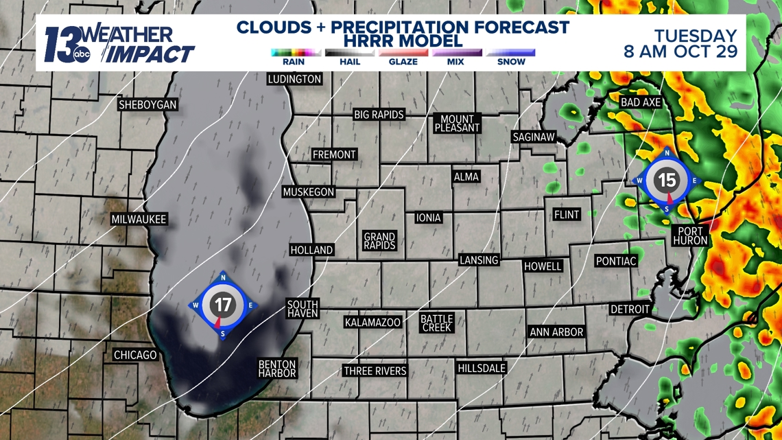
Rain starts overnight tonight and goes into Tuesday morning with a quick round of weak storms. The bulk of the rain moves through from 3 a.m. to 6 a.m. and then clouds will break apart throughout the day. While these storms will likely contain thunder and lightning, they are not anticipated to be severe. Once the rain ends, our winds start to crank up out of the southwest.


WIND GUSTS
It's time to bring in the Halloween blow-ups and the jumbo skeletons because winds will be howling over the next several days. Winds will be sustained at 15 to 25 mph, gusting between 30 to 35 mph inland and 40 to 45 mph along the lakeshore. Lakeshore counties could potentially be placed under a wind advisory due to the strength of the winds.

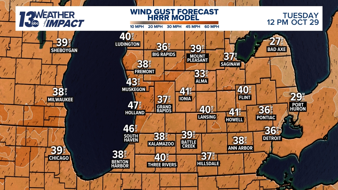
These strong winds aren't going anywhere. I expect breezy to windy conditions through Halloween.
RECORD WARMTH
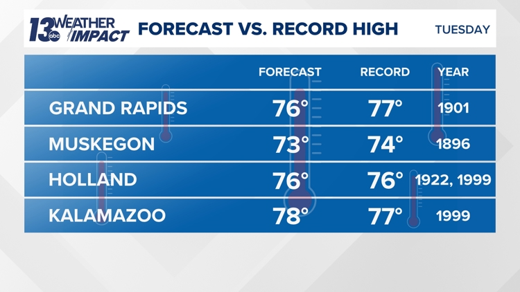
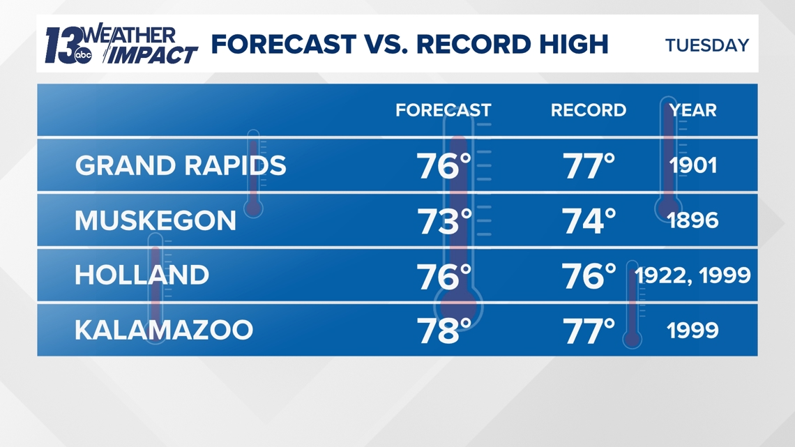
The strong southwesterly winds are ushering in temperatures that are 20 degrees above normal, potentially breaking records. Our Tuesday forecast high in Grand Rapids is 76 degrees (record 77) on Tuesday and 75 degrees (record 79) on Wednesday.

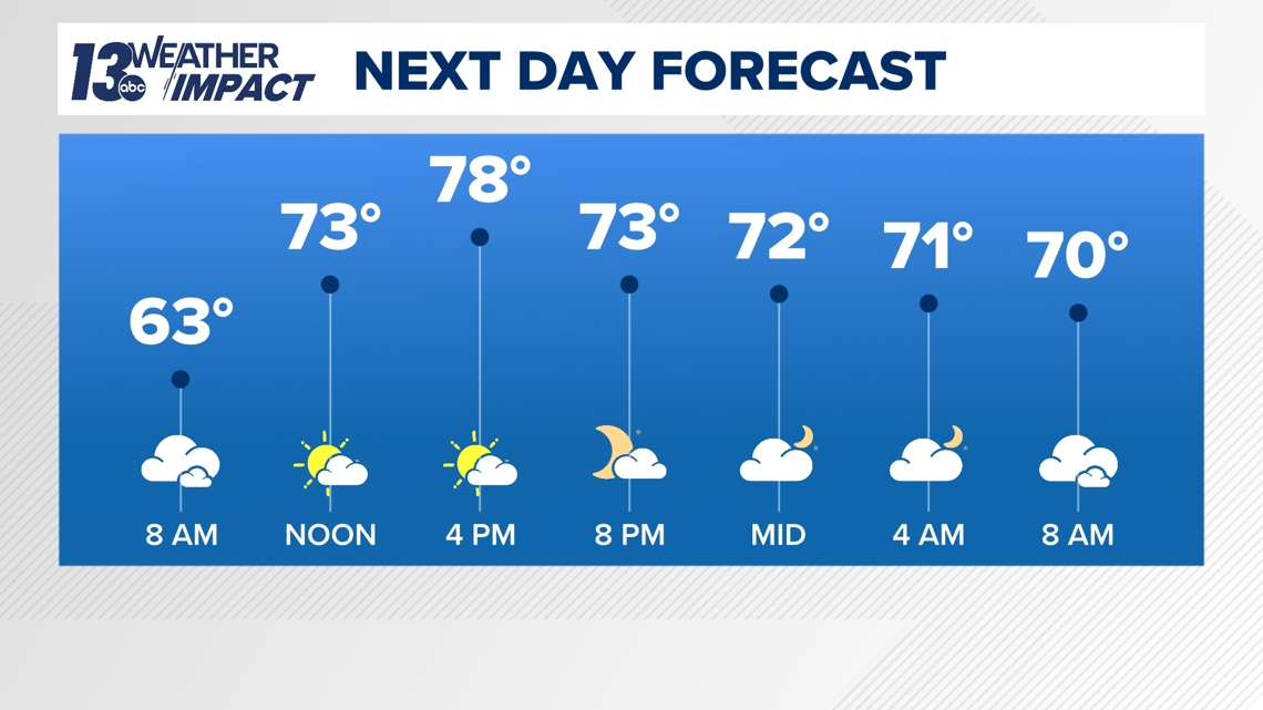
All areas have a chance at breaking their record high temperatures with Holland and Kalamazoo being the most likely. There will be another opportunity for record-breaking warmth on Wednesday, but chances are slightly lower. Temperatures will return to seasonable averages throughout the day on Halloween and into Friday.

6-10 Day Outlook
Thu. Oct. 31 through Mon. Nov. 4 calls for above average temperatures and above average precipitation. Average highs are around 52-54° with an average rainfall of 0.60" and average snowfall of 0.4".
8-14 Day Outlook
Sat. Nov. 2 through Fri. Nov. 8 calls for above average temperatures and above average precipitation. Average highs are around 51-53° with an average rainfall of 0.81" and average snowfall of 0.8".
Have a 30-second video or photo to share? We'd love to share it with everyone! Share your images by texting your name and location to 616.559.1310 or email to Weather@13OnYourSide.com or post it to our 13OnYourSide Facebook Page